|
| TopaTopa Lodge Camp |
Okay it has been entirely to long since my last post. Work, family functions and a few other things have had me sidelined for a bit. I thought it would be nice to come back with a bang so here's a big one that's been on the list for sometime now. What's that you ask ? Well how about another forgotten Camp in the LP, would you expect anything less from me ?

From my data collection I have not seen TopaTopa Lodge Camp appear on LP Recreation Maps since 1972. (Though I am missing some years) I imagine sometime very shortly after that it was removed from the Forest Service inventory. The Camp did make appearances in some of the earlier maps dating back to the 30's. Notice it pictured above in the 1969 edition. (Click image to enlarge). According to some of
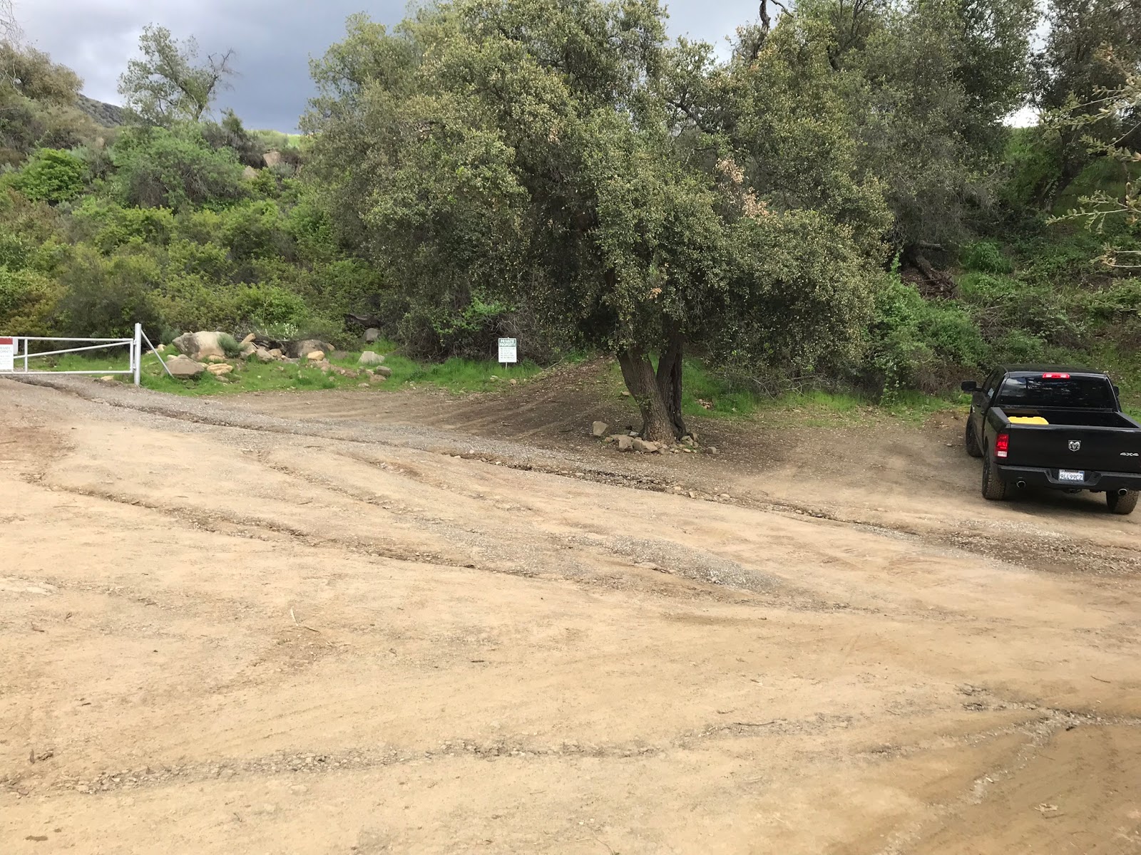
Craig R Carey's earlier writings the Camp was once a staple destination for local Santa Paula and Ojai folks that frequented the Last Chance Trail. While there are multiple ways to reach the Lodge, with daylight being scarce now, if we were going to have any chance at taking down Hines and Cream Puff in the same day as well our best option was gonna be from Nordhoff Ridge Road. Driving up this route from Rose Valley Campground requires a permit from the Forest Service. You can pick them up at the Ojai Ranger district office and reservations can be made up to 2 weeks in advance. 4 wheel drive is required. The Locked Gate is accessed from Camp Site #2

 |
| Rose Valley Campground |
From my recollection it was about a 10 mile drive along the steep, narrow, rutted dirt road to reach the far Eastern Gate that begins the Red Reef Trail, it was here we parked the car to start our proposed loop. When driving up from Rose Valley keep to the left at the multiple junctions, within a half mile from the destination you Pass Elder Camp to your left. While the road is in fairly good shape the beginning climb is the worst, I had to make two attempts at one particular bad section. (basically a well shit that didn't work lets back down this spot and try again).
 |
| Elder Camp |
 |
| Park in the turn out here adjacent the gate. |
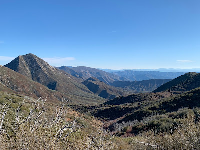
Notice the sign above referring to the junction with Last Chance Trail in 2.5 miles, I don't think that is actually historically correct. That junction in reality was 21W20 the short Connector trail that dropped down between Hines and Cream Puff to gain the Last Chance Trail. Technically speaking from this location the LC Trail starts along Red Reef much closer. (approximately one mile in where the trail climbs to the northern terminus of the bluff. If none of that made sense scroll back up and take another look at the 69 map. Ignoring the Red Reef trail for now walk back down the road from which you just came in a very short .1 of a mile there is a well defined spur trail that climbs up to the southern end of the Bluff. You gain about 900 feet elevation in .8 of a mile to reach the Top. While not far distance wise it definitely gets the blood pumping and takes the chill off the morning air. Once atop the Bluff take few minutes have a seat on the stone bench and enjoy the incredible views.
 |
| Great lookout from TopaTopa bluff |
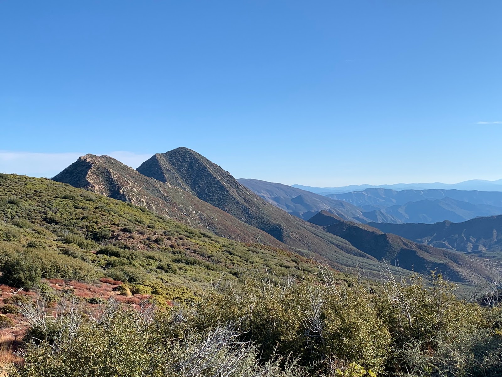
Once you have had your fill continue east along the Bluff in less than 500 feet hang a hard right south and onto the Last Chance Trail 21W09. No sign marks the trail but it is fairly easy to make out. I can tell you right now I was expecting far worse than what we got. For a trail that receives little to no maintenance the first 1 to 1.5 miles was pretty uneventful and easy to follow. Yeah there is some tight brushy spots but nothing really to complain over, bonus you get a real nice perspective of upper Santa Paula Canyon, Hines, and the Topa Topa Ridge toward the tower.
 |
| How beautiful is that ? |
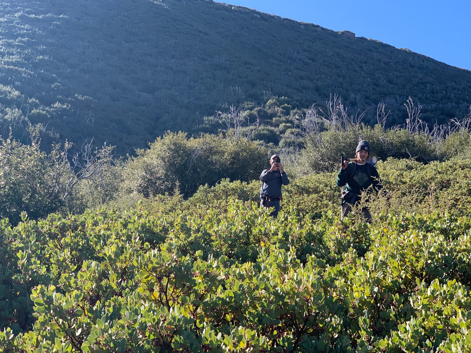
Along that first 2 mile section I was pondering why more people don't attempt this loop considering the current trail conditions, eventually I got the answer. That smooth sailing I spoke about earlier ends in a brush fight for the last 1 to 1.5 miles into TopaTopa Lodge. You can pick up bits and pieces of the old trail however it's basically a pick your own path through thick Ceanothus, Manzanita, Chamise Etc, Etc. I'm sure you get the point after popping out and into the Lodge my face looked like I had been in a cat fight.
 |
| Jeff and Reece coming down one of the nicer of the bad sections |
There are 3 main tributaries you will cross that come together up here to form the Main Santa Paula Canyon watershed, all 3 had enough water to filter with the best water coming from the Connector just North of Topa Topa Lodge. I have included the waypoints on the google map below and as well in the downloadable GPX & KMZ files.
Arriving at the Lodge we really didn't need to do much the Camp was in pretty good shape. We stood up one of the 2 Ice Can stoves that had fallen over and left a brand new camp shovel, courtesy of LT. I wasn't given permission to use his full name but you know who you are and thanks brother for the generous tool donation. If you're reading this lets get out there soon. The Camp has a nice sized fire ring with cooking grate. While maybe not the most glamourous of places as it sits in a rather exposed location the condition of those Large stoves are amazing, I can never get enough of these forgotten Camps. If you haven't been I suggest you go.
 |
| Me showcasing the new shovel that Reece lugged into Camp |
 |
| Great view from Camp looking down the canyon |
Finding the Camp was great but the day was far from over we still had 3 big uphill slogs to attend to before we could rest our feet back at the car, with the first segment being to continue the last 1/4 mile along LC to meet up with and climb the last mile (give or take) of 21W20 back up and onto Red Reef . In a nutshell from the Lodge you can figure about 1200 Feet elevation Gain up to the ridge. Getting over to the connector from the lodge is a little tricky, if you stick to the old trail proper it will weave you rather nicely through the thick surrounding brush. If you don't, well then plan on a lot of unnecessary bushwacking. Surprisingly the Camp is well hidden, you can't really see it at all from the connector, which would explain why more folks dont bother trying to attempt a visit. Really the best view down on the Lodge from the top is from Cream Puff see photo below, brown flat patch in the middle is TopaTopa Lodge Camp.
 |
| View down from Cream Puff onto TopaTopa Lodge |
 |
| Looking east at Hines Peak from 21W20 |
 |
| View from Red Reef looking back down 21W20 |
Again here as before if you are diligent in following the old trail climbing the connector proper is not to bad. I will say it is easier to access the lodge from the North rather than from below. I suspect those upper trails get much more use. From the ridge we hung a right headed North east and in less than a Half mile we were at the Sign pictured below which is precisely where you want to begin climbing the spine of Hines.
 |
| Front view |
 |
| Back Side looking better than the front. |
The trek up Hines is short but steep. You reach the top only to find out it is a false Summit and you must go a little farther. The Views from the summit proper are not as good in my opinion as the false one as they are more obstructed by brush. Make your way to the outskirts and you will find much better photo opportunities. A summit register can awaits as does a USGS Survey marker. I believe this one is a sierra club HPS Hike.
 |
| Hines Summit Register |
 |
| Down there lies the Sespe |
 |
| Killer view down Santa Paula Canyon & SP Peak |
 |
| Reece skiing down hines |
After Hines we stopped for a bit of lunch out of the wind and recharged our batteries up next would be Cream Puff. We now preceded west along Red Reef back toward the connector this time passing it. In .7 of a mile we reached the entry for Cream Puff. As you can see from the photo below the hike up is similar to Hines a little shorter but definitely no less steep.
Cream Puff is an SVS Peak (Seldom Visited Site). From my knowledge John Wilson (Pine Tar) and crew placed 10 of these SVS register cans in remote corners of the Los Padres. Last one I encountered was atop Cedar Peak along the Thorn Point Ridge. This Summit has no name on maps. Why it got the label Cream Puff I have no clue, but I bet my friend Kim Coakley knows.
 |
| Views from Cream Puff |
 |
| Looking back down onto the Red Reef |
Back down off CP we just continued westward the last few easy miles of RR 21W08 to complete the loop back to the Car. Not the longest of days with the total mileage being only 10, however definitely well earned. The register on Cream Puff talks about completing the Topa Triple, where one starts hiking from the bottom of Sisar road up to the bluff then onto Hines and Cream Puff. So maybe one can consider this the Topa Quad, we didn't hike up Sisar but we added the Lodge and extra miles along the LC to make up for it.