|
| Thorn Point Fire Lookout |
Since reading
Stillman's report from 2013 Cedar Peak has been on my hit list as has visiting the abandoned Thorn Point Fire Lookout Tower. A plan was devised to to get them both in one shot, here's how it went down.
 |
| Old news now but if you didn't know Grade Valley Road is open |
 |
| We Parked the car at the Cedar Creek Trailhead. |
Jeff and I hit the road at 6:30am and we were rolling up to Cedar Creek Trailhead by about 8am. I debated for days whether I should bring my dog Lacy or not. I knew there was a chance that the traverse from Thorn to Cedar Peak might be bad, against better judgment I let her come along. When road conditions are favorable you can drive the next .7 miles to the Thorn Point Trailhead, however right now that is not the case shortly after Cedar Creek major road repairs are needed and the last little stretch to Thorn meadows Campground is closed to vehicle traffic. Parking here works out better anyways as this is your exit point for this loop.
 |
| Lacy leading the charge |
 |
| Some serious road damage before Thorn meadows |
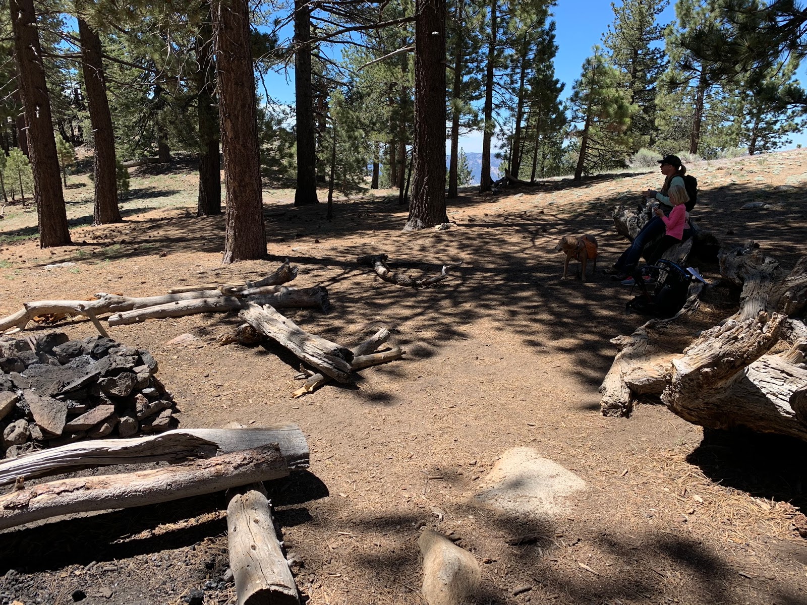
Since this was my first visit to Thorn Meadows Camp and the Trailhead for 21W07 we took a few minutes to poke around the Campground vicinity. The area is real nice and secluded, we were the only ones around. This was at one time an old forest service guard station. There is a horse corral and the station building remains standing.
 |
| FS Guard Station Building |
 |
| Horse Corral |
 |
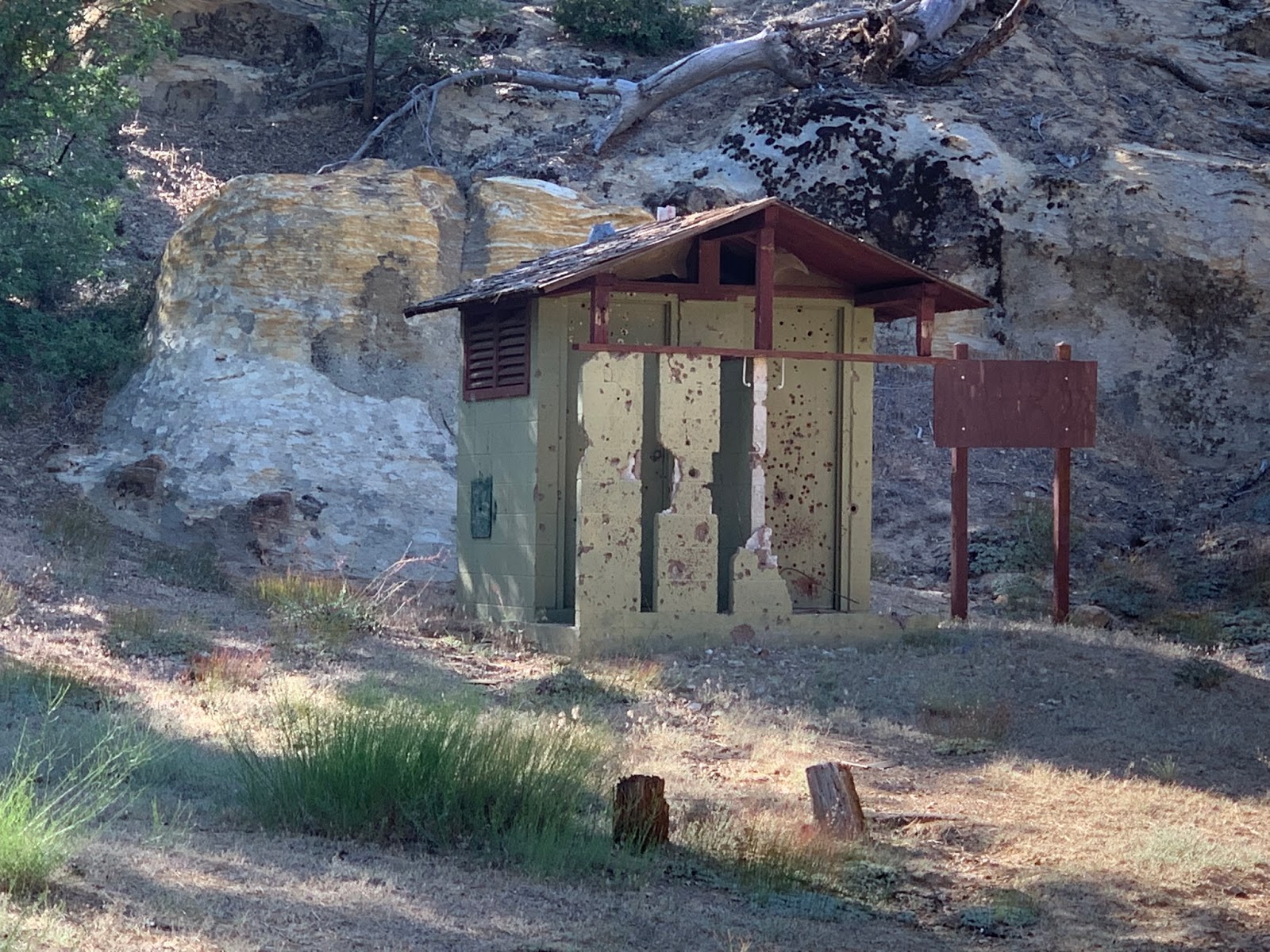
| Shot up pit toilet |
Thorn Meadows was established in 1961 and is set amongst a backdrop of Pines and sandstone outcrops. Named after W.H Thorn an early surveyor responsible for the mapping of central ventura in 1905. I observed 2 sites both with fire rings and picnic tables, I read from
Hike Los Padres there is a third site across the creek, however did not go looking as we had already burned enough time and needed to get going.
 |
| Thorn Meadows Site #1 |
 |
| Site #2 |
 |
| Thorn Point Trailhead |
Take off point to Thorn Peak along 21W07 is pictured above The first half mile of trail is being overrun with brush and is difficult to follow. This does not last long so stick with it, in short order the trail opens up and is easily followed the whole rest of the way to the top.
 |
| Very brushy first 1/2 mile |
 |
| Half mile in the trail is wide open and beautiful |
The trail starts off gradual then quickly begins the steep ascent toward the peak, gaining just under 2000 feet of elevation over the next 4 miles. The views here surrounding the Grade Valley area are stellar and there is no shortage of interesting rock formations and towering pines. The higher elevation makes this an excellent summer retreat and just like all my other trips to this corner of the forest it did not disappoint. Within a mile from reaching the Peak you start getting your first look at the tower.
 |
| Wild country so picturesque |
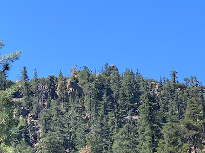 |
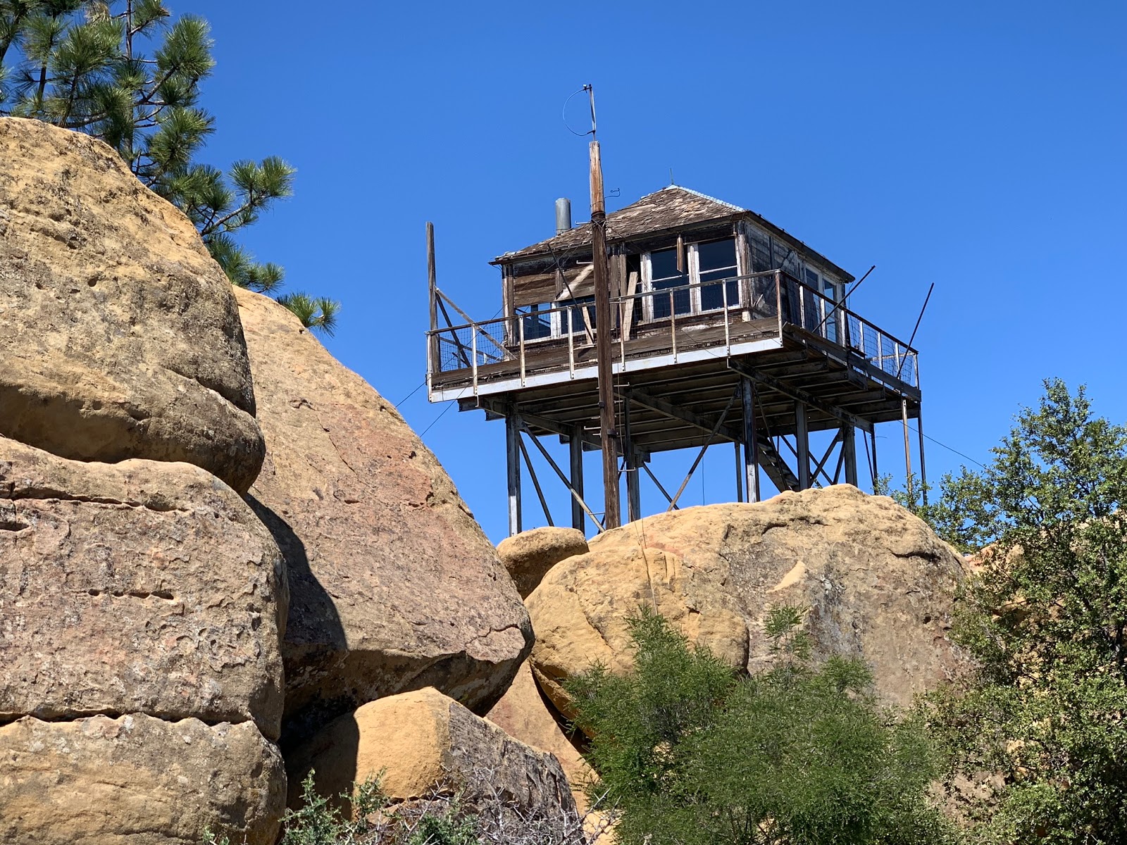
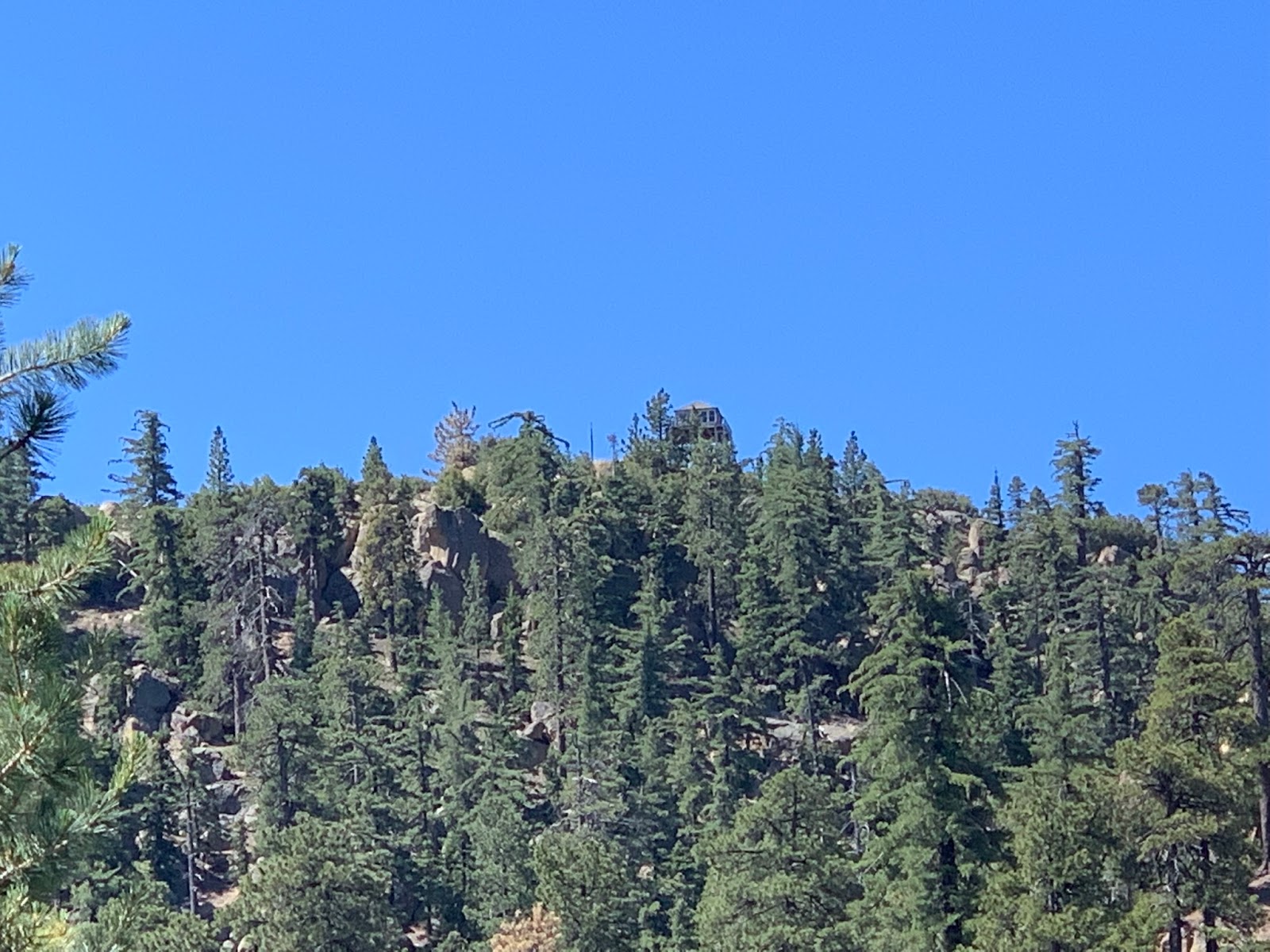
| First Look at the Tower peaking through the pines |
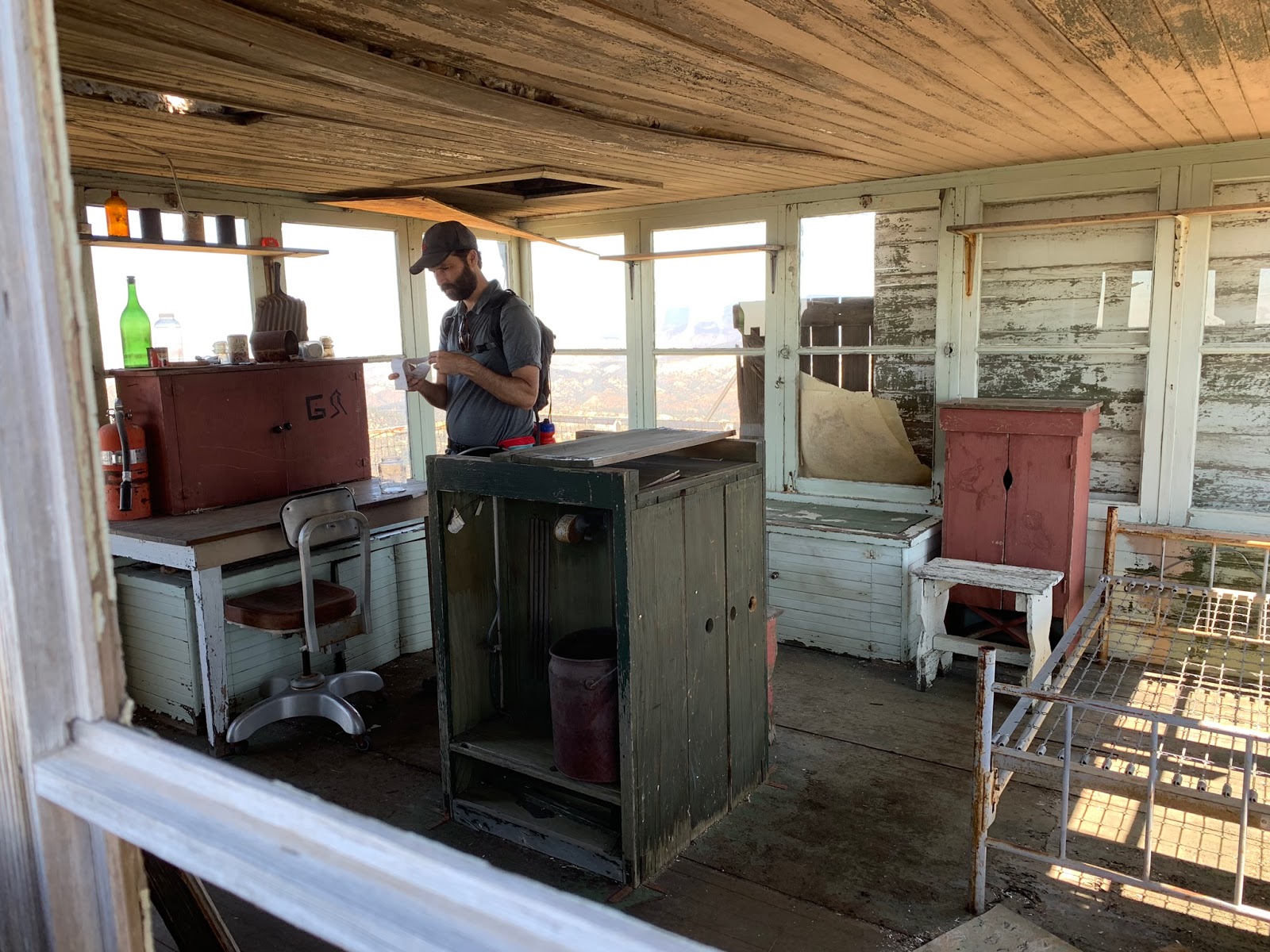
We pushed hard and made good time up the hill it wasn't long before we were strolling up to the fire tower. Thorn Point is one of the last remaining lookouts still standing in the Los Padres National forest and is considered a historical icon. The structure can still be accessed and inside one finds relics from it's glory days. There is a metal register box on the ground near the staircase and also another note pad left in a jar inside the tower with old signatures. Either by miracle or the lack of someone wanting to carry it out the Sign has not been stolen. That made me happy I love those damned old signs. If you read this and go steal the sign you are a piece of garbage, future generations deserve to be able to enjoy these as well. The building adjacent the tower is pretty worn down but still standing and was being guarded by a rattlesnake. The snake paid us no attention and even allowed a close up picture (not recommended). I've yet to witness a rattler this docile.


The steel structure is still in decent shape
 |
| Me Signing the Register |
 |
| This place is just begging to be restored |
It doesn't look like it but I got really excited when I spotted that Thorn Point sign
 |
| Jeff Having a look around |
 |
| Outbuilding adjacent the tower |
 |
| Rattlesnake on guard |
No bagged peak write up would complete without at least a few pictures of the view, sorry this may already be a disappropriate amount of photos but hell I was having a blast so here you go whats a few more.
 |
| Looking South Chief Peak in the Distance |
 |
| Is that you I see to the north Mt Pinos |
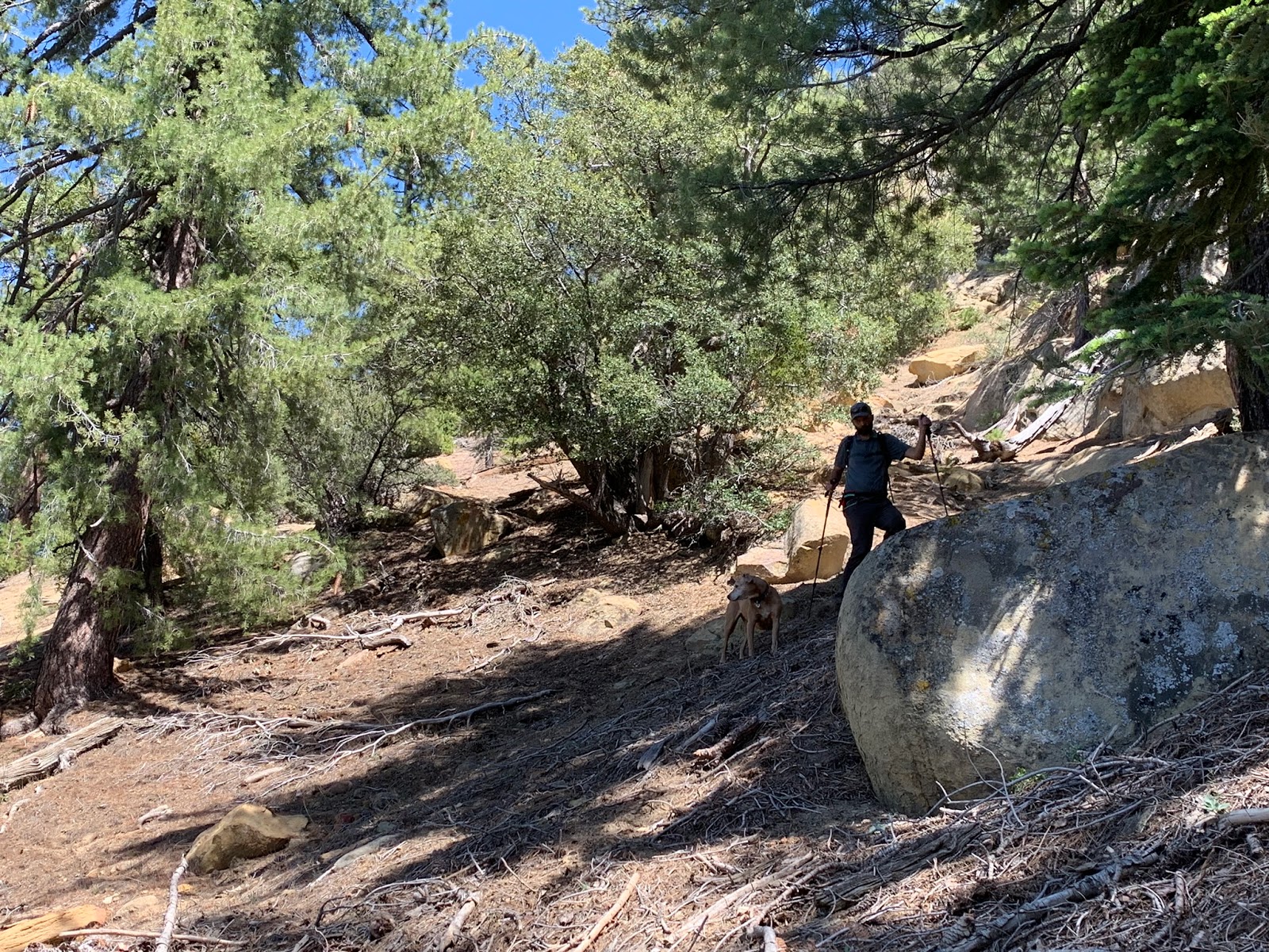
Okay so now the real fun begins, to get to Cedar Peak from Thorn Point one must traverse the ridge In a Northwesterly direction. Originally I calculated this next leg to be approximately 2.6 miles and it might have been just that had we'd been able to stick to the top, however with the dog that became impossible. I quickly realized I should have left her home, that old saying "I screwed the pooch took on a real life meaning here." Right away from Thorn you must drop steeply down to the west over and around massive boulders to gain the ridge. My dog is a tough girl but rock hooping in the heat is not her forte.
 |
| Looking Back on Thorn Point from the initial drop in, you can see it in the far left corner. |
While some of the ridge was open a lot was brushy and I mean thick, ugly manzanita brushy topped with boulders and boulders and boulders. Our pace became a crawl with me having to lift and carry Lacy constantly. The poor dog was tiring fast and to make matters worse she was sucking down her water supply to fast, every bush that provided any shade she would abruptly plop down under it and pant. I now was becoming concerned for her safety. I put myself on water restriction and my supply became hers. Breaks were mandatory about every ten minutes to ensure she did not overheat.
 |
| Lacy trying to get some shade on a nice lower part of the ridge, Jeff right behind her. |
What felt like hours into this forsaken ridge, I knew something had to give, I made the decision to drop lower beneath the rock and thick brush and just traverse the slope. This sped progress tremendously though walking sideways and going up and down around every obstruction added miles and made for sore feet. I didn't care though, this was working for my pup and that's all that mattered to me. Coming home with no dog would surely have me exiled as the dog might rank higher on the list than I do as far as my family is concerned. I was reminded many times prior that I better come home with a happy healthy dog. I will say this ridge can get ugly at times, however had it just been myself and Jeff It would have been a hell of a lot easier. Now Jeff's opinion may vary he was becoming a bit overheated and low on water, by the time we reached Cedar Peak he was more than ready to be off this section. Later at the car I made a comment something to the nature of well Jeff you know sometimes my trips can be rough and he responded yes every time they are, but that's okay keeps me in shape. Jeff's a team player and our adventures go way back to when we spent our free time scuba diving, spearfishing and lobster hunting.
 |
| Gotcha Cedar Peak |
When the time was right we made the cut up back onto the ridge to top out on Cedar Peak. Pictured above is me holding one of Pinetar and KC's Seldom Visited Site Register cans (SVS). There are a few more of these hidden throughout the Los Padres in remote locations for those interested. Seems like the peak is on a 3 year schedule for visitors. Last signature was from Matt Roberts in 2016 coming up From Piedra Blanca and before that David Stillman in 2013 who came up the same way as Matt, and now the added addition of mine as Jeff's from Thorn Point for 2019.
 |
| Placed in 2003 not very many people have signed that book |
 |
| Excellent View down upon Piedra Blanca from Cedar Peak |
 |
| Click photo to enlarge way back there is Thorn Point and the ridge we crossed to get atop Cedar Peak |
 |
| Notice Lacy is no longer carrying her pack, taking it off helped her get some air flow and to cool down. |
By now temps were really getting warm after a brief stay we quickly made haste and descended the last nasty section of the ridge before dropping onto the Cedar Creek Trail 21W10. Here again to make travel easier on the pup we dropped lower down the north face than I first planned landing on Cedar Creek trail further down than my initial planned exit point. Once back on the trail it was another 5 miles to complete the loop back to the Car, bringing the grand total to 14.1 miles on the dot.
 |
| Cedar Creek Camp looking lovely as always |
Water is still flowing good at Cedar Creek Camp, as we were rolling in I was sipping my last drop, not wanting to stop and take out my filter I just kept going. I had a cold beer waiting on ice in the car and the thirstier I got the better it was gonna taste.
 |
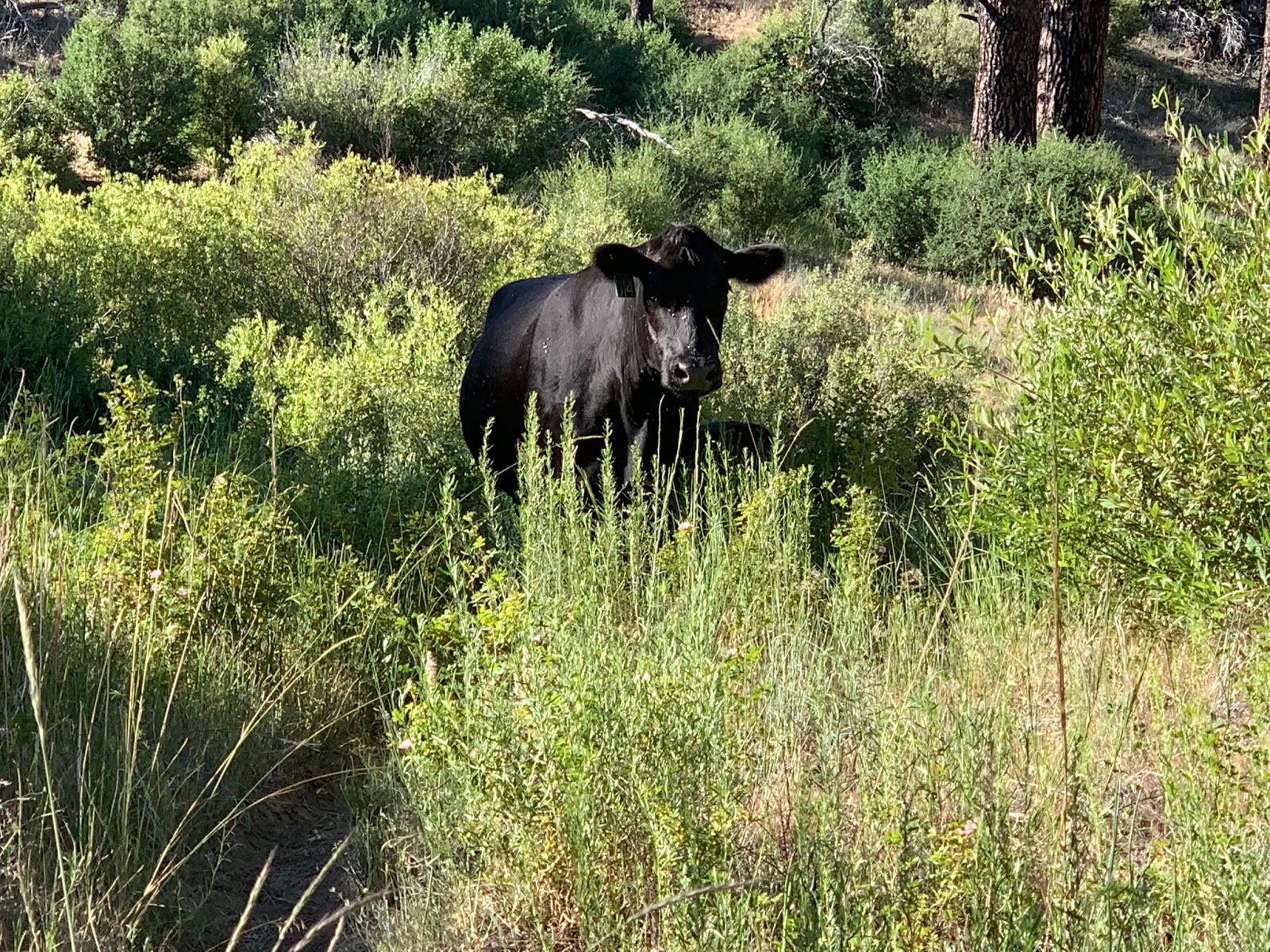
| Momma Cow with baby in tow |
 |
| Winter rains took its toll on the lower portion of Cedar Creek trail |
Within a half mile from the end and feeling victory we encountered this road block. Big old momma cow with her baby behind her. She was being protective and not moving, in fact starting to look a bit irritated that we were getting too close to her young one. Dammit cow I'm thirsty get out the way, I yelled while Lacy barked and growled, it fell upon deaf ears that cow was not budging. We ended up bushwhacking around her through the creek and a sharp thorn patch. Thanks alot cow! 10 and half hours later we were back at the car. A gnarly day Lost In The Los Padres. I've included a google map, KMZ and GPX file for download below.