Sunday, July 17, 2022

Lockwood Valley Trail Ride with American Jousting Alliance

All the things I love 

Turn off from Lockwood Valley Rd,  follow the signs to 15568 Greenleaf Springs Rd.

In need of some old fashion family fun in the Los Padres? Well if so look no further than to Southern California Horseback Trail Rides (American Jousting Alliance). This place is an absolute gem and the owner James is a rad person. I don't normally post such things however my family and I had such a great time I feel obliged to share. Hard to find these types of authentic experiences this day and age, especially when they come with a reasonable price tag as does this. 

James Zoppe and my girls at his ranch. With a side of horse ass, your welcome.

Aside from trail rides and lessons, James offers a myriad of other activities. Try your hand at Archery, western roping, braiding, dirt skiing, spear throwing, sword play and of course jousting.

"A third generation rider, James was born into a family of trick riders. His early riding career, which included somersaulting from the back of one galloping horse to another, slowly gave way to entertaining audiences with jousting. His choreographed jousting shows broadened into presenting medieval style jousting tournaments. He once wrote the American Jousting Alliance Book of rules and Guidelines. James now turns his lifetime with horses and his 30 plus years of jousting experience into training people and horses in the sport." 


Brief safety/training lesson complete it was time to mount up.


Not long into the ride it was obvious these were not your typical cattle call horses. What I mean by this is they did not have the feel of a horse that gives multiple rides per day, doing the same activity over and over. They had real character, a mind of their own if you will. We were responsible for controlling our own horse. When the animal wanted to stop and eat or meander off trail a bit you needed to correct the action. Felt real and was a great learning experience for myself and the girls. 

I started on April she was a good girl. Half way through Haylee stole her from me.

Musical horses became my theme. After Haylee got April (white horse) I ended up on Swissy, the black horse. Ultimately though Skyann (probably spelt that wrong) the brown horse was tiring out Caitlin so she became mine and should be yours if you like a horse with some attitude, as I do.


Toward the tail end of our ride James says "were gonna stop here, rope up the horses and do some exploring. I want you all to hike up to the Sandcastle." As we approached the castle he says "these are so unique I want to show you something you may have never seen before." To which I replied "oh yeah these are great we've climbed this type up Apache Canyon." Ahh man you've climbed these, oh well it will still be fun come on." I got to hand it to James he motivated my girls to get to the top of this rather steep and slippery formation, which for them was no easy task. Alone I might have never convinced them to keep pushing on. I remember thinking man I love this guy he's a hoot.


Victory

Ride over and back at base Camp James finished us off with some Archery. I honestly couldn't believe we had spent well over 3 hours with him on this adventure for a mere $75 bucks per person. That's cheap. Search and you'll find some of his competitors (while I'm sure they are nice people) charging over 200 bucks per person for just trail rides alone into the LP. If your wondering we received no special treatment either. James has no computer or tv and will most likely never see this post. Hell his flip phone is probably a decade old. Mention Lost In The Los Padres and he will have no clue what the hell your speaking of. Do me one favor though, if you visit please tell him Chris with the cowboy spirit sent you. He will most likely get a kick out of that. Before we departed I offered to trade volunteer work for riding lessons should he feel so inclined. Will see if I ever get the nod. I feel an immense sense of wild and freedom while mounted. Sure would enjoy getting to doing it more often. 

Bullseye


If you enjoyed this post you can use the feature below to subscribe by email and receive additional posts delivered to your inbox as I complete them. If you don't want to follow by email there is also the option to subscribe via the RSS feed reader widget. Which you can access from the desktop view.  Thanks for the support. 

Subscribe

* indicates required

Tuesday, July 12, 2022

East Bear Trap (23W01)


With summer in full swing for obvious reasons I tend to turn my focus to higher grounds. East Bear  Trap (23W01) has been on my radar for a few years now. I still recall the first time I spotted it on the older maps. Immediately a "wow check this out" text was sent to Craig who then in typical Craig fashion (if memory serves correctly) proceeded in a very nice way to explain that I had really discovered nothing new, he was well aware of the route and in fact was one his brother would walk yearly back in the day. Sigh, I was so annoying back then. (Might still be) Sorry Mr. Carey. 

East Bear Trap 23W01  (1967 LPNF Recreation Map).

Trailhead Parking (N34.68960° W119.30130°)

Cuyama River

We found this beautiful cat dead in the Cuyama near the intersection of Bear Trap Creek. IMO possibly poisoned from pesticides or other toxic chemical runoff. More on this later.

EBT/ Cuyama junction (N34.68831° W119.28519°)

 
There are some washouts and brushy sections out of the Cuyama and up onto to the ridge top but all in all not bad. Once atop it opens wide and travel is much quicker. Stick with it, the first half mile is the worst and then it's sorta easy street. Assuming of course you stayed on the old trail proper. Deviation in the LP usually ends with ouchies and band-aids. That said throughout, obvious signs of old cans/bottles, cut trees, crib and former tread lead the way. For decades with no maintenance I found the condition quite impressive. 

Signs, signs everywhere signs.

Further up the trail (beyond the falls)


Spur to EBT Falls

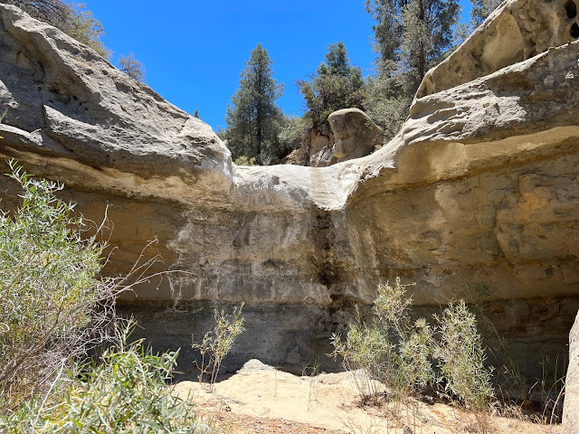
Just over 1.5 miles in a rocky marked spur trail leads south away from 23W01 and down into the Bear Trap Creek drainage to what I have labeled East Bear Trap Falls. This magnificent waterfall was unfortunately dry this time of year however during the wet season I reckon its a site to behold. Definitely worth the side trip. We followed BT Creek a short distance past the falls and found a scummy pond still holding that one could filter from if needed. This drainage is really enchanting and the temptation was there to follow it (if possible) all the way to Bear Trap Camp. Mixing things up a bit on the way out instead of climbing the spur we followed the drainage back to where it intersects 23W01 yonder up the ravine.


East Bear Trap Falls

Bear Trap Creek drainage


Back on trail now and progressing onward it wasn't long before we spotted the infamous black tubing. Another Damn grow site. I swear every great remote place in this forest is polluted by these assholes. This tubing does not appear to be that old and unlike some other sites they took the time to completely bury this shit underground over a long distance (semi east/west direction) from the mini falls shown below. I started to pull it out and follow it but stopped short of the end points where most likely the fields were or are ? With the drainage dry my hunch is they are gone for the season. But you never know. Makes me wonder was our friend the Bobcat from earlier a casualty of this mess? I wouldn't doubt it. These zones can be and often are extremely toxic and devastating to wildlife. 

Tubing runs Northeast/Southwest from here.


East Bear Trap grow operation N34.68291° W119.27586°
Much of this crap runs precisely inline with the old trail and was not visible. Rarely (in my experience) does it seem they take the time and effort to hide it this good 

50-75 feet West of the tubing

Looking South up the drainage beyond the site that we would ultimately drop into from 23W01

From the grow site drainage the main trail runs parallel and south up the ridge. Depending on the map in hand some have it terminating around here N34.65502° W119.25185° at 6000 feet or so in elevation, while others show it extending all the way to Haddock Camp. We ultimately went about another mile up before having lunch and deciding to blindly drop off trail into the canyon to loop back down to the grow vicinity. More often than not a move such as that is painful but this worked out okay. We got to poke around numerous interesting rock formations and get a good look at was going on further up. No sign of the growers, in that direction at least. 


The day finished at about 7.2 miles and a few thousand feet of elevation gain. Ultimately I  would have liked to explore further along 23W01 albeit curiosity of what else we might find got the better of us. Sometime I will return and see about following the trail to Haddock and as mentioned earlier maybe skipping along Bear Trap Creek from the falls to the Camp. 

Cheers 

DOWNLOAD KMZ FILE (Google Earth)

If you enjoyed this post you can use the feature below to subscribe by email and receive additional posts delivered to your inbox as I complete them. If you don't want to follow by email there is also the option to subscribe via the RSS feed reader widget. Which you can access from the desktop view.  Thanks for the support. 


Subscribe

* indicates required