
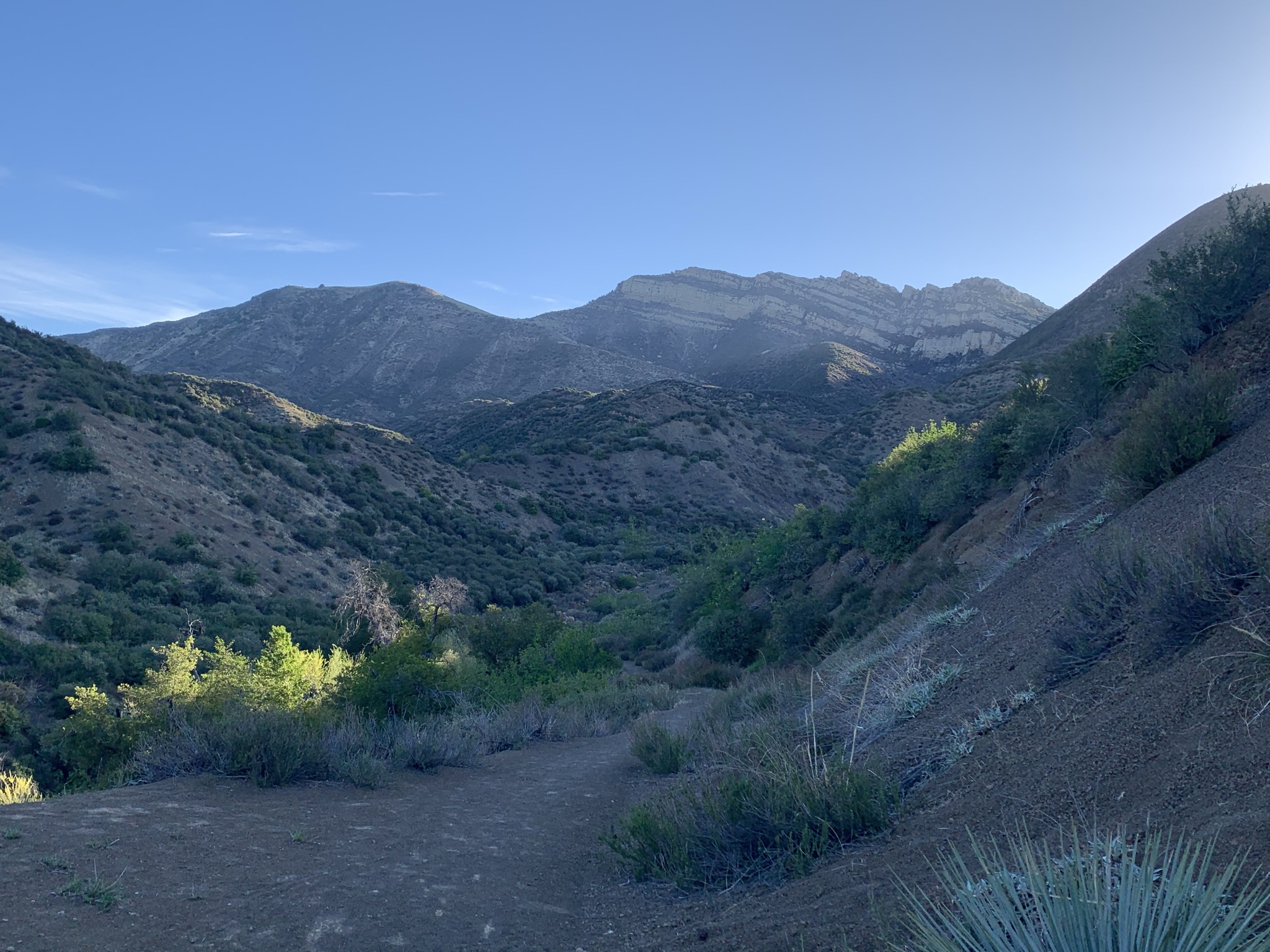
The Big Narrows
I'm gonna go ahead and start this post off with a nod to the Forest Service for completing the necessary requirement's to finally open the Potholes Trailhead. I've been critical at times, even down right nasty over the years voicing my displeasure regarding the whole situation. While I can be quick to complain, I also want to make sure I give credit where it's due. So THANK YOU to all involved this extends to those folks outside the agency as well who worked tirelessly to see this through. People are excited, and already out there using the trail once again. The AB is back and you should all be proud. This is a beautiful area with new access for all to enjoy.

Well that's me with long time pal KC at the Dough Flat Trailhead

Got a shot of them all before they could scatter. Left to right NW, JD, KC, SB and MS
I got a few friends (not many) most of them appear in the photo above. Some of them may look a bit ancient and weathered but don't let that fool you. These dudes can smoke folks half there age on the trail. When we assemble for a group backpack it's usually noteworthy. Recently we vowed to all come together at least a few times a year when we can get our work schedules to align. Most these trips for various reasons will never make the blog. The last one (our best if you ask me did not). Sucks yes I know however I'm really making an effort these days to be a grown up and not put online things that shouldn't be. BOO, BORING, Sorry we cant all be as bold as Stillman was. That said plenty of highlights from this venture can and should be written about if nothing more than to celebrate the opening of Potholes and to credit Stephen with his Tin Can Cabin find. (More on that later). Not to mention I have been saving my personal completion of the Agua Blanca Trail (insert some great words from HS Thompson here) to when I could slide into Potholes broadside, thoroughly used up, totally worn out and loudly proclaiming victory. Yes this was indeed to be a special trip.
Whiteacre

Sulphur Peak


Ran into Tony C and his family not long after departure. Not the first time and doubtful to be the last that we cross paths in the LP.
Located east of the Bucksnort Trail (19W18) 0.2 of a mile from the Alder Creek/Bucksnort junction and within eye shot of what I call lower Bucksnort Spring Camp is a faint use trail that leads up to the Spring Proper. A small rock fire ring signals arrival. About 50 feet north down in the gully is the rounded concrete cistern. Water was stagnant and very mucky. The well shaded flat is pleasant though and this upper camp area offers much more privacy than the exposed lower site.
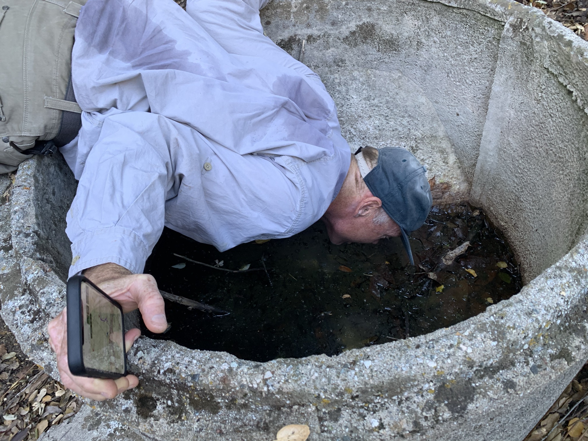
SB sampling the water at Bucksnort Spring, last I heard he was still alive.

What I label as Upper Bucksnort Spring Camp.


Once arriving at Ant Camp we promptly dropped packs for a little house cleaning and a snack break. This camp is notorious for having trash scattered about. Conveniently there was a large black plastic bag lying around that we filled with old bottles and empty wrappers. I wont lecture anyone but do wish folks would pack out what they bring in. Admittedly the camp was in better shape than I found it last time around. We didn't see much activity, nonetheless at times the site is alive with little insects it was so named after. Please though let none of that dissuade a visit, all things considered this is a beautiful spot which provides a very large flat to accommodate group events and or short overnights with plenty of opportunity to explore the surrounding area. In fact rumor has it adventurous souls can bushwhack further up the trail where most likely an Rei gift card still awaits at Saddle Skirt Camp.


The upper section of the Agua Blanca from Ant Camp down to Cove Camp has not seen much if any trail maintenance for many years. The tread is very much discernible at times and not so much at others. Expect some washouts, Bushwhacking, and a healthy dose of Poison Oak. In fact you should look forward to and be happy about it. This enhances your Wilderness experience. I thrive and feel most alive in these settings and it's where some of my best memories are made. The ticks were out and especially bad at least for me. My guys tend to make sure I'm in the front. I don't know if its because they trust me to lead the way or that they know Ill catch all the ticks first. (Probably the Latter). That said much of the route still has flagging with an abundance of rock cairns to follow and because of the new trailhead downstream, foot traffic is picking up, which helps break up the brush and smash down tread. With the new access and being part of the Condor Trail I suspect at some point plans will be made to continue the trail work up from where it currently ends around Log Cabin Camp.

Tin Can Cabin one of the great mystery camps of the Southern Los Padres, at least it has been to myself and many other nerdy backcountry enthusiasts. Pictured on several older editions of LP Recreation maps and even Hike Los Padres (though not surprising HLP has the location completely wrong, marked way to far downstream). I'll note while that may sound rude I do believe Bryan enjoys when I harp on them for such matters. By the way, where is that web update they have been teasing us with? Tick tock, tick tock. Anyhow back to business in 1974 Gagnon writes: " From Ant Camp bear right (southeast) onto what remains of the Agua Blanca Trail (19W10), and follow it, mostly in the streambed, for 1 mile to the site of Tin Can Cabin: On a flat off the no longer maintained Agua Blanca Trail, this camp, boasting a cabin made from abandoned five gallon water tins, is scheduled to be removed in 1974." Prior to our trip no material I previously researched had yielded an exact location as to where this site might actually be. On top of that no official record exists, at least that we could find. Gathering physical evidence on this one has been at the top of my must do list. On the drive up to Dough Flat I blurted out to the boys "hundred bucks to anyone that finds an old five gallon water tin near the flat." Clearly that statement was all Stephen needed to hear. The old hound dog picked up the scent. Thus after Tin Can staying a mystery never stood a chance. I'm confident he found the site and feel the evidence below speaks for itself. Unless someone out there can prove us wrong, right here, right now I'm calling this the official site of Tin Can Cabin- 34° 34.260' -118° 52.712'

Looking down upon the old Tin Can Cabin Flat. The historic site is near the creek just behind our tents (center left). 0.7 of a mile downstream from Ant Camp. Here as seen on the 1943 Devils Heart Peak Quad an old trail coming up from the Agua Blanca & passing through a serious of awe inspiring meadows, once connected with the current Bucksnort Trail. I refer to it as the old Bucksnort Spring route. Further proof that a cabin would most likely be built where a trail once came in.
 Proposed cabin foundation of natural river cobble in a perfect rectangular shape.

Large pile of rocks inside the foundation that may be the remains of a stone chimney.


After much satisfaction in finding what we believed to be the TCC Site it was decided the location would make for a great night one Camp. After all the flat was plenty roomy for our large group to spread out and not feel cramped. The added bonus of being less than 6.5 miles from Dough Flat afforded us with plenty of extra daylight hours to check off the remaining to do's on our list. We spread out and what was to follow may have been a lot of rock outcrop mapping, or perhaps a severe brush beating into the unknown. The days memories are a bit fuzzy after Tin Can Cabin, the nights dreams were epic though!


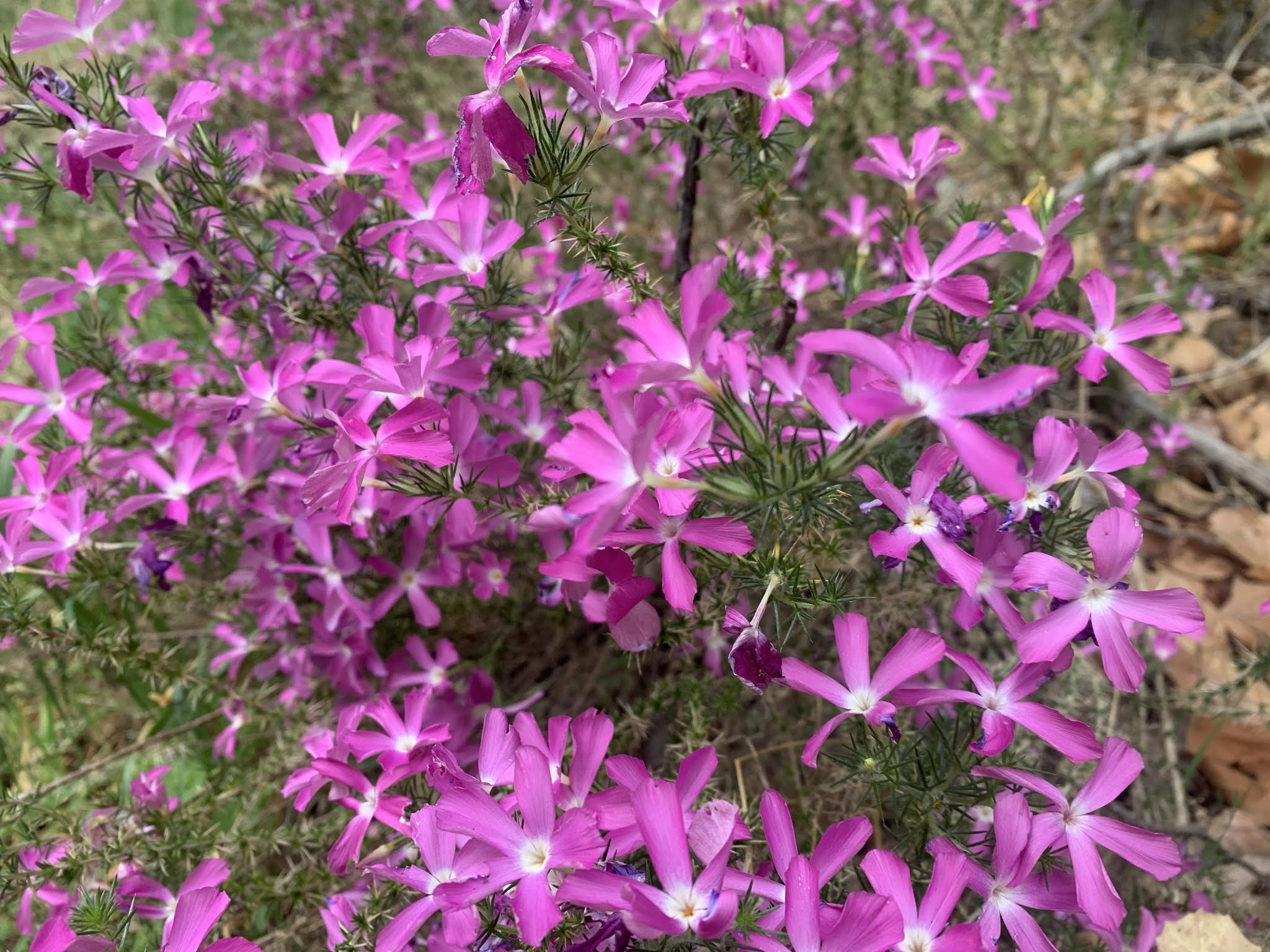
Nate steady capturing the beauty of the local flora.


Very old Trail Blazes

The Agua Blanca Big Narrows


Possible grave site ?

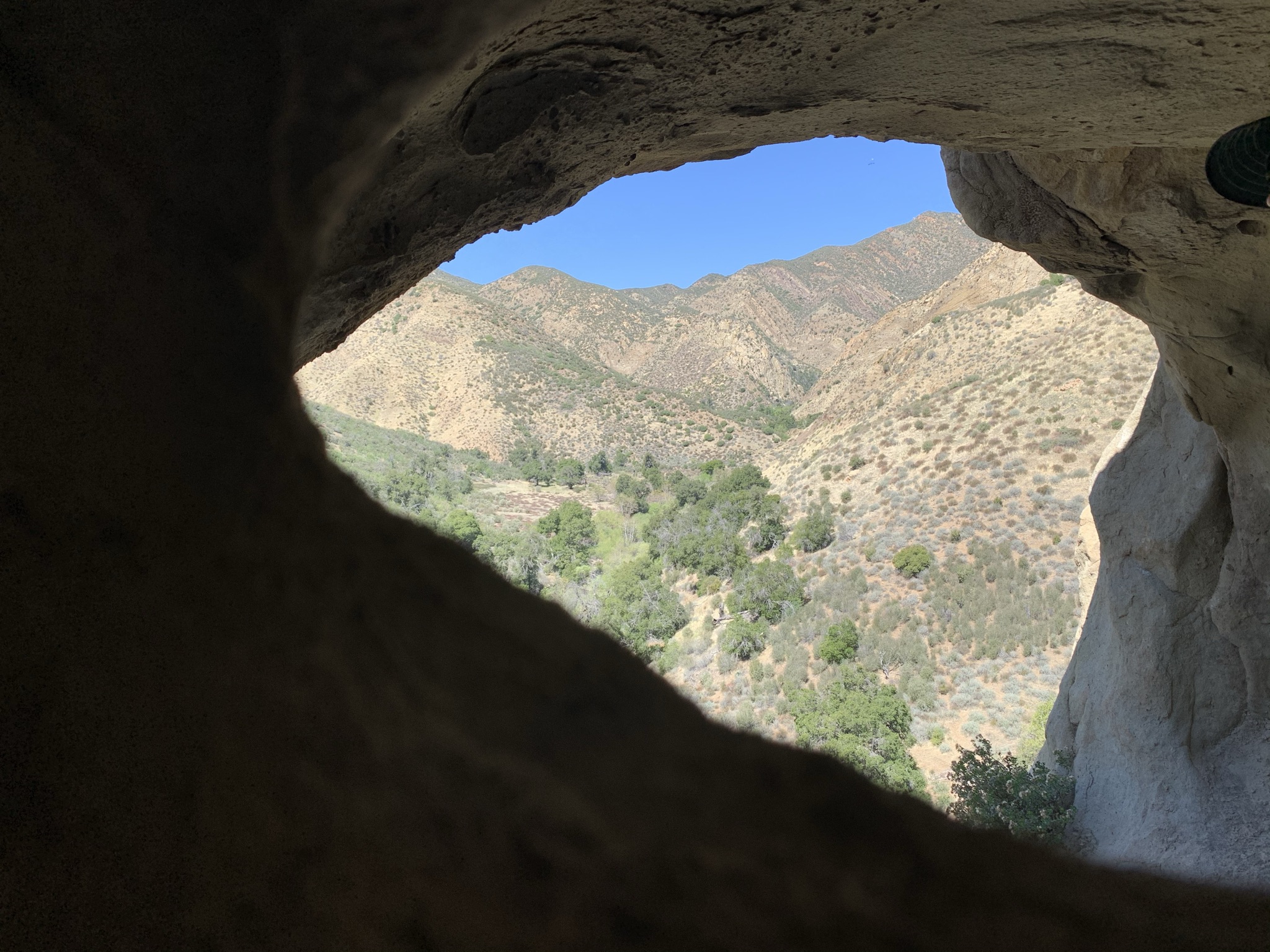
Upon exiting the big narrows the terrain widens considerably, offering great slot canyon views back upstream. We poked around the vicinity a bit and found what appeared to be stones aligned in the shape of a cross. Perhaps marking a grave site or something of that nature. After some exploring we continued along for another half mile or so arriving at our second night's camp destination the seldom visited Cove Camp. Well at least it definitely was before the Potholes opening. Not long after setting up camp a group of two men walked right up on us looking surprised and disappointed to find a full house. I can say we were equally as shocked to see them. Prior odds of running into another group at this camp in the past would have been slim to none. If you ever read this Addsion Jerlow (I seen your HLP Report) Sorry for being the reason you and your friend had to push on.


Rocking my new Zpacks Plexamid


Log Cabin Camp - (34° 32.971' -118° 48.383')


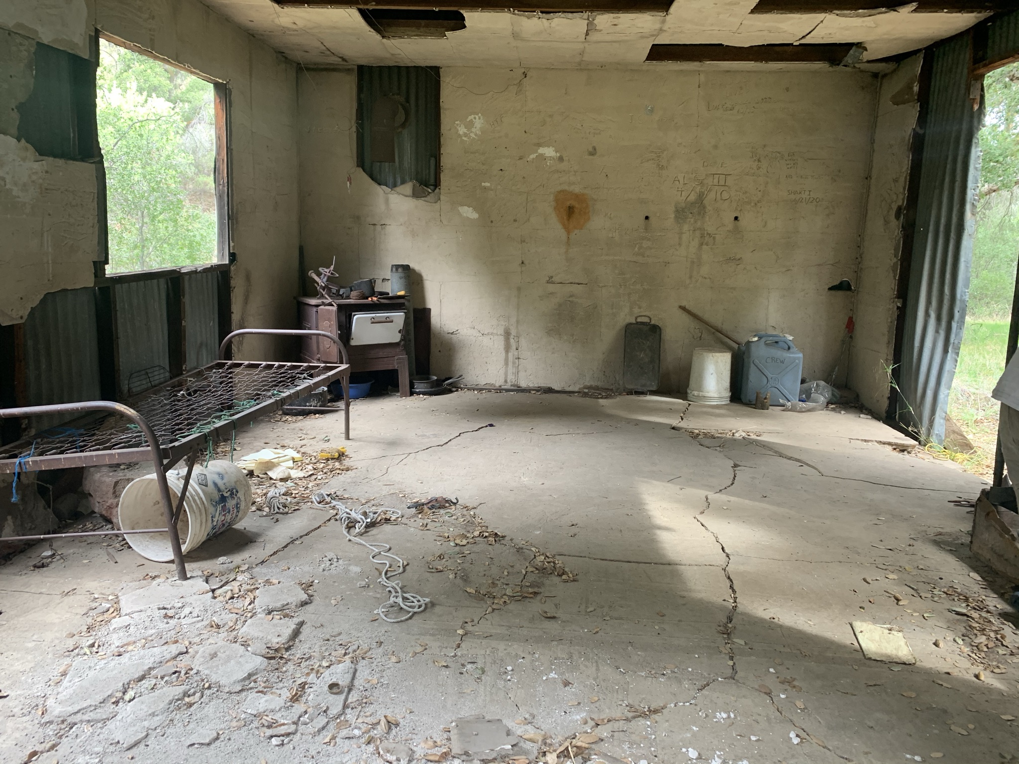
Whitaker Cabin at the unofficial Pothole Spring Camp


Devils Gateway


Scratching post for the bears. We re-installed this sign back in 2018

Kester's Camp

Pothole Trailhead (34° 30.701' -118° 45.772')


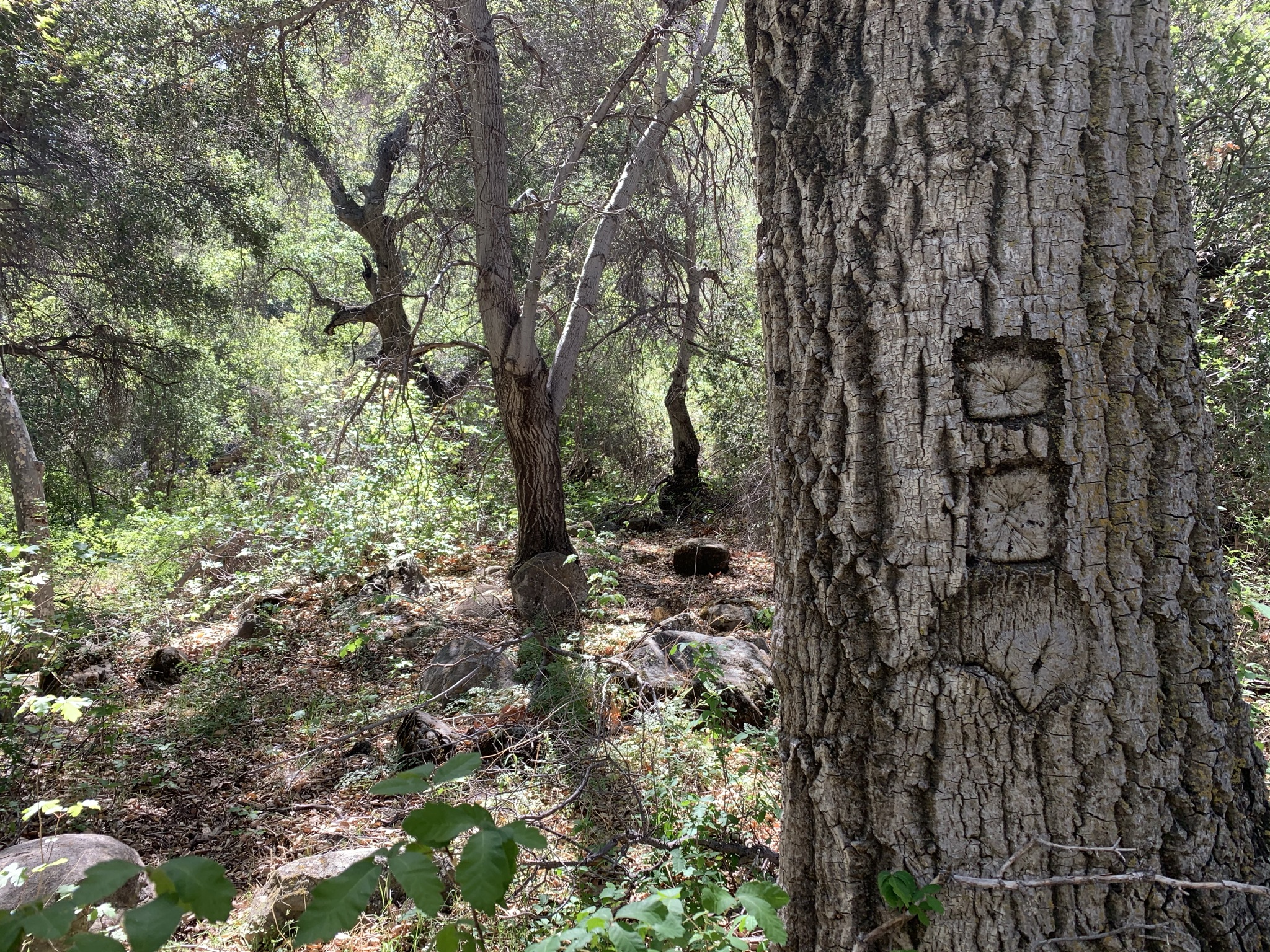
Big ass beautiful Live Oak.

NW with the his Osprey eyes always making the great finds. (Objects left in Situ)

