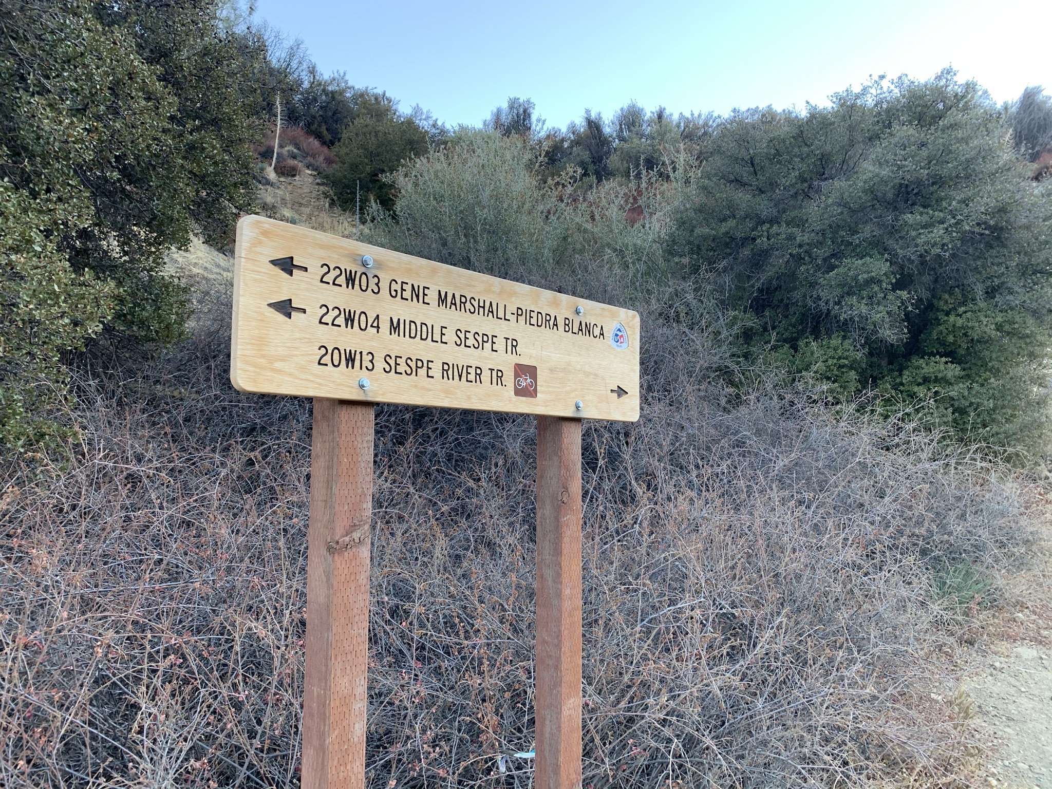
Red Reef Trail (21W08)
2020 hasn't been all bad, in fact this years Thanksgiving weekend just might have gone down as one of my most productive yet. With still semi full bellies from our previous evenings feast Jeff and I set off along the Sespe River Trail with the intentions of visiting one largely forgotten camp and completely renovating another.
Sespe River Trail (20W13)
The morning was cold. We knocked out the first 4.3 miles or so to Bear Camp in a hurry hoping to thaw out all the while easily keeping our feet dry throughout the many crossings. As to be expected this time of year water levels in the Sespe were low and intermittently flowing. With a full parking lot I expected Bear to be crowded however we only encountered one small group. My guess everyone was partying it up further downstream at Willet and or Sespe hot springs. Bear is a good size camp with world class swimming holes though I must admit on this day the water looked a bit mucky and uninviting. In 1971 the Bear fire originated here, hence the name.
Bear Creek Camp - N34° 33.605' W119° 06.129'
Across the Creek and approximately .3 of a mile downstream to your right (South) is what I call an old brick house shitter. These relics of the past still dot the landscape from a time when up until the late 70's the Sespe River trail was a former 4wd road.
(Sespe Hot Springs Video 1974). Continuing on another .3 of a mile is a user created site just before the year round water source of Kerr Spring.
Brick House Shitter
Unofficial Kerr Spring Site
Downstream from Kerr Spring (about a 1/2 mile) the trail once again crosses the Sespe. A large Oak tree in the distance marks the spot. In January of 1969 six young boys and four men lost their lives here attempting to make the crossing in one of the worst rain storm events to ever hit Southern California. In 2008 Outside Magazine Published the horrific details in a story titled
Hell in High Water (which you can read here).
Hell In High Water - N34° 33.734' W119° 05.123'
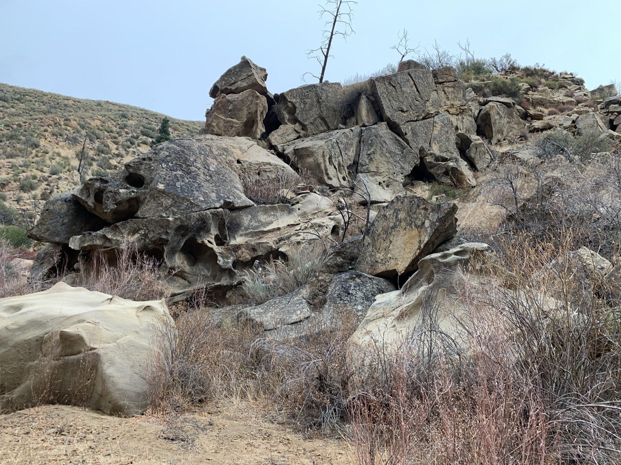
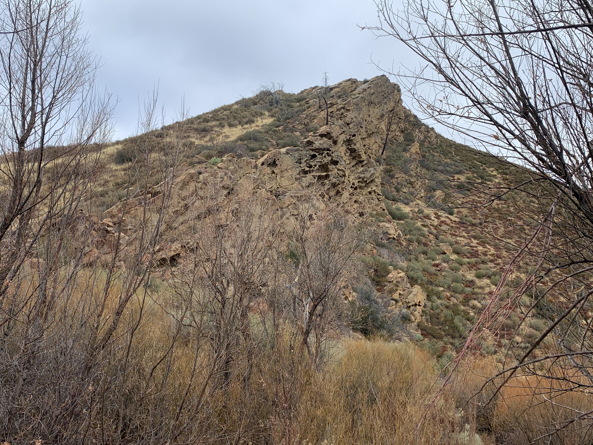
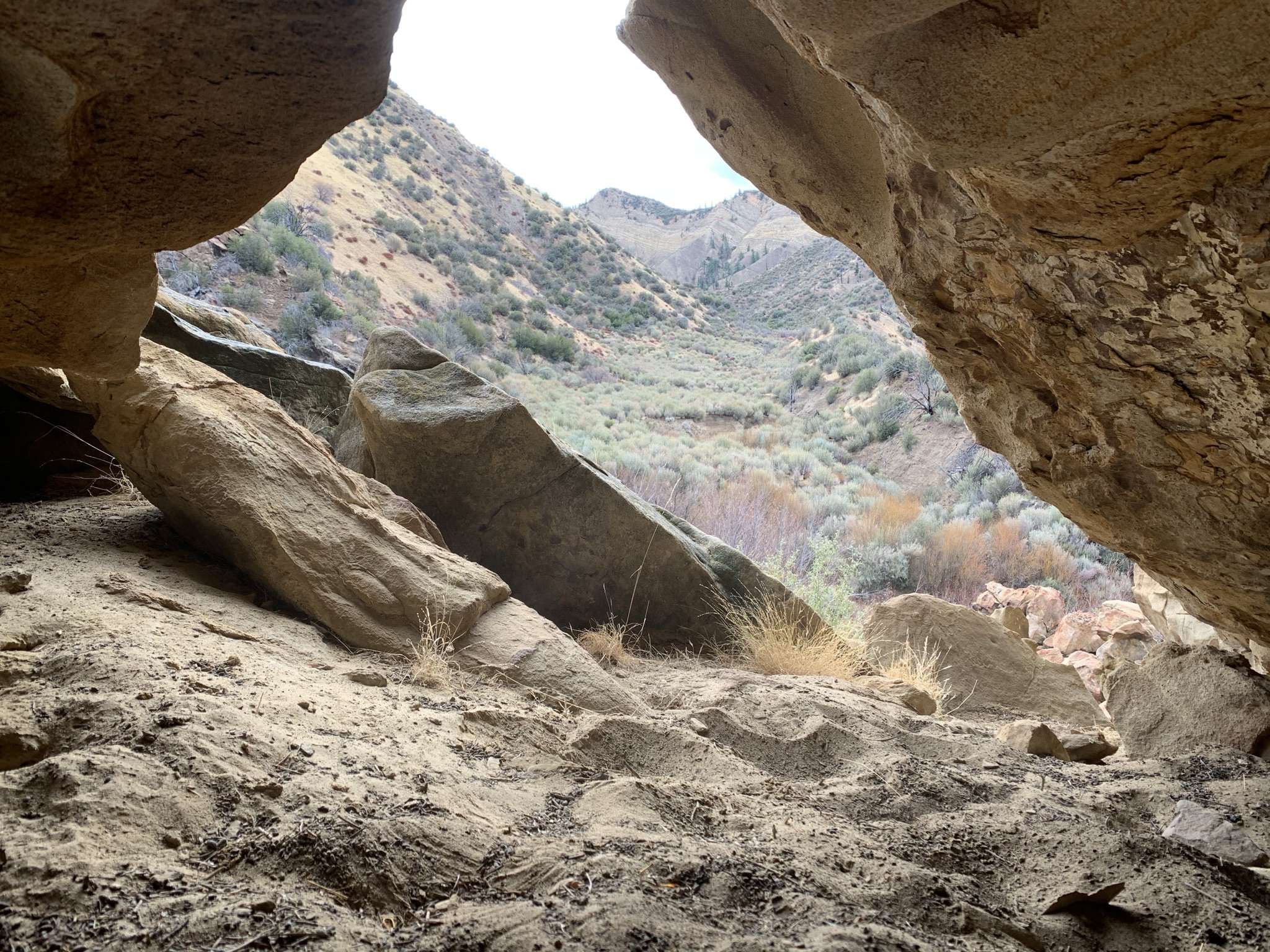
High above the Sespe River around the 6.5 mile mark the trail bends north at the mouth of Kimball Canyon, it's here that earlier Forest Service recreation maps show a spur trail leading south to a Timber Canyon Camp. Modern maps make no reference of this camp. Only showing Oak Flat Camp in the very near vicinity (see examples below). Upon first glance one might think they are one and the same, when in fact they are not. In 1973 Dennis Gagnon writes
"Timber Canyon camp will probably be removed in 1974" along with so many others as part of a big fiscal crunch. This we know from
Craig R Carey's Hiking & Backpacking Santa Barbara & Ventura was not the case. Craig writes:
"To access Timber Canyon, head downstream along Kimball Creek (the drainage just before the turnoff to Oak Flat) from the trail through the red Sespe sandstone and to the creekside. There are wind- and water-eroded rock formations and excellent swimming holes here. Just downstream of the Timber Creek confluence is a flat with a handful of mature live oaks and the old camp. Enjoy!"
2014 addition of the Tom Harrison Sespe Wilderness Map
1967 Los Padres National Forest Recreation Map. Also note Sycamore and Horsethief camps. More on these below.
Looking down upon Timber Canyon Camp
Craig's description above was spot on and led us straight to the site. Along the route and just adjacent the camp are various other fire rings which still appear to be getting a decent amount of use. I reckon to locals this place is no secret as much work was done here creating the stone benches and the elaborate circle rock formation pictured below. Hopefully I don't receive hate mail for posting these photos.
A few sites adjacent the old camp. Couldn't help but to admire the rock work. The stone seats were neat as well and quite comfortable.
Timber Canyon Camp - N34° 33.399' W119° 04.199'
After a satisfactory visit of Timber Canyon we decided to have lunch over at Oak Flat. Instead of backtracking our way to the trail we instead followed the Sespe River down around the bend coming into Oak Flat Camp from the backside. Along this stretch is a magnificent little swimming hole. A few fire rings mostly used as overflow sites are available on the east bank which allow for easier access to water than from the main camp.
Excellent swimming hole just downstream of Timber Canyon
Oak Flat Camp - N34° 33.574' W119° 03.942'
Red Reef/Sespe River Trail junction - N34° 34.150' W119° 03.165'
Done with lunch we followed the Oak Flat Spur back to the Sespe River Trail. From that point it's about 1.6 miles to the Junction with the Red Reef Trail. Our original destination plans for the next two nights was to spend them at Horsethief Camp (no longer included on modern maps). Once reaching the sandy beach where Red Reef leaves the Sespe for the climb up canyon we changed our minds. With the short daylight hours and unknown water situation at Horsethief the decision was made to base Camp very nearby at what's left of the old Sycamore Car Camp a few hundred feet east of 21W08 down in the Cottonwoods. This Camp was abandoned along the with road in 1979. While not much remains the site is still very suitable for overnighters. A few scummy ponds were still holding water in the Sespe, we weren't thrilled about the prospects but hey scummy water is better than no water.
Sycamore Camp center stage down in the Cottonwoods

Beach front Site where the Red Reef (21W08) crosses the Sespe River.
30 weight mineral rich water Yum!
Our Camp at Sycamore - N34° 33.936' W119° 03.186' it's obvious from the more recent burnt wood that the camp is still getting some light use.
Full moon rising
No campfires (current fire restrictions) in late November can make for brutally cold nights, ours were no exception. Not to mention by 6pm it's completely dark out which doesn't bode well for anyone that likes to stay up chatting into the night. Luckily that's not the case for myself nor Jeff. Were both perfectly fine with quiet evenings and a good night's rest. Without all the extra layers I packed last minute and a few shots of whiskey it's almost a guarantee I would have spent the evening in the fetal position praying for sunrise. Yes it was that cold.

A look back down on our camp from the Red Reef
Making our way up toward Horsethief
We woke early with the sunrise, gathered our tools plus essentials for the day and began to make our way up the Red Reef Trail. Thanks to recent maintenance from the fine folks over at the
LPFA the first mile is in really good shape and easy to follow. Shortly after the Harris Tunnel (blasted out by the Harris brothers in 1904) the trail gets brushy, you'll no doubt have to push through some overgrowth until shortly before reaching the saddle between Red Reef and Timber Canyons.
Harris Tunnel - N34° 33.445' W119° 02.972'
At about .4 or so of a mile after passing through the tunnel is a well defined fork in the trail (Stay to your left) going right once led to old switchbacks that brought the user high above on the west side of the Canyon. We figured the trail at one time had been rerouted but did not know the whole back story until conversing with Mickey McTigue after I returned. Apparently after the 69 flood washed out much of the trail the Forest Service in the early 70's hired a contractor to reroute the trail up and away from the creek with 40 switchbacks and miles of crbwall. In 1991 before the Los Padres Condor Range and River Protection Act ranger John Boggs (Ojai's district trails manager) and other volunteers put the trail back along the creek. You can still see much of the old shoring if you look high along the route.
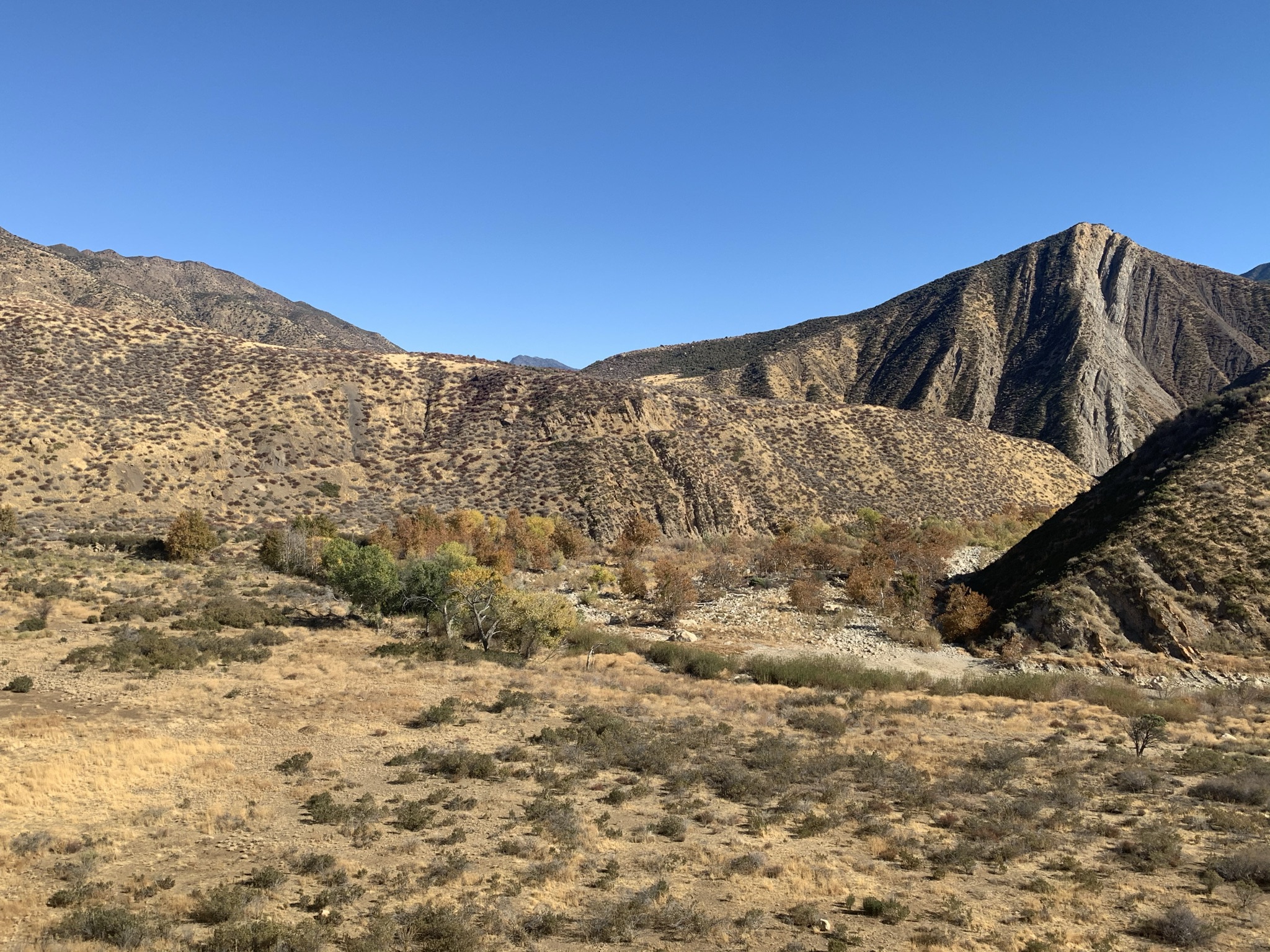
TopaTopa Mountains
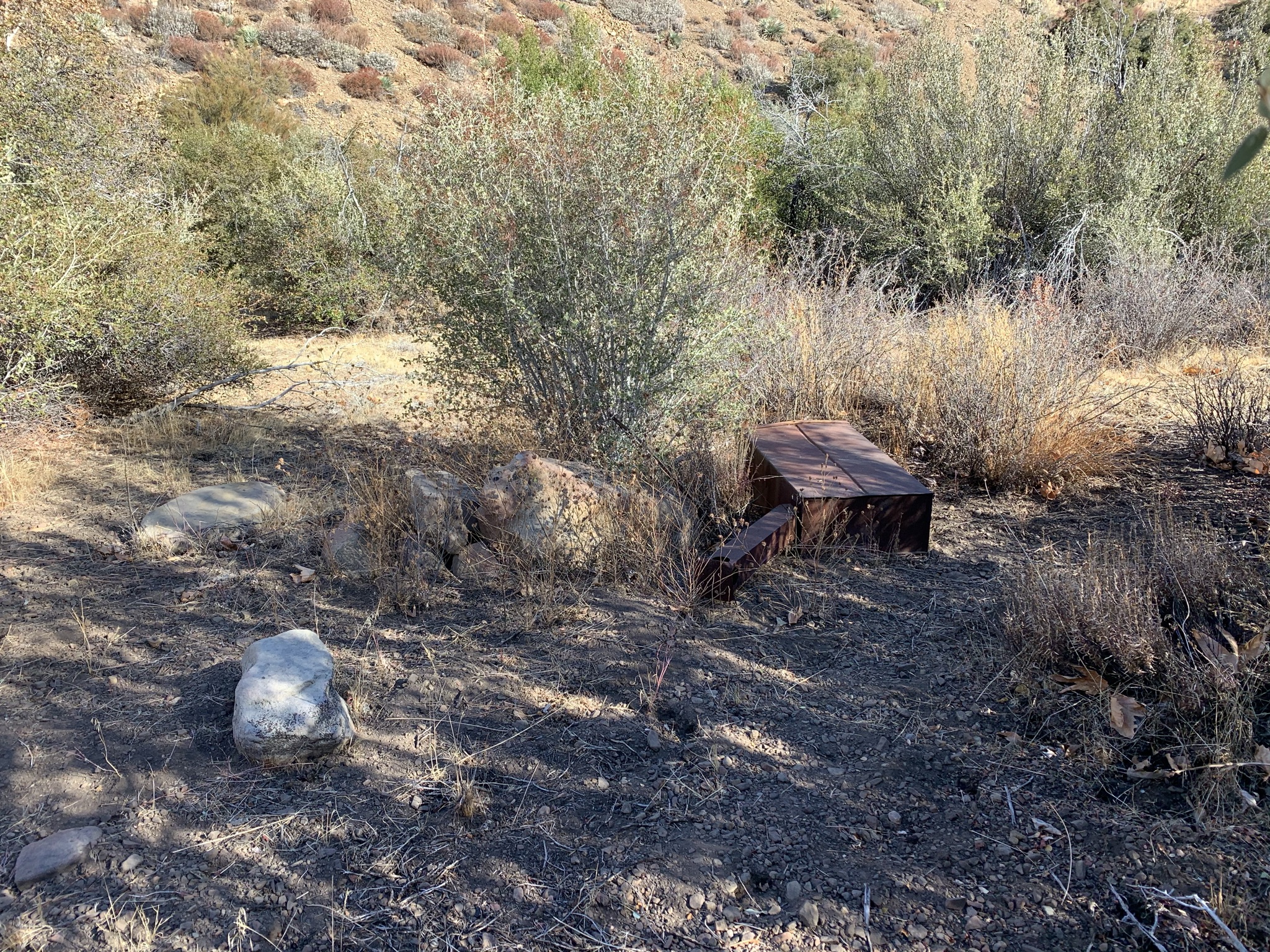
View from the saddle down upon Horsethief Camp. Look closely and you can see the ice can stove peaking through the brush.
Right before the trail drops down to cross Timber Canyon Creek is the old spur trail to Horsethief.
(N34° 32.615' W119° 03.161'). Obviously if you hit the crossing you went to far. The spur is short maybe .2 of a mile if that back downstream along Timber to the Camp on the east bank. The last 100 to 200 feet sucks you will be bushwhacking and possibly crawling but it wont last long. Again I'll refer to
Craig's much more eloquent writings for a little camp history here.
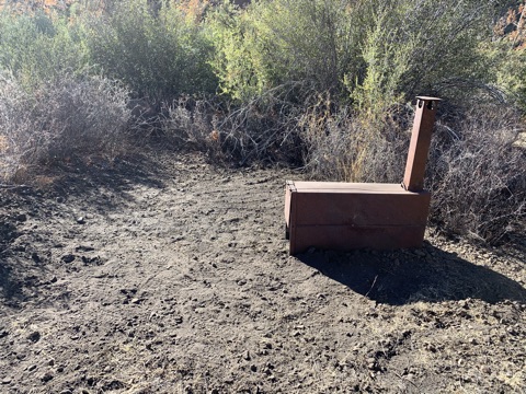
"Horsethief Camp, named for the desperados who stole stock from further south and grazed the animals on Old Man Mutah's pastures before continuing on to the Central Valley, sits largely unnoticed along the Red Reef Trail. Situated comfortably on a flat just beneath a gap dividing Red Reef and Timber Creeks, it's been denuded of most of it's shade but still features three ice can stoves, and space enough for a small crew."
It's been my dream for sometime to locate this camp and get it fixed up and that's exactly what we did. See the before and after photo's below and yes we left the customary $25 dollar REI gift card as this is now the #7 Lost In The Los Padres Blue register can site. Get out there while the getting's good.
Camp condition upon arrival
After Our work was completed
Horsethief Camp - N34° 32.688' W119° 03.265'


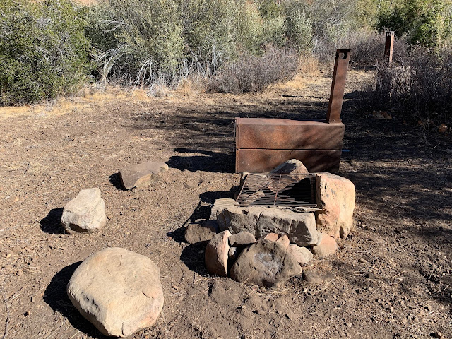
After hours of blood, sweat and back breaking labor I'd venture to say Horsethief looks better than it has in decades. We put into it as much effort as humanly possible for two men with limited hours before having to return back down to our camp on the Sespe. We left a small new camp shovel and mcleod tool on site. Should you visit please leave the camp in better condition than you find it. There was a small pool still holding some water just downstream of the camp and Jeff heard flowing water somewhere upstream (he hears a lot better than I do). Alternatively plenty of cool clear water was available back down the trail in the Harris tunnel vicinity. Much thanks to Jeff for always having my back on these labor intensive trips, appreciate it my man couldn't do it without you. After the work was complete we hiked back down to spend our last night once again at Sycamore before returning back to our car at the PB Trailhead. A full GPX and KMZ file are available for download below. Also if you did not get a chance the first time scroll back and check out the clickable links (highlighted in orange) for a great video and some good reads.