|
| Santa Paula Peak in the center |
So before summer roles around and the Los Padres becomes a steaming inferno I will be gunning to knock a few peaks off my list. I've had my eye on Santa Paula and San Cayetano for some time now. By accident or design I am not certain but Fillmore has succeeded in making access to certain trails in the Los Padres difficult and these two peaks are no exception. My decades old prized possession LPNF Maps do show forest route 4N02 leading up toward San Cayetano from Grand avenue and connecting to 20W15 however that has long since now landed on private property. I did read about Stillman trying a route near that once but he was stopped by an impenetrable wall of brush and some 100 degree temps. Santa Paula Peak was once also a popular spot for locals with the two main routes being the East fork of Santa Paula Creek 21W11 and Timber Canyon to 20W16. Herein lies the next problem the old East Fork trail is extremely over grown and washed out leaving that route for the die hards and the newer property owners, unlike the previous ones have blocked public access to Timber Canyon to all but a select few that they choose to share the gate codes with. I've been told mostly search and rescue. Fortunately for me I was granted access, so with that boots on and to the hills we went.
 |
| First Look at Santa Paula Peak From Timber Cyn |
Before I start into my normal route instructions I want to emphasize that this is private property and should be respected as such. Please do not attempt this route without the proper permissions and access codes to the multiple locked gates that need navigating to the old Trail-head. This write up serves to help those folks that have been granted access. All others should reach this peak from the mouth of Santa Paula Canyon travelling up the East Fork.
 |
| The trail starts here between the two Oak Trees |
Pictured above between the two Oaks is where the Trail begins, there is an adjacent area wide enough to turn your truck around and park here. The road starts as paved and eventually turns into a very narrow channel dirt rutted road between high brush. With all the currents rains it was in worse shape than it had been in the past. Without 4 wheel drive in my truck I was forced to park about .7 mile further down from the actual Trail-head which in turn added some unplanned distance to what was an already planned long day.
Right out the gate the peak looms over head and looks a lot closer than it actually is. Most of the distance comes from the old trail switching back and forth across the whole southern face. The wildflowers in the lower portions were out in full force and really added some pretty contrast to the hills.
 |
| Good look at the terrain you should expect coming up from the south face |
 |
| Reece found a nice spot for a break |
 |
| Outstanding views along the whole way up to SP Peak |
The Santa Paula peak trail no longer receives maintenance and as one would expect is not easily followed for the casual hiker. Nature as fully taken back the trail in most places. However the Thomas fire has opened up the whole area leaving mostly at max just knee high brush to contented with. Most folks with off trail experience should have no trouble getting to the top. You will want to mind your steps though as travel is mostly along steep rocky, bushy, uneven surface. A small slip here has the potential to be really bad. This jaunt is no walk in the park all the way in is an uphill grind you will gain a good amount of elevation quickly (aproximetly 3300 to SP), there is no water so pack accordingly. From where I parked it was about 4.2 miles one way to the top. You can shorten that .7 mile each way if you drive all the way in.
 |
| Thanks Reece for capturing this shot |
 |
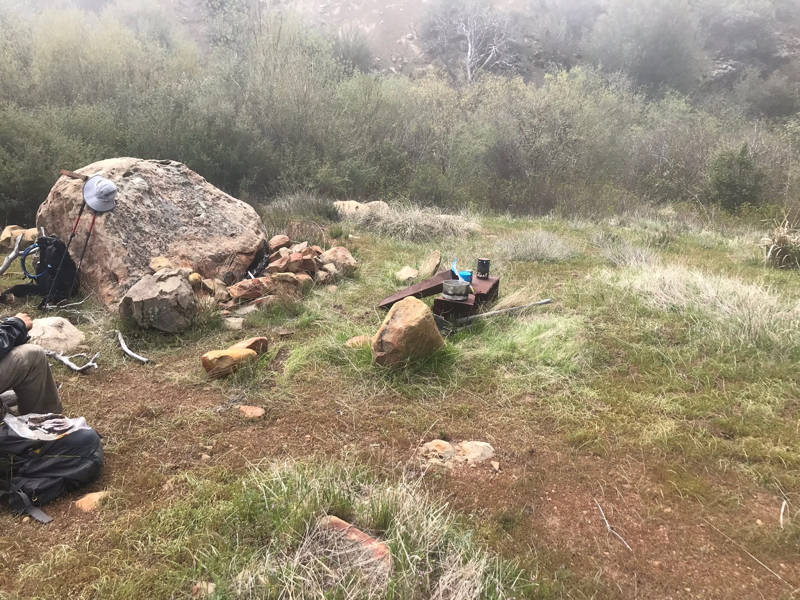
| Rock Fire Ring at the Guerrilla site |
 |
| Overview of the Guerrilla Camp |
About 2.8 miles in to the west of the trail is a little guerrilla site with rock fire ring. Possibly used by hunters or maybe just overnight campers wanting to hunker down out of the wind. Even further up the trail pictured below is a nice port-a-potty should the need arise.
 |
| Trail facilities |
 |
| Evidence of the Thomas Fire |
About 4 miles in just before 20W16 starts to head down the backside toward 20W15 is an unmarked spur trail that will lead you up to the Peak. Spur coordinates - (N34° 26' 22.1" W119° 00' 28.2")
 |
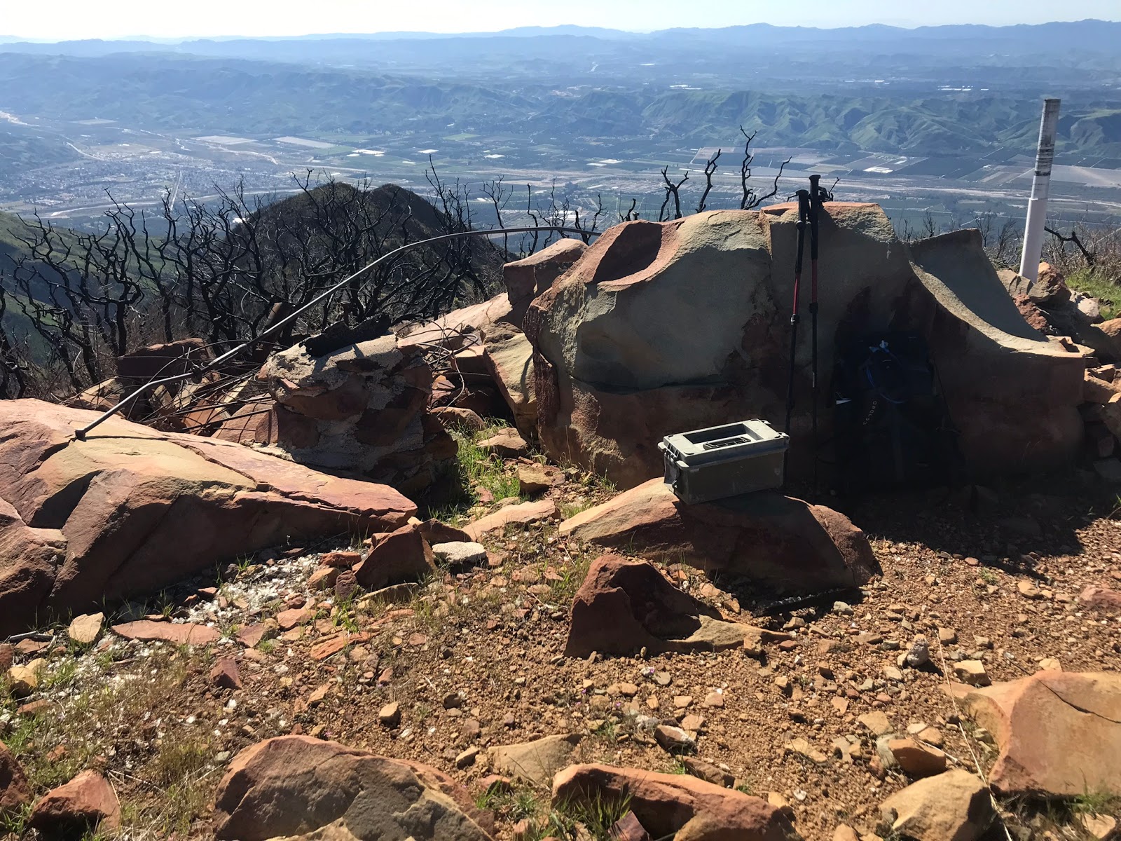
| Picture on the summit of the register box and some metal left from the fire lookout tower |
 |
| Memorial Plaque on Sp Peak |
 |
| USGS Marker |
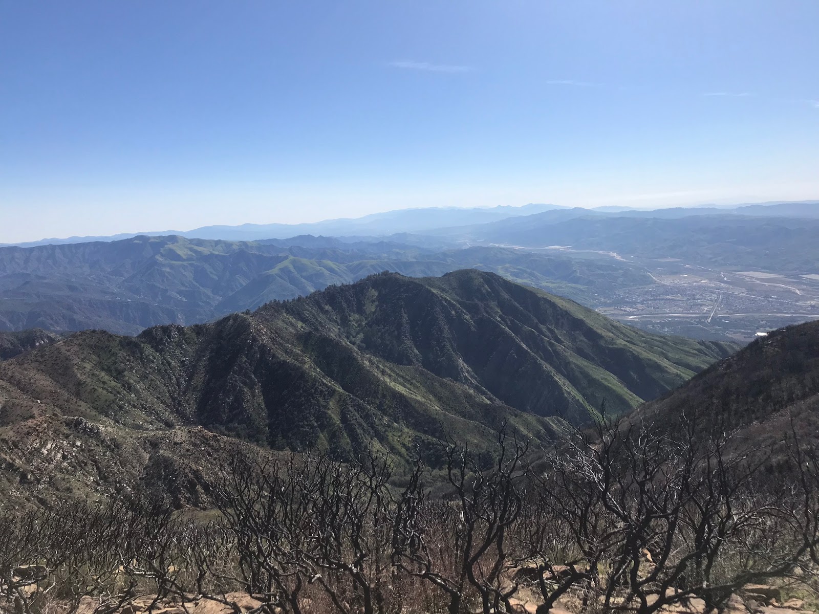
The 360 degree views from Santa Paula peak are damn good. Arguably some of the best. Probably why at one time there was a great fire lookout tower up here. Which I believe burned in the wheeler fire but don't quote me on that. I could see the Channel Islands, all of Santa Paula, Fillmore and pretty much every other prominent peak and land mark of the surrounding area. I was impressed and would have enjoyed staying longer had we not had to get to our next intended destination. Couple of the many Summit views pictured below.


After signing the register and having a snack we quickly high tailed it down the spur trail and back along 20W16 now making our way further along the trail and down the north side. The going here is easy through the burned area with the trail well defined. Right around the 4.7 mile mark is the junction with San Cayetano 20W15. Here the Santa Paula Peak Trail cuts west to head down toward Cienega Camp and meet with the East Fork 21W11. San Cayetano (our intended route) heads to the east.
 |
| Looking down the East Fork where lies Cienega Camp. |
 |
| That old rusty McLeod marks the junction with San Cayetano Trail. |
For the most part up to this point we were optimistic about reaching San Cayetano Mtn. Shortly after merging onto 20W15 we quickly realized that this old trail is long gone and I mean bad shape, following any semblance of this trail was not gonna happen. However we were fine with that as the Thomas fire completely opened up this stretch to where we could follow the general path and create our own route if needed to the ridge toward SC. Our luck began to change though when we ran into a wall of Poodle Dog bush. Instead of continuing to switch back down along parts of where the old trail once was through that crap we opted for an abrupt right turn shooting straight down the ravine through a opening in the poodle dog and back up and out the other side.
 |
| Poodle Dog brush wall |
 |
| Boulder Creek |
 |
| Reece Climbing out of boulder Creek |
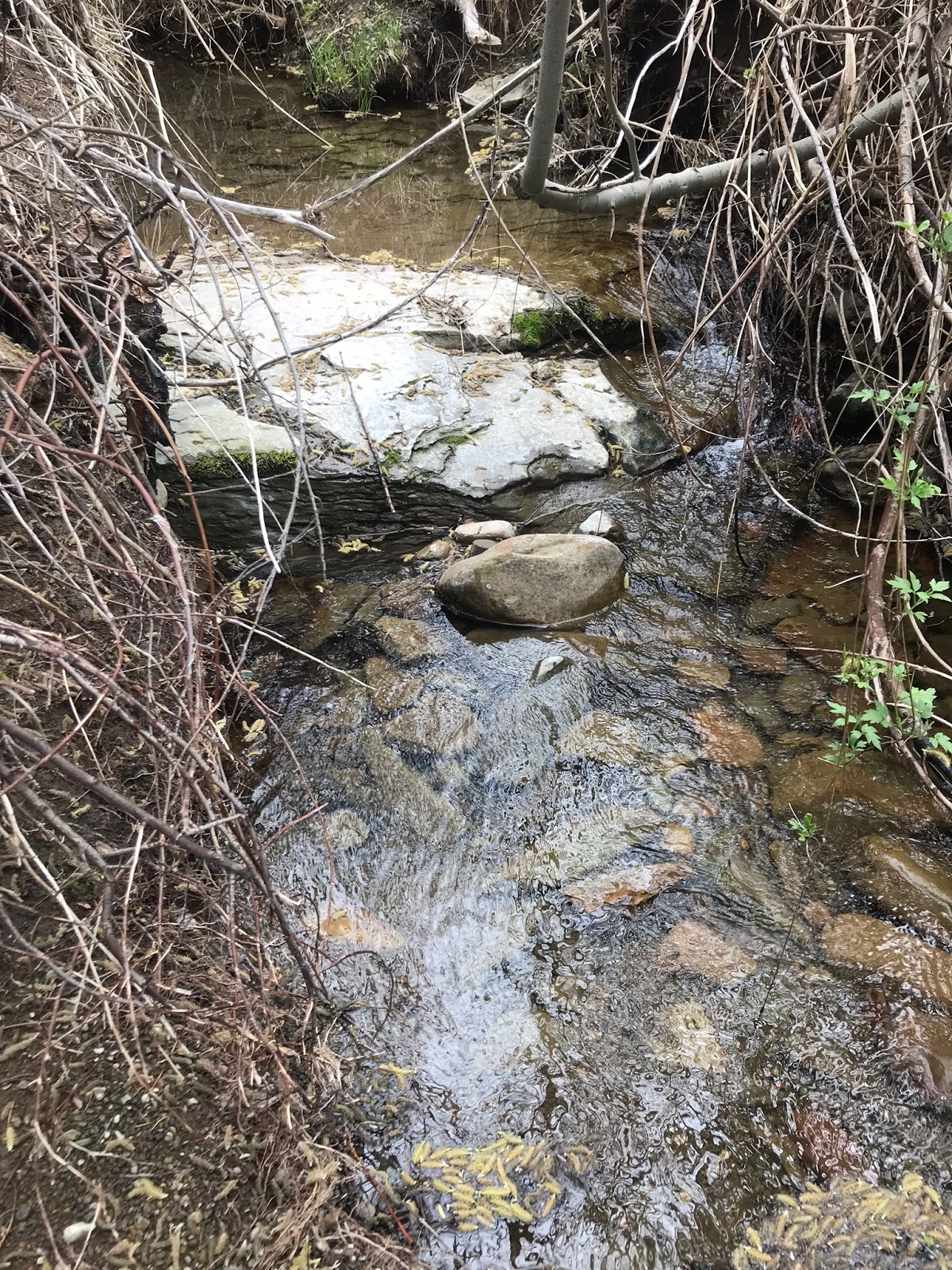
To our surprise at the bottom of the ravine we found Boulder Creek flowing with nice cool water. At this point our progress began to slow considerably. Once out and atop the ridge again we picked our way along. The nice open burn area I spoke about became less and less and we soon were battling thick brush. The problem on this ridge toward SC is it becomes razor thin. The Top and north side are impenetrable apparently missed by the Thomas Fire. The south side is much less brushy but it's steep and dangerous to keep going up and down along the ridge clinging to it's slope was just unsafe. The original 20W15 never intended to take you to the summit here, it would have lead you down the north side and eventually out at Grand Avenue, so I figured on it being rough but that was an understatement. As much as it hurt we knew that at this pace we would not have enough daylight to get this done. We were by now getting tired and had already taken a good brush beating. Not to mention I was covered head to toe in black soot. We ended up calling it less than a mile from San Cayetano Mountain Summit. With the worst section still being in front of us. So close yet so far, dammit I was crushed.
 |
| Example of the thick brush we were experiencing |
 |
| Click photo to enlarge, black arrow shows about where we quit |
 |
| New register can that I had hoped to place on San Cayetano |
So with that we made our way back out the way the same way we came in. Just under 12 was our total mileage for the day with about 4600 feet of total elevation gain. (though it felt like much more) The black arrow in the photo above shows about where we quit with San Cayetano mountain east of that. By no means am I done with Cayetano. That shiny new register can I made up is going to get to the top of that mountain. Currently I am looking at a different approach from Fillmore. If that does work out I will be back on this same ridge dressed for battle, starting much earlier in the morning with with loppers in hand and a smaller pack. Come hell or high water I will stand at the summit eventually.