If you have been following my blog then you know back in March I found what I thought was the only two different sites that over the many years have been associated with the fabled Last Chance Camp. In my previous post I detailed the route in from lower Santa Paula Canyon and the many attractions one can find along 21W09 (The Last Chance Trail). If you missed that write please see it here:
https://christopherplord.blogspot.com/2019/03/last-chance-camp.html. Weeks later I was still relishing in my victory over finding the camp when I got served up a big dose of reality from KC. Turns out I missed the original site by less than 100 feet. His pictures of the large boulder and the original ice can stove indicative of the camp were proof. My heart sank, all the hard work I put in, I couldn't believe it. How the hell could that have happened. I've studied just about every old map of Last Chance going back decades and I thought I had thoroughly searched the area of where the original site should have been. I even found a piece of that stove at the lower spot I had labeled site #1. At the time it seemed like a slam dunk, case closed. (All the while though I did wonder a little why I never found a large boulder directly on any of the sites I was at). There was though a large rock really close to what I labeled site #2, it was surrounded by thick brush so just assumed that was probably the one others had made mention of in the past. KC sent a waypoint I examined it on google earth, it was in the middle of a brush choked creek drainage that I had walked within feet of. The camp could not have been there. I plead my case had a little back and forth with him on how I found part of the stove and probably just missed the boulder. Picturing the area in question in my head was hard to grasp how I could have missed The main Camp. KC was gracious but in the end he held strong on the fact that he believed I missed the target, and deep inside I knew it as well. I slept horrible that night. I hate getting things wrong. It is not easy to get to Last Chance and back in a day but I knew that was exactly where I was heading. We were all set the following day to try another summit attempt on Cayetano. My compadres got a last minute text saying change of plans were going back to Last Chance. One more time I pulled up google earth inserted my prior track and all the relevant camp waypoints I had made on the last trip. Pulled up KC's pictures and started to line up the surrounding mountain features in the background of his photo versus google earth close ups and that's when it all came together. I noticed a small flat on the west side of the drainage where the old trail crosses the creek to head toward Hines Peak. Zoomed in and all be damned if the mountains features didn't line up perfect. All the the maps had it wrong. Every where I have ever looked showed last Chance Camp on the east side. All my sacred 1960's Rec maps WRONG. Over the years I can easily imagine now how countless folks would have never found this main site. The maps lead you directly to what I had labeled site #1 and site #2. Lackluster spots with little fire rings. If you were just going up from the lower Santa Paula Canyon and back you would have no reason to even attempt to try and cross that brush filled creek and the views are somewhat restrictive. If you didn't go out of your way trying to see across you could easily never spot it. I won't go into detail again of my route in this time but I have included a map below, my new GPX track for download and of course the new photos of the original Last Chance Camp. Total mileage for the day came to 18. The Fog was thick and made navigation exceedingly difficult but we got it done.
 |
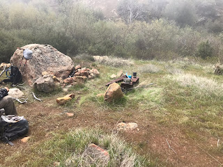
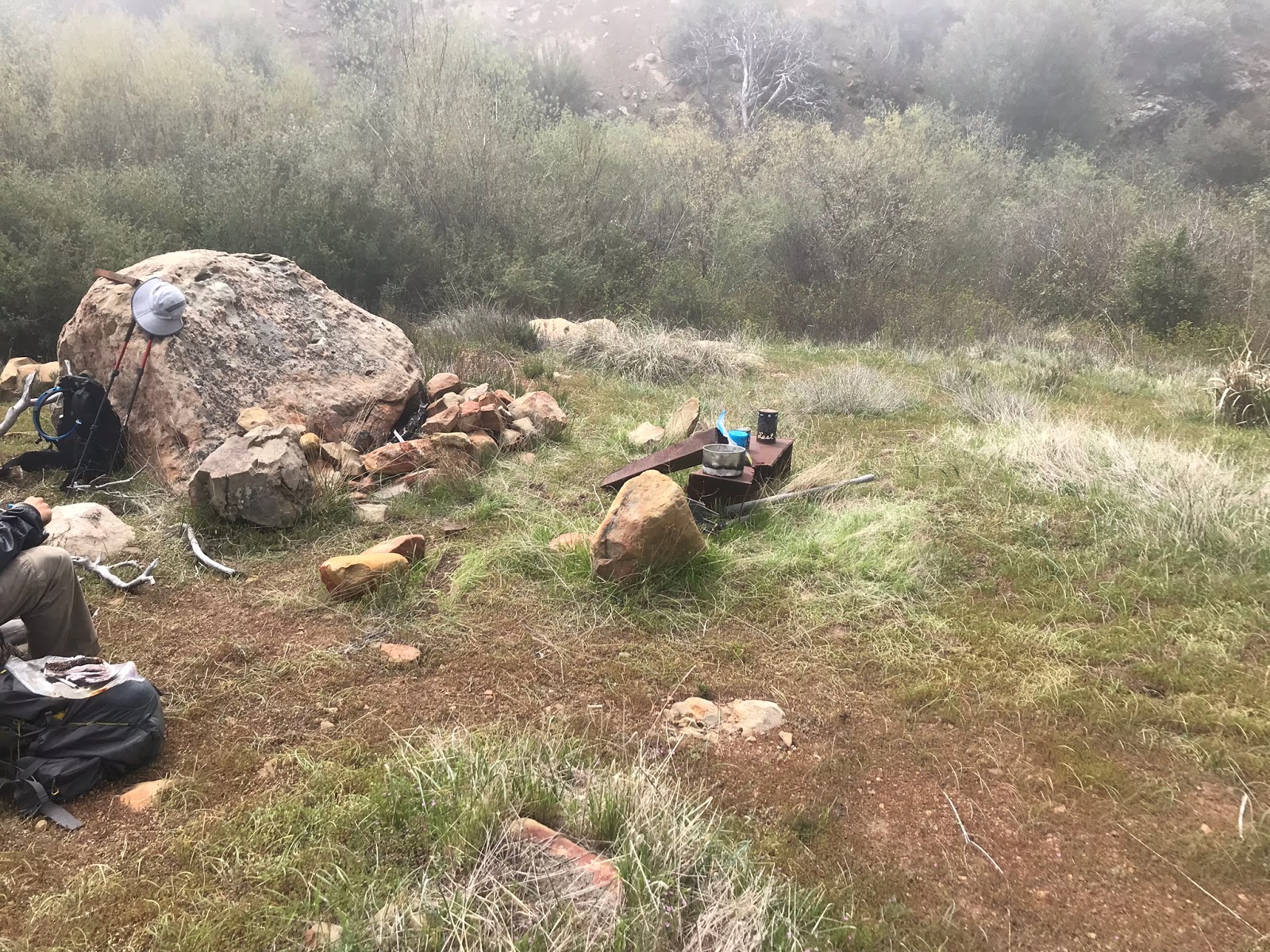
| Last Chance Main Camp at this site you find a large rock fire ring, couple old McLeod tools and a very weathered Ice can stove. |
 |
| That infamous large boulder indicative of the original camp |
 |
| The brush surrounding the Camp has made a healthy comeback since the Day Fire |
 |
| Camp overview with Reece Pictured above. |
 |
| A look down onto the fire Ring |
 |
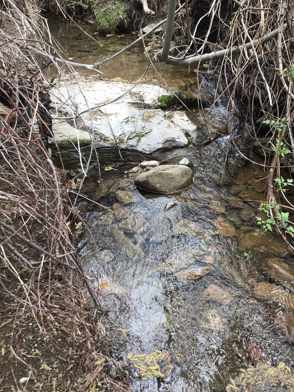
| The Creek located about 25 feet from the Main site was flowing |
I'm now of the opinion that my photos above show the original Forest Service Last Chance Camp and that Site #1 and site #2 on my first outing were most likely either overflow spots or later guerrilla sites set up by others who came through the area. The only bit that still troubles me besides every map having it located in the wrong spot is that the door of the old ice can stove was found down on the lower site #1. Why would someone drag just the door of the stove over there from the main Camp. You would think they would have drug the main body of the stove and left the door. Possible conclusions could be that there was at one time 2 different stoves. One at each site, or maybe the original site was the lower one and they drug the stove main body up to "The New Main site." I may never know for sure but I am satisfied with my new current assessment and grateful for the help of the more experienced and knowledgeable folks like Kim, Craig, Mark and Bryan who have continually made themselves available to assist me on my journey's into the Los Padres.
 |
| The older site register can is rusted badly and in bad shape, water has damaged the entry's. We sealed it back up as good as we could and positioned it back in the ice can stove where we found it. Some of the papers might be salvageable if the next camper takes the time to properly dry them out in the sun. However the site now also has the new register can pictured below. |
 |
| New Can hidden under the boulder |
 |
| #1 "Lost In The Lost Padres" site Can with $25 dollar REI Gift Card |
I will now from time to time be leaving these baby blue "Lost In The Lost Padres" site register cans pictured above at hard to reach and seldom visited sites in The Los Padres. (Those in the know, yes I did steal this brilliant idea from Pinetar's SVS cans). I hope it will encourage others to keep trying to visit the forgotten places and not let the memory of these historic sites fade away. While it is true some of these areas can be very challenging to access one can't help but feel a great sense of pride and accomplishment after putting in all the work and arriving at the destination. I left a $25 dollar REI gift card in this first can placed here at Last Chance Camp for the next person who visits to use and enjoy. Below is a few more photos of the days adventure.
Almost stepped on this gopher snake across the trail and apparently there be big bears in this part of the forest.
 |
| Looking down toward the Punch bowl |
 |
| Ever so beautiful Jackson Hole |
 |
| Eric navigating up the steep grassy ridge |
 |
| Santa Paula Creek |


7 comments:
That was legit
Good times for sure
We spent a fine spring night at Last Chance Camp in the early 2000's when the trail was quite good. We went on to the crest the next day to bag Hines Peak. Great country!
Hey George I'm hoping to get a look at the condition of the upper trail toward Hines soon. I have a feeling it's rough.
That lead photo is one of the best I’ve ever seen of our neck of the woods. —Jack Elliott
Thanks Jack
Post a Comment