
Been promising my pal Mark a Wilderness Camp survey of Upper Rancho for months, probably a year. At risk of soon looking like a bum who cant keep his word I wanted to get this done before the gate slammed shut on the 2020 season. By a stroke of good luck my friends and I managed to get out there in the nick of time, beating the closure by a single day and thus keeping my reputation somewhat intact.


I doubt anyone who might actually read this rag isn't already familiar with Rancho Nuevo Trail in the Mighty Dick Smith Wilderness but by chance if that is you Bob Burtness describes "Rancho Nuevo as meaning new camp or new ranch in Spanish" also stating "this camp was so named because at one time the land here became "the new ranch" for part of the Reyes family" (Referring to the now drive up car camp from which the trail takes off in a westward direction following Rancho Nuevo Creek).

Lord, Wallis and Ward ready for take off. Yes I know these selfies might seem cheesy, however I realized after we lost our pal Hnatiw that I wished I had taken more group shots.
It was a cold and cloudy morning we met at the dirt turn out just off Hwy 33 which starts Road 7N04 and provides accesses to Rancho Nuevo and Tinta (N34° 42.400' W119° 22.673'). From there we jumped into Josh's jeep to cross the Cuyama and ride the next few miles to the trailhead. (High clearance 4WD/AWD recommended). It's great that Calduc offered up the jeep as I get in trouble every time I bring my wife's Highlander home beat up with more of what Craig calls "Mohave Pinstripes."


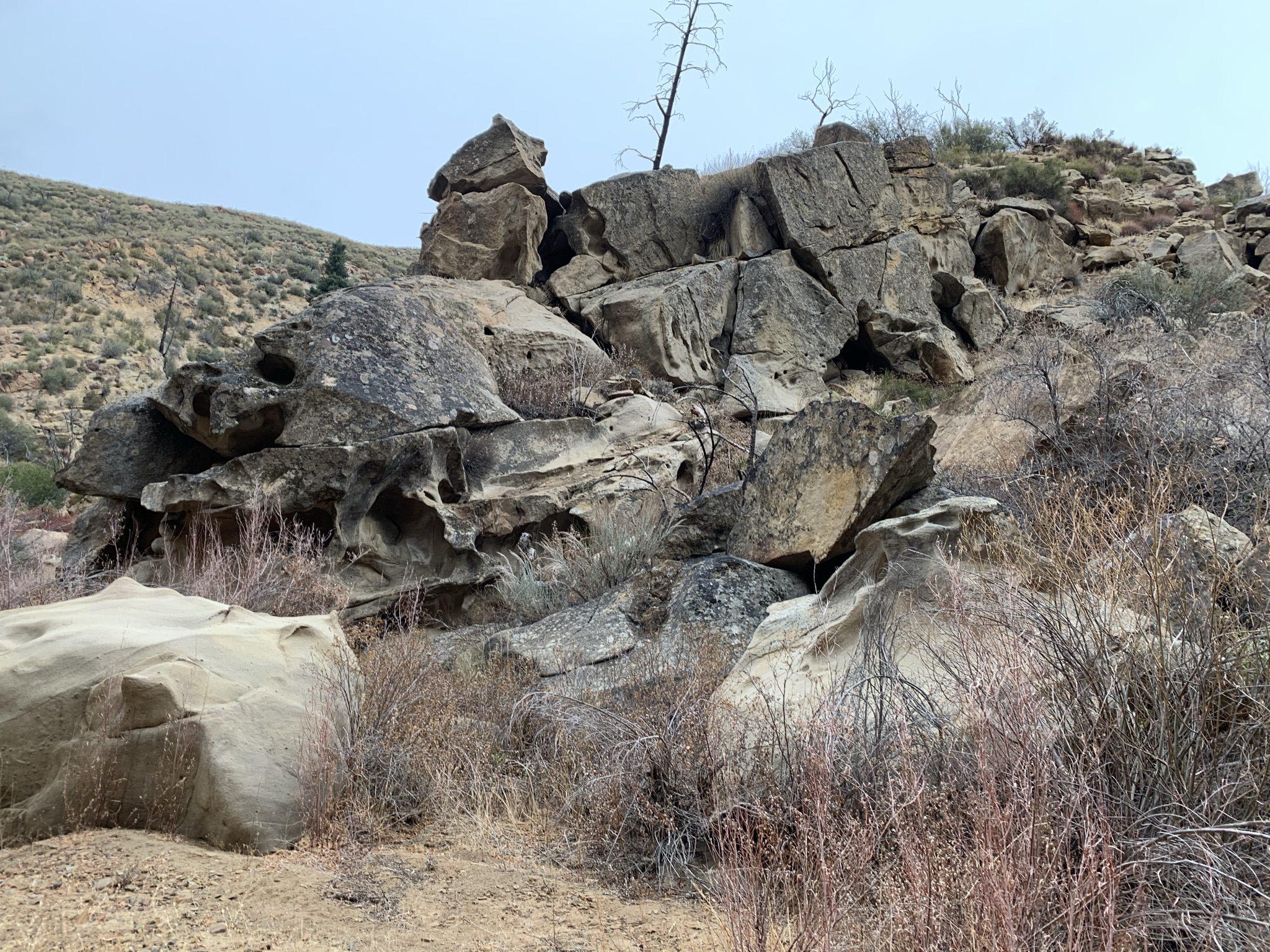
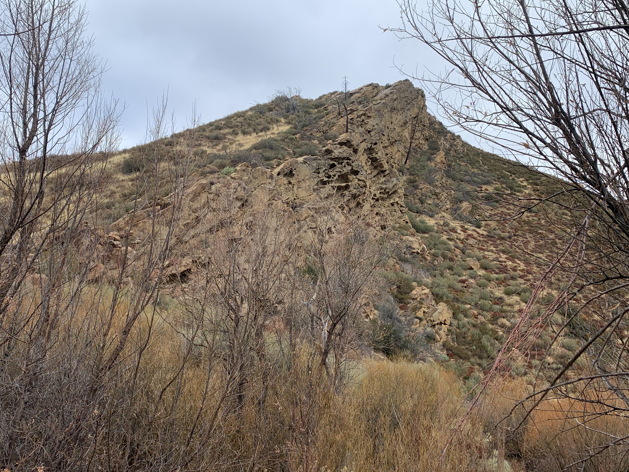
Last July 2019, volunteers (my self included) were out here working the lower portion of Rancho Nuevo. We cleared brush and removed hazard trees up until the junction with Deal Trail at just under two miles. This portion seemed to be in just as good if not better shape than we left it. Being this late in the season most of the tall grasses have died back allowing for even easier travel. Through here the canyon is quite picturesque, large oaks and firs are aplenty with the main attraction (I find) being the elaborate wind eroded rock formations.

Deal Junction Camp (N34° 41.366' W119° 24.927')

As the name would imply Deal Junction Camp sits right at the Rancho Nuevo/Deal Trail intersection. This former cowboy camp is a small site with single steel grate stove and not much shade. Upon arrival water adjacent the camp was mostly stagnant with a small trickle. Though I reckon that's not the case now after last nights big storm.


After reading the most current reports on HLP I was expecting the trail after Deal to be worse off than it actually was. Sure it could use some brushing and work on the crossing's, also there are a handful of downed trees across the trail (all easy to circumnavigate) but for the most part it was easy to follow. I'd say the most annoying thing was all that Rose Thorn surrounding the camp. With a little love next season from volunteers this trail could easily be pristine.

URN sign install courtesy Troop 111. Thanks men great work.

Upper Rancho Nuevo Camp (N34° 41.170' W119° 27.640')


In 1974 Dennis Gagnon writes "Upper Rancho Nuevo is nestled deep in a remote canyon on a streamside flat, this camp is flanked by steep canyon walls where big cone spruce, pinon pine, yucca, and chaparral find their home. Water is available in the wet months, when the surrounding peaks are frequently dusted by winter snows. Facilities are limited to four stoves and two tables.
This we know of the former facilities is no longer the case as years of fire, flood and lack of maintenance have taken it's toll. Nonetheless it's still a nice little camp (when it's not getting trashed by hunters) with great access to explore even fur beyond into the less traveled, wildly remote Dick Smith Wilderness.

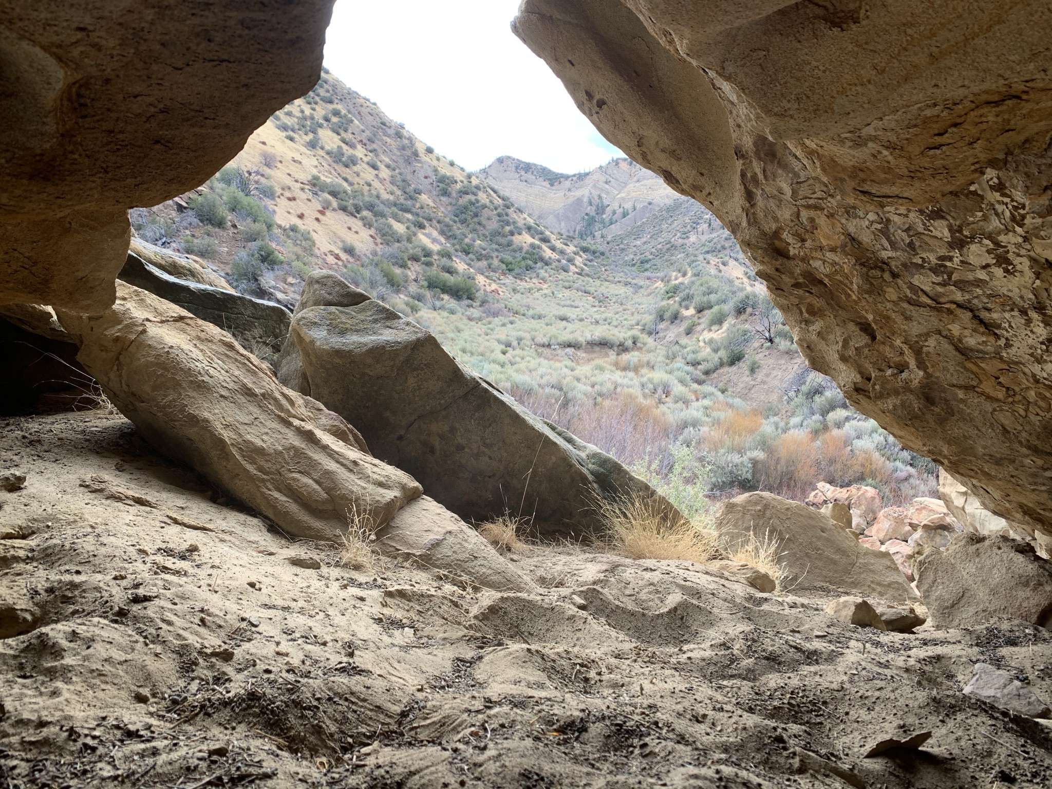
Lucky for us after we had just about finished all our business at URN the sun broke through the clouds reveling beautiful blue skies and ensuring dry weather for the remainder of the trip. Happy with the prospects of no more rain we decided not to head straight back, instead opting to poke around deal canyon for a bit. Glad we did as the improved lighting provided limitless good photo opportunities. Attached below the map is a one way GPX and KMZ file (from the trailhead to Upper Rancho Nuevo Camp) available for download. Though not sure it will do you much good until next year as the gate for the season closed yesterday December 28th. Anyone wishing to visit now will either have to walk the extra miles from the gate and or make the longer haul up from Bear Canyon or the Deal-Connector.

Deal Canyon


11 comments:
'Mojave Pinstripes'. lol.
Chris, do you accept donations somewhere? For camp shovels/whatnot?
Hey Chris thanks for asking I appreciate that. Trail tools were and still are expensive for me especially since I try to leave them at the camps I fix up for the next person to enjoy. I did in the past accept a donation and it actually went a long ways. I still have one small camp shovel left from it. I have not pursued donations as of late because I wanted to try and set something up with the Los Padres Forest association to where The persons donation is tax deductible for them and at the same time I get help with tool donations. I will try in the coming days to discuss this the LPFA and will see where it goes. Thanks again for the support.
Sounds good. And for what it's worth, I don't care about tax deductions, or anything of the like. I just want to directly support, in a small but direct way, the things you are doing.
Thank you Chris
Yet another article full of your priceless wonderful most enjoyable wilderness travel porn. There's Robert Service, Jack London, Ernest Hemingway, and Chris aka Lost in Los Padres, only one of whom is still writing. I'll also put you on the same pedestal as favorite author, Louis L'Amour, who set a few of his western novels in our beloved Los Padres Mountains. And I love your shout out to Dennis Gagnon. I started mapping out my Los Padres adventures back in 1988 with Dennis Gagnon's book "Hike the Santa Barbara Backcountry" and an old-school topo map spread on the floor. ("GPS?, we don't need no stinking GPS.") In my humble opinion, you absolutely should author a 2021 update to Dennis' classic Los Padres trail guide. Con respectos, "Oh Three"
Oh Three Thanks for the kind words I’m glad you’re enjoying the blog my friend. Update to Gagnon’s guide, hmm I don’t know if I could fill those shoes Dennis was the man. That being said I heard from a little birdie that a new addition to Craig Carey’s book might be hitting the shelves real soon here. That’s one we got to pick up. I’ll try to keep the interesting stuff coming thanks again man.
Another great run Chris. How's the wild rose running up RN these days? Also, ever stretch that run a bit further up to Lizard's Head?
Mike it’s not bad along the trail but is thick surrounding the camp. Haven’t done lizards head yet but plan to. When are we going ?
Neat area that I haven't made it to yet. I like the open, scrubby look of the place. I assume it's a furnace in the summer.
Madison that it is. Thanks for dropping in pal.
Another great post. I last through hiked Rancho to Deal where I had a bike stashed for the ride back to Tinta in 1999. Not one tick. I actually missed the Deal/Connector junction, there was no sign at the time. So I came out further up the highway and had to walk down in the dark to get to my bike. I went back 02/27/2021 to go in at the Deal (Ozena) Trl head to find my previous error. there's a beautiful new sign now LOL. I was impressed with the amount of ticks through Deal, a post fire bloom I imagine(?) As I got close to Deal Junction I decided to through hike out RN (no ticks) then stay in the river bottom back to my car at Deal Trl head. I went back the next week 3/7/2021 walking from the Tinta gate, Rn with intention of finding URN camp and reported archeological sites. Again the ticks were insane on URN. I stopped at approx 3 miles in where finally after a bunch of ugly to look at stuff the valley ends in a V with some dramatic rock formations and a rock wall across the back of the V, but more bushwhacking and ticks to get there. I lunched and turned around. Ticks not as bad on the return. They had not had a chance to re-establish themselves on the bushes I had just passed through, but I was seriously disappointed that now on the beautiful stretch was alive with ticks!!! Chris did you guys spray yourselves with repellent? It was nasty.
Post a Comment