With no kids this Memorial weekend the wife was ready to get out and go somewhere, in fact her exact words were "babe take me on an adventure" to which I replied yes ma'am coming right up. Waiting til the last minute on a holiday weekend left everything booked, I could not reserve a single car campsite anywhere I wanted to go in the Los Padres. My wife Suzanne is not a backpacker and rarely gets out tent camping so I was hoping for a nice developed site to start getting her feet wet. I was not confident about it but knew we would have to try our luck and see about snagging a walk up somewhere. Wanting to go a little farther from home I hit up Conant and asked what he thought about my chances on getting anything at Nira, Davy Brown or Figueroa Mountain. Bryan seemed enthusiastic and said he was 90 percent sure I should be good to go. Hearing that was good enough for me, we loaded up and hit the road.

Hoping to have easy convenient access form camp into the San Raf Nira was to be my first Choice. Here we could walk right onto The Manzana trail without needing to use the car. After about a two and half hour drive we pulled in to find the place packed not a single site to be had. Damn I thought that's not good.
South of Nira a short distance back along Sunset Valley Road is Davy Brown Camp. Which provides direct access to Davy Brown Creek and the Fir Canyon trail. I was optimistic that possibly we would have better luck getting something there. Upon arrival I was again reminded that this was a holiday weekend dummy and we would be getting nothing. Well shit Figueroa was to be our last hope as far as developed campgrounds in this immediate neck of the woods was concerned.

Back along Sunset Valley we went, from the Cachuma saddle it is about 7 miles along Figueroa Mtn Road to reach Figueroa Mountain Campground. This is a much larger Camp than Nira or Davy Brown in fact almost triple the amount of sites. Walk up site choices here are numbers 2 through 10. Again upon arrival this was not looking good. As we cruised through checking each site one by one everything was taken. Then I remembered in the very back corner of the campground site #25 was also a walk up. This would be our last hope, wife was saying lucky 25 is gonna be it and I'll be damned it was open. Maybe regarded as the ugly duckling as unlike every other site here this one had no picnic table, no steel fire ring and no camp kitchen grill set up. However none of that mattered to us, is was available and it was gonna be ours.
 |
| Tested out our new tent we were given as a gift worked great |
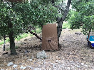 |
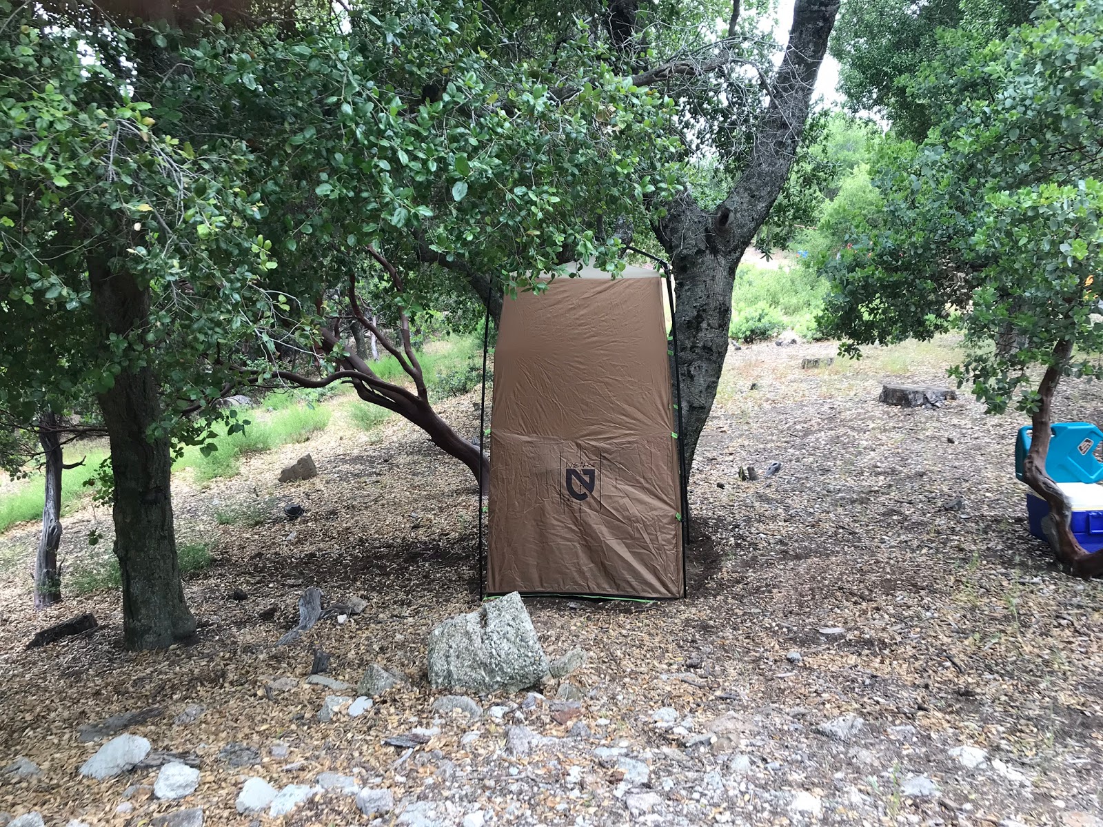
| Nemo privacy shelter |
 |
| Here adjacent to our tent flat was small rock fire ring surrounded by weeds and leaves. We left it in much better shape than we found it. |
Aside from the lack of amenities listed above this one had great potential. The site was massive with multiple flats and very private sitting on the camps edge we had no one behind us and direct forest access. We quickly got to work setting up all our gear and making fire. Took the dog for a walk, had a nice dinner and a few beers and it was off to bed. At some point in the night it began to rain and never really let up for the rest of our trip.
 |
| Manzana Trailhead parking area |
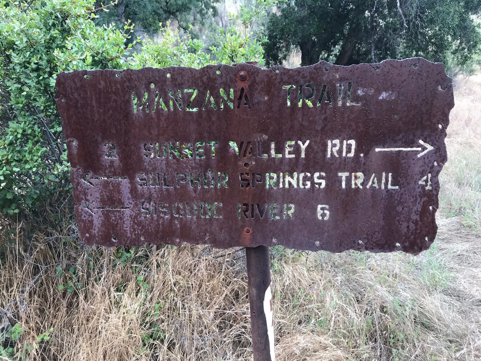
Sunday we woke bright and early after breakfast burritos under the easy up we donned our rain gear and headed back down toward Nira and the Manzana Trail. (30W13). Approximately a half mile before Nira is the lower Manzana Trailhead pictured above. Here you find a large parking area and informative signs. You can also access the upper trail from the eastern end of Nira Camp.
 |
| Manzana Creek |
 |
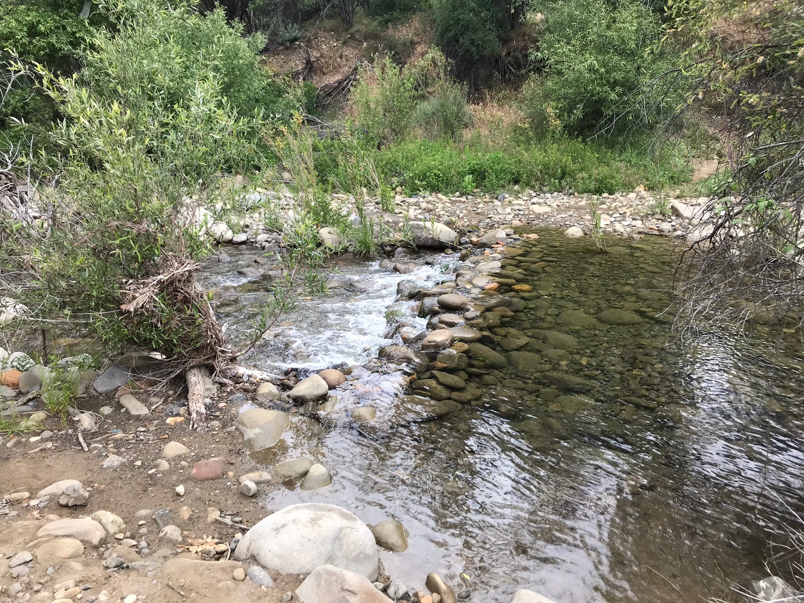
| Creek Crossing at Potrero Camp |
After an immediate crossing the trail climbs along the southwest bank of the Manzana taking you above the creek for the next 1.3 miles before dropping down to Potrero Camp and the junction with Potrero canyon trail. (29W12)
 |
| Potrero Camp |
 |
| Lots of bullet holes in the Arroyo Toad informative sign could be some hostility there if you know what I mean |
I liked this camp, very scenic and close to the creek with nice fire ring and picnic table. Would make for a great quick overnight and or child's first backpacking trip being as close as it is to the Trailhead. I noticed two available sites. After crossing the creek here it is about 300 feet to the Potrero Cyn junction.
 |
| Big Fan I am of these old metal signs |
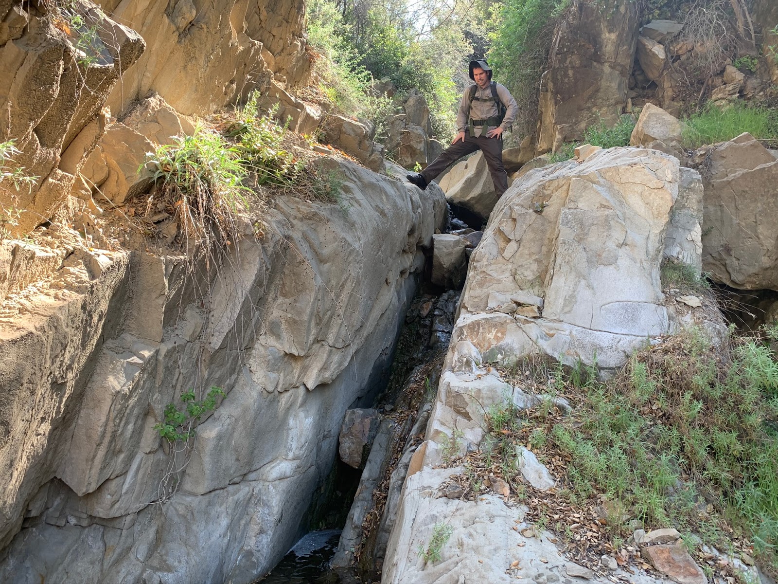
We left the Manzana behind and began to climb Potrero Canyon. The trail is in pretty good shape and easy to follow. Could benefit from some brushing in places but really nothing to complain about. From the Creek junction it's 3 miles to the Hurricane deck and basically all uphill. Your afforded great views of the surrounding Canyons and the area becomes more lush once reaching Negus Meadow.
We spent a fair amount of time poking around the upper reaches of the Canyon. Sometime I would love to return and travel the whole length of the Hurricane Deck Trail. My wife was a trooper following me up and down off trail and climbing in and out of caves with some bushwhacking in the pouring rain. She asked for an adventure and I didn't want to let her down.
 |
| Lacy is all smiles |
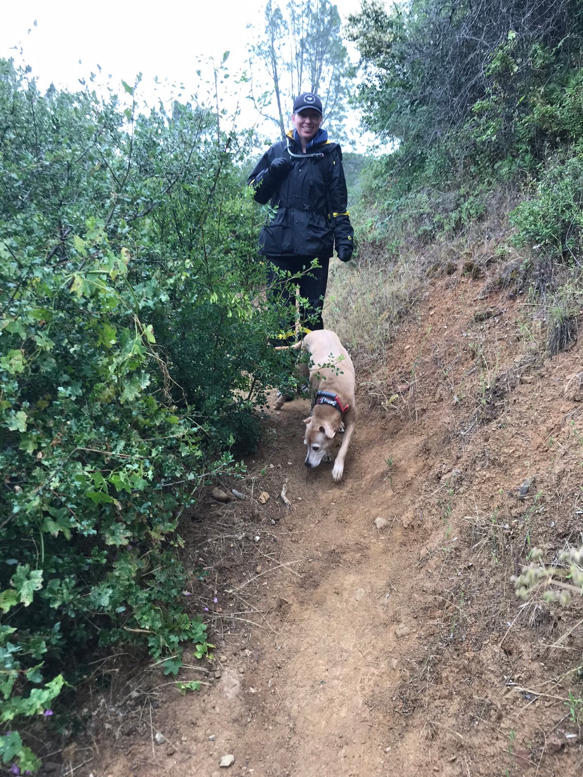
My dog is normally pretty reserved and well behaved on the trail but for some reason while passing through the meadow she got all crazy excited and was hauling ass back and forth jumping and bounding through it like a gazelle. Funny I don't know what got into her but she liked it up there.
 |
| Negus Meadow |
I spend a great deal of my time close to home in the more southeastern districts of the Los padres so it was really nice to be able to head north a bit and get into some newer terrain. I definitely am going to make it a point to try and get up here more often on some monthly or bimonthly trips. Start putting some check marks in my long list of San Raf and Dick smith places.
 |
| Chumash bedrock Mortars |
After a brief lunch we hightailed it back out the way we came. At this point we were soaking wet and my wife was starting to develop what I nicknamed her Baden-Powell walk. That's when the steps get really small and her pace slows. I only seen it once before and that was On Baden-Powell of course. A cute unique little walk but a signal that she is about done for the day. Our total mileage was close to 10. Sorry I have no GPS track available for download (not that you need it here anyway the trails are good) somehow I bumped it and it turned it self off. Maybe I should start using the lock screen feature. Anyhow trip was a blast, thanks babe had a great time can't wait to see what we cook up for next year's memorial outing.