Plans are in the works for a future loop trip to push all the way up the Main Gut of Matilija Canyon to connect with the upper portion of the old Bald hills Trail and descend 24W06 back to the Trail-head. We hope to Summit Cara Blanca and search for any evidence of Rich's Flat, Wild Mare and Bald hills Camps. If you just read all that and are thinking dammit Chris I came here for waterfalls I'll get back to that now.
 |
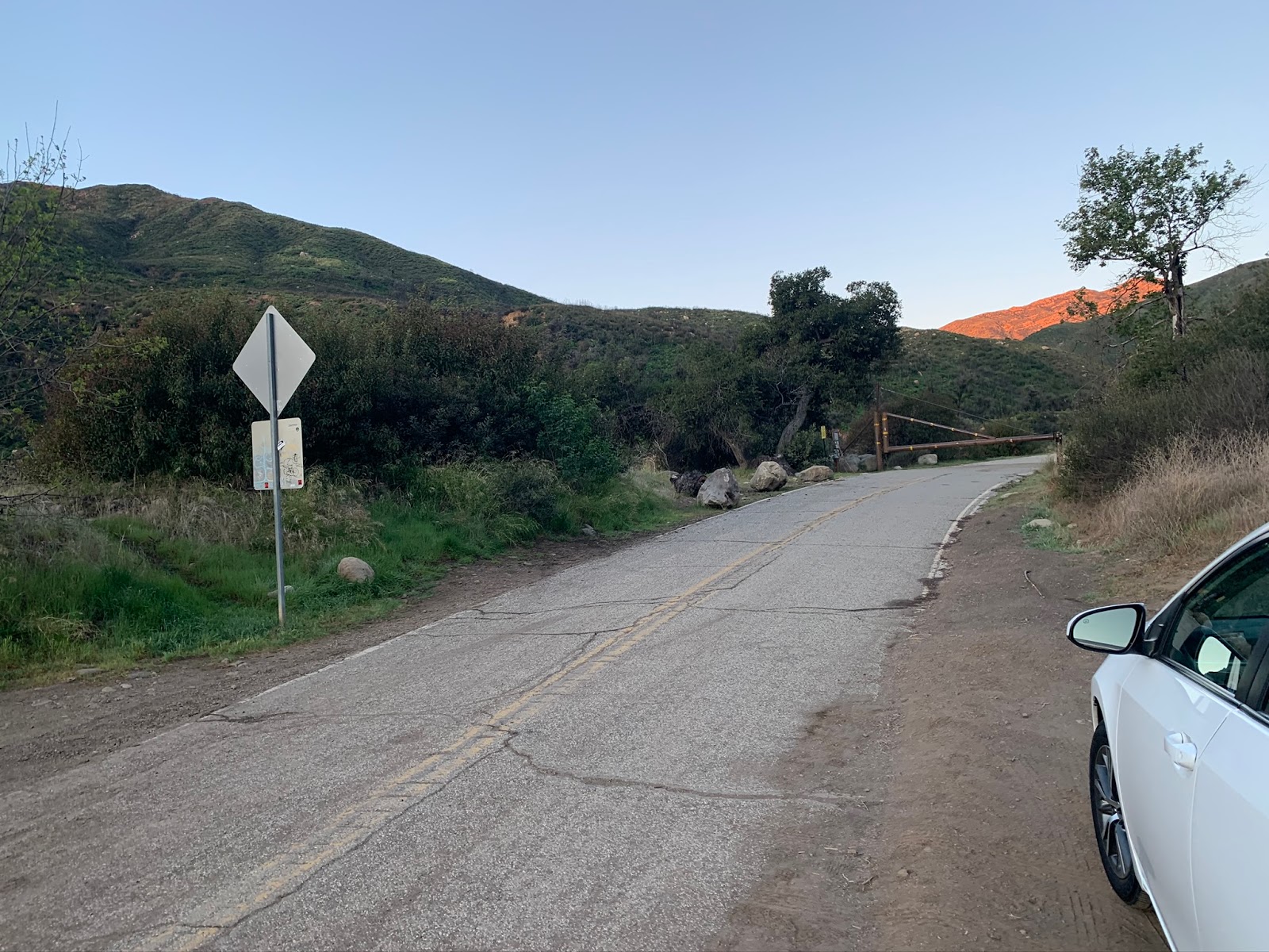
| Matilija Trail-head Parking N34° 30' 18.8" W119° 22' 28.7" |
Reaching the falls is fairly straight forward begin by parking along the road Southeast the locked gate at the Matilija Trail-head. There is also a parking turnout to the left however after recent rains will look more like a lake. Pass through the gate and stay on the road as you immediately cross through the private in holding of Matilija Canyon Ranch. In about .6 of a mile is the first creek crossing. Water was flowing strong this morning, looks like it will be wet feet for us right out the gate. Moving along in less than 300 feet to your right you will pass the junction with the North Fork Matilija 23W07 and we will call it another 500 or so feet even further to your left the junction with Murietta Canyon 24W07.
 |
| Stay left as the sign indicates for all trails. |
Very shortly after Murietta upon approaching the Blue Heron Ranch is where most folks not familiar with this area may get confused. Stay left at the junction sign pictured above to skirt the western side of the property. Immediately after this junction is the one shown below where you make a right continuing your Northwest trek through the legal public easement on the ranch.
 |
| Stay right here at the junction making your way through the Blue Heron Ranch |
Years past there was a legal battle going on between the land owner in the area and KAMFO (a group of conservationists and hikers basically over the public rights to cross through the private lands. Some of the old shenanigans may still be apparent in the sign above. Notice the No trail circled on top, then the bottom with an arrow pointing left for roads (5N13) yet the pointed arrow head removed from the white line indicating trails to the right. Click the photo to zoom in and you'll see what I'm talking about or better yet go check it out for yourself. Fortunately everyone is now on the same page and the public can freely pass through with no more risk of confrontation.
 |
| Gate open for all to freely pass through |
Just after your right at the no trails sign we discussed above is the main Blue Heron Ranch Gate. Notice the open side to the right as weird as it may feel at first go on ahead and pass through the gate, again this a legal easement onto public forest lands. Do respect the property though and stay on the road. Some angry looking German shepherds (more bark than bite) are around to ensure people do.
 |
| Stay left here along the road |
Before reaching the mouth of Old Man Canyon is the last gate encountered on the Northern reaches of the Ranch. Do not pass through the locked gate. Stay on the road to your left. Studying older maps I am fairly confident at one time the old trail 24W06 did indeed go right through the gated area here and down onto the creek. Maybe somebody much wiser than me can answer that with certainty sometime.
 |
| Good water flow from Old Man Canyon. |
Not long after the locked gate the road turns to single track and thanks to recent work from the
LPFA and friends the trail is in excellent condition and very easy to follow. After crossing Old Man Canyon the path leads you high above Matilija Creek along the northern Banks. Plenty of early morning shade here and great views to be had up and down canyon. A touch over 3 miles and you begin the decent from the switchbacks and back onto Matilija. Before dropping in look down onto the eastern bank and you will spot one of the user created Camp Sites.
 |
| View from the switchbacks looking down on the Campsite |
Once at the bottom and directly across the creek at the 3.5 mile mark is a couple camp sites with fire rings that I labeled MF Camp #1 and MF Camp #2 on the map below.
 |
| MF Camp Site #1 |
 |
| MF Camp Site #2 |
 |
| Jeff showcasing right about where the trail ends. |
After the Camp as you continue along the East bank further up Canyon the trail slowly begins to disappear and rock hopping along the path of least resistance becomes name of the game. I noted it was just under the 4 mile mark where we had the last of real tread. During higher water as we had this morning keeping your feet dry is entirely out of the question. Make it easy on yourself and bring some good water shoes.
No trip to Matilija Falls would be complete without a stop at West Falls. Approximately 4.5 miles in Matilija Canyon and West fall Canyon converge. Once at the junction hang a quick left, it's less than a few hundred feet to reach West falls. Here elaborate sandstone wall formations surround the tiered waterfall, a beautiful site indeed.
 |
| Junction for West Falls |
 |
| West Falls |
 |
| Fire ring on a bench just below the falls |
Finished at West Falls we continued on up Matilija Canyon as temperatures warmed and the sun made it's way directly overhead the clear cool water at our feet was a welcome reprieve. Plenty of deep pools abound for wading and relaxing and the scenery is damn hard to beat. While all the people were packed in on the lower trails surrounding the Trail-head (not social distancing) we had this tranquil beauty up here all to ourselves. After leaving West falls it's really only about half mile further, give or take the 5 mile mark until you reach Matilija Falls.
 |
| Matilija Falls |
 |
| Lower fall with rope to reach the next level |
What we got upon arrival was pristine conditions, water gushing over the falls made for excellent photo opportunity's and just an all around perfect day. Really what more could you ask for. The lower waterfall has a cave behind it and a rope as seen in the photo above to reach the next level. The west bank of the upper falls also has a sketchy old rope to get one high above and in position for what some people might be using as a small cliff jumping spot. Note I do not know the depth of water in the upper pool and I am not recommending you jump in. I climbed it and I would consider it dangerous and not suited for most to attempt. This is for the majority of hikers (not all) the end of the line. It is difficult to climb further beyond this point. We spent a good amount of time with ropes looking for various safe ways around with a heavy pack for an upcoming trip. In the end we got what we were looking for. With that the first scouting session is complete. I suspect a few more to come in the very near future. I have our total out and back mileage for the day at 10. More if you count all the climbing up and down we did. Some more highlights pictured below.
 |
| Jeff descending a steep chute |
 |
| Purple nightshade perhaps ? |
 |
| Me on the West Falls |


16 comments:
I've followed that old road bed along the west side until it just petered out at a flat high above the creek bed. I didn't see any evidence of a track heading further north-northwest. Do you suppose that abandoned road bed is the remnants of 24W06 leading to Bald Hills and beyond? Or do you think that old trail is further up the drainage?
Hey Madison many many years ago I think the old road bed and 24W06 were one and the same. Recent trail work with agreement from the landowner has brought many changes to the trail as it is now. To spot where Baldhills trail takes off Northwest from high above is very difficult (near impossible) from all the overgrowth. After the fire Bryan found the old tread and was able to follow it for awhile. I believe I found it as well last time I was there. When the snakes go back to sleep I plan on hitting it hard. You should roll with me.
Good to see you back out in the forest bro.
Hey Mike ready when you are for the last one we talked about.
Thanks for sharing old names/points of reference. Crazy to think where some of these camps used to be. Have you post-Thomas fire explored Old Man Cyn?.. I've just gone .25 miles, I'm just very curious since the water is different. It's very clear & crystal like, was wondering if there's a hot Spring up there or reasoning for the water. Thanks for sharing some history to the area. Can't wait to go this week after all rain
Terra funny you mention Old Man Canyon as that is up next. I plan to Summit via Monte Arido then descend Old Man to complete the loop. Would have done it this weekend however some things came up
You have probably seen this but this article and included map seem to show the historic location of the trail crossing the creek right where that gate is then continuing on the east side: https://lpfw.org/agreement-secures-permanent-public-access-to-matilija-falls/
Also do you know what ever happened to that whole idea of moving the trail back to the east side? Seems to have died which frankly seems just fine.... Also I am curious if the north eastern parcel was ever actually transferred to the national forest system. That seems to be where a lot of the trail camps are.
Also if you want a hand bushwhacking up the bald hills trail or exploring old mans canyon they are both on my todo list. Don't have to actually stick together if we move at different speeds.
Jess thanks for sharing the article I have seen it but it's been awhile, had completely forgotten about it. I believe the trail is going to stay currently where it is at. That parcel in question I want to say it was never transferred but I could be wrong on that. I don't plan to attack the Bald hills mission until fire restrictions are lifted again and or when things start to cool off. Looking like it might be a fall or winter trip.
The sign at the right turn onto Blue Heron has been fixed up with "Pack it in Pack it out" (if only those worked...) and other NF signage and an LPNF carsonite trail marker/arrow pointing hikers in the correct direction. Water levels were still nice and high yesterday (8/11), few humans, many two-striped garter snakes, and only one medium-sized bag of trash to pack out. Thanks for this and all the other posts--can't wait to hear about the down canyon trips.
Sounds like you had a good day out there Adam, thanks for the report
Have you ever been up to or down from Ortega via Matilija creek?
I am wondering how passable that upper section is? So far scouted the trail head from the Ortega side but not sure if I risk just heading down and hoping to strike trail in Matilija creek someplace.
Sorry I haven't spent much time on Ortega you might have luck searching http://www.hikelospadres.com/. Great resource for current trail conditions.
Hi, so i am getting confused with West Falls and another in this area called maybe Twin Falls...have you hiked to this one?
here is a photo from David Stillman's blog a long time ago...i'm starting to think this waterfall is not on this same trail.
https://2.bp.blogspot.com/_LkLRy3LDzgo/S-dpPHBUauI/AAAAAAAACIY/vSISbsKG7jE/s1600/Matilija+Lost+falls+05-09-10+028.jpg
Hi Anonymous that is the same one but before the Thomas Fire and the extreme flooding that followed.
As of January 2026, that small camp ground just before going up to west falls, is no longer there, portion of that side of the mountain came down which covered that small campground.
Post a Comment