 |
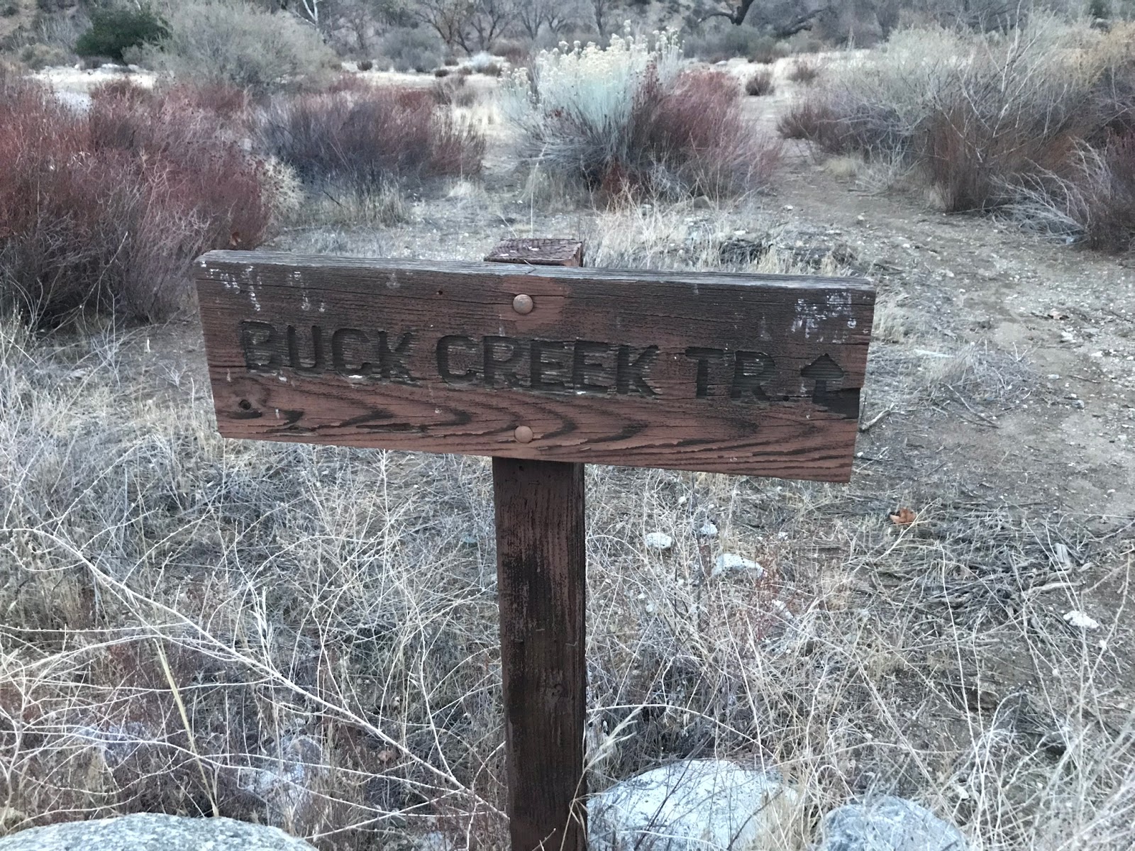
| Buck Creek Trailhead Sign |
About every 5 years the Mt Pinos Ranger district volunteers submit Wilderness Camp surveys to the Forest Service. This work is very important as it gives them a record of how much use the camp is getting, what the current condition of the camp is and what if any maintenance is required. Often times a Trail Survey will be done in conjunction as well to record trail conditions leading to and from these camps, so that work crews can return with all relevant information needed to maintain the trails. Thanks to my friend and forestry mentor Mark Subbotin I have been trained to do this work and very much enjoy participating in these projects. Next Camp up on the list was to be Buck Creek. Now I sort of have a love hate relationship with this area. I love being there but I hate getting in as access requires a walk or bike ride along the steep 3 mile closed HardLuck or Buck Creek Road from the east and or a high clearance vehicle (which I do not have) from the west at Stewart Mountain. This day would prove to be all Good though since Mark has the Los Alamos Gate keys and the volunteer agreement with the Forest Service we were able to drive all the way to the lower Buck Creek Trailhead(18W01) at the now closed HardLuck car camp.You can thank the endangered Arroyo Toad for all these closures. Now on to the Conundrum. Buck Creek Camp is literally all over the maps. Looking at several one might wonder where the actual original Buck Creek Forest Service Camp was really located and where does it sit today. Here are some examples of the madness below. Not the best quality shots sorry, however you click on the photos to enlarge them.


(Left) 1967 Los Padres National Forest Map(Courtesy of Craig R Carey) shows Buck Creek at the lower camp east of the drainage as does the 1978 to the (right).
Also worth noting here is both maps above show Hardluck Camp at the confluence of Buck and Piru Creek.(HardLuck Camp and the road leading into it was permanently closed and no longer maintained in the summer of 2009, due to it's close proximity to Piru Creek which provides habitat for the Arroyo Toad). What remains of this once 26 car camp site is not at the Buck/Piru Confluence but is further North as Pictured below on the newer maps. More on this later.
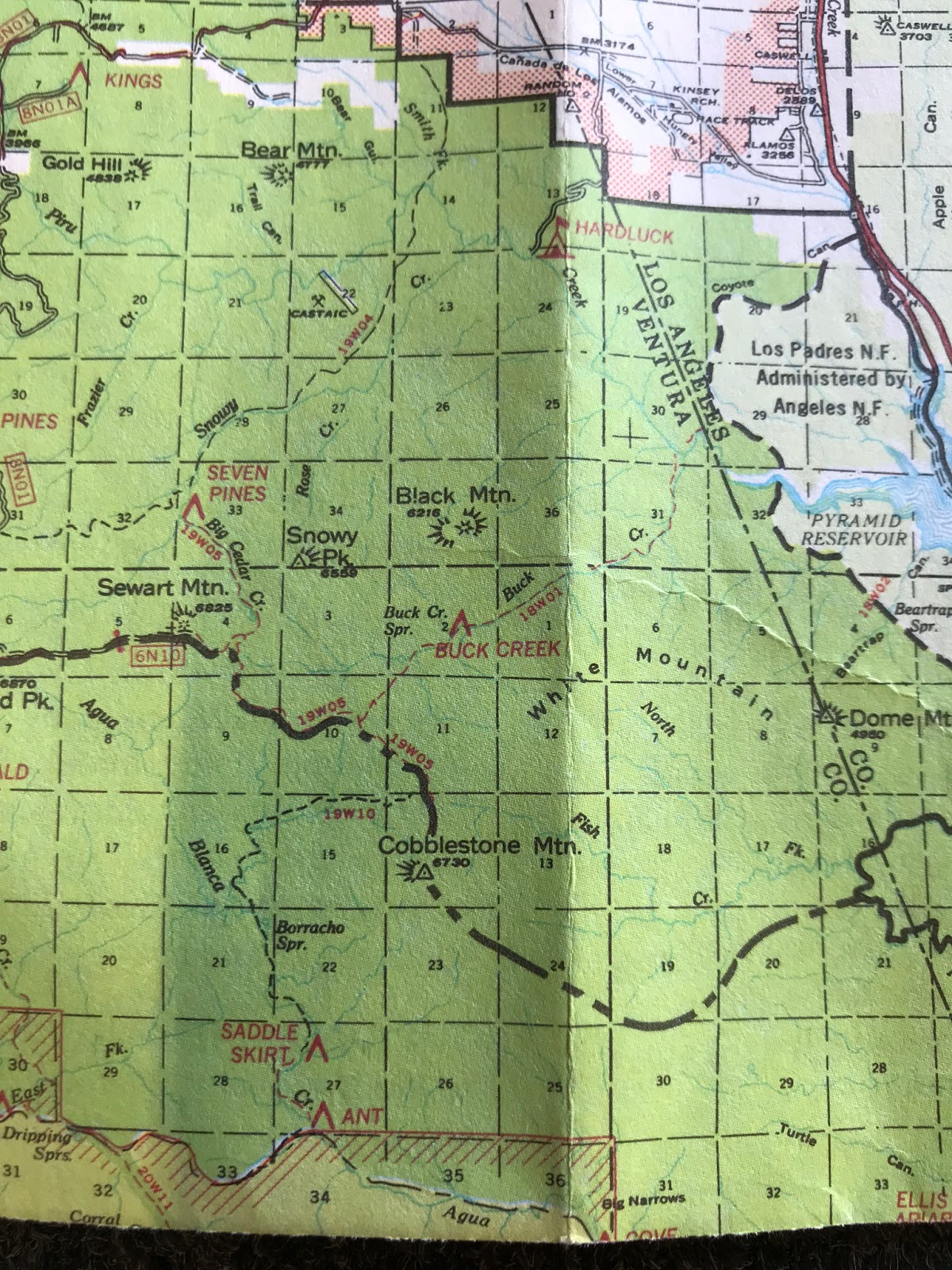

(Left) 1984 LPNF Map shows Buck Creek at the upper Camp near the spring as does the 2016 FS Topo map to the (right). With HardLuck now showing in the location where it currently resides.

2016 National Geographic Map (left) shows Buck Creek at Lower camp but west of the drainage which conflicts with the older maps and 2014 Tom Harrison Sespe Wilderness map (right) well he has the camp even further up the trail with what appears to be not near any of the other map locations and he has removed HardLuck completely.
Hike Los Padres has Buck Creek at the upper Camp by the spring as Does California Trail Map. I have more evidence of the shenanigans going on above but I will spare you the extra photos and details. I'm sure by now you can smell what I'm stepping in here. So armed with all this I was of course very excited to get this camp survey complete and get some answers as to what's really going on here. This is how the day went. Hopefully your still with me.
 |
| View of Hardluck from atop the water tower |
We Parked the cars at At Hardluck (pictured above) just adjacent to the cars is the Buck Creek Trailhead sign from which this hike begins. The first 2 miles follows parallel to Piru along an old jeep track with a very slight downhill grade to the Confluence of Buck and Piru Creek.


Vehicles Prohibited sign and Flat Camp spot at the OG Hardluck
It is here according to the old maps that the original Hardluck Camp was situated and I found plenty of evidence besides being on the old maps to back this up. First being long ago you could drive in all the way to this spot (see no vehicles beyond this point sign above). If you could drive all the way in here most likely you would have camped here. The area also has a couple flat spots that appear would have been perfect drive up sites. Not pictured we also found the cement in the ground with hole in the middle that was probably the Original Buck Creek Trail sign as this would have been your starting point for (18W01). For whatever reason this Camp would eventually be decommissioned and the new larger Hardluck was installed where our route began.
 |
| Spillway at The Piru & Buck confluence |
 |
| Cable Car at OG Hardluck |
There once was a lot of action going on at this very spot. Pictured above is the Cable Car which still stands today that can carry goods across Piru Creek to a platform and tower that may have been a weather or water gauging system again still standing but doesn't appear to be in use. Also pictured above is the spillway that was most likely put there to keep invasive fish from Lake pyramid out of Piru Creek where the wild trout program is ongoing.
 |
| Another view of the Flat at OG Hardluck Camp |
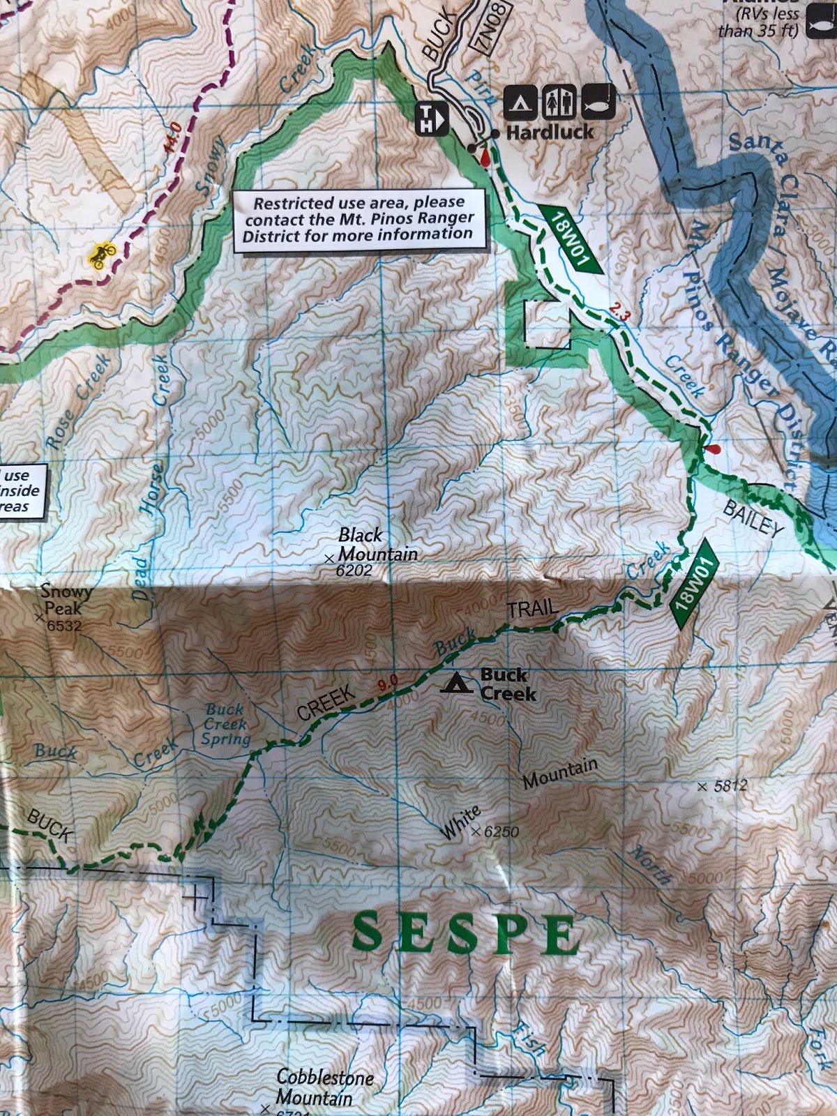
From here your route begins the southwest accent into the buck Creek drainage at around the 3 mile mark and approximately 1 mile from the The Piru/Buck confluence you arrive at a guerrilla site most likely used by hunters. The camp has a rock fire ring, some make shift benches and sits above the creek on a flat.
 |
| Hunters Camp on flat above Buck Creek |
The Buck Creek Drainage is a very beautiful part of the forest. Oaks and Big Cone Spruce dot the landscape and the canyon provides tons of shade. The water in Buck is cold and clear. In my opinion you would be hard pressed to find better local forest water quality. I always filter my water however I know a few guys that drink directly out of this creek. The pools are crystal clear and very inviting. Water was flowing nicely along the whole length of our route.
 |
| Water Flowing in Buck Creek |
For a trail that receives little use and even less maintenance the lower portions are fairly easy to follow. There are are spots where the trail disappears under heavy tree fall and poison oak but with good observance and route skills is very easy to pick back up again.
 |
| Fall colors in the Los Padres |
 |
| Unnamed drainage before the second guerrilla site |
At about 4.5 miles from the trailhead you reach the next guerrilla camp site which is situated under massive oak tress across the drainage pictured above. The site has a rock fire pit and complete shade. Seems it had some recent use as we cleaned up empty gas canisters and plastic bottles left behind.
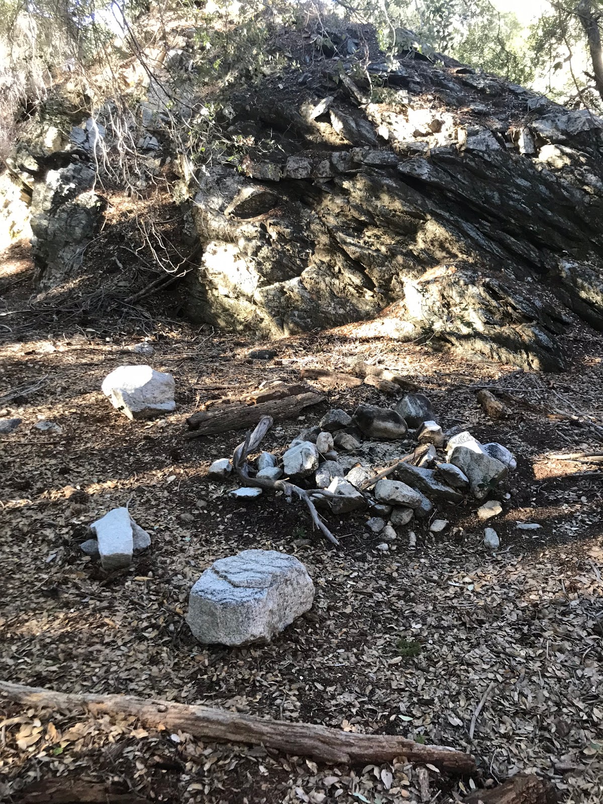

After leaving the guerrilla site continue about a mile along buck creek trail further upstream. At around the 5.5 mile mark you come to what I'm gonna call the original Forest Service Buck Creek Camp. The camp now has 2 sites as the original one lies buried under a large fallen tree. Here are the coordinates for the the Original Buck Creek Camp. N34° 38' 40.7" W118° 51' 03.5"
 |
| Old buried USFS stove parts |
 |
| Stove, fire pit and T stakes smashed by the tree |
 |
| Parts I dug out and and evidence of the original stove that was placed here many years ago |
 |
| The original Buck Creek Trail Camp |
At one point this camp had a table, I'm assuming burned up in the Day Fire. The evidence of the USFS service stove and how this location appears on the old maps confirms for me that this was indeed the original Buck Creek Camp site. While on this trip I was not able to make it further upstream to the upper camp shown on later maps due to time restraints. I am fairly confident that any of the other camp sites listed on maps are just guerrilla sites. At some point in the past Whenever the error occurred on the forest service Topo's probably created a domino effect and subsequent map makers just followed along with the information at hand. Due to budget constraints very few USFS workers are out in the field so errors would have become very common. To fully validate my conclusion I will however come back in from Stewart mountain and take a look at the upper site listed by the spring. Less than a couple hundred feet below the original site a new camp area has been set up complete with fire ring and a pile of wood to be used once fire restrictions are lifted. The site is closer to the creek and very well shaded. (See pictures below) The new site is very nice and accommodating I can imagine many hikers would just use this one and possibly pass right by the original one not knowing it was even there.
 |
| New site just below the original |


To recap as mentioned above most of the trail is easy to follow. From a little over 4 miles in and beyond it starts to get messy. With Lots of overgrowth and poison oak in places. I noted with way points for my trail survey at least 40 downed trees along the trail with most being beyond the second guerrilla site. On the way out we flagged the creek crossing's and most of the hardest parts to follow. We also did some clearing of the smaller downed trees. A return Sawyer trip will hopefully be in the works to clear the larger trees. Tread work will also be needed along with a good amount of brushing to get the trail back in tip top shape. For now though we left the trail in much better condition than we found it and is worth a visit should you feel inclined. I have included my track below for download and a map. Just over 11 was the total mileage for the day out and back. Camp survey and partial trail survey was completed and to me the mystery solved of the original Buck Creek and Hardluck camp locations.

Download GPS Track (GPS Units)
Download KMZ File (Google Earth)
11 comments:
Dig it. Good sleuthing finding that original site. I don't suppose that area sees much visitation given how difficult access is. That makes it all the more appealing. ~wildsouthland
Thanks Madison Buck Creek really is a neat part of the forest.
Those makeshift benches at the lower guerrilla camp were laid down by the intrepid mountain men of Troop 111 (Ventura) during their service with Mark back in March. Huzzah! Great write-up, CPL.
Thanks Craig some mighty fine work those scouts have been doing
Thank you for the write-up. I look forward to the update.
In 2009 I attempted to hike the Buck Creek trail as part of a crazy-ass hike I did from Santa Barbara to the PCT. I was going to come down the Buck Creek trail from the top, but I got lost and ended up on the Big Cedar Creek trail instead (not sure if that's the name of it) and after 4 hours of arduous and horrible cross-country hiking down the creek, ended up at Hardluck anyway.
I'm considering attempting this hike again from Santa Barbara to the PCT. I was thinking I would do the Big Cedar Creek trail again, this time on purpose, and hike on it until the junction with Piru Creek and then just go cross-country down Piru Creek to Hardluck. But maybe if you guys get out there and look at the upper part before I go, I'll have a better idea which I should try.
It still kills me that I got lost in 2009 and didn't hike down Buck Creek.
If you want to contact me I'm Diane of Santa Barbara Hikes. Craig knows my email and you can probably guess it.
Hi Diane I vaguely remember reading your blog entry awhile back and always wondered what the exact route was that you took to end up at Hardluck. Was it Seven Pines camp you found or Divide Camp? From Stewart Mtn Big Cedar Creek trail (19W05) would have taken you north to seven pines camp and eventually dumped you onto The snowy Ohv trail(19W04) which would have taken you to the junction with Piru creek and and then a cross country southeast along Piru Creek to Hardluck. From an MPRD wilderness camp survey in 2012 I read on seven pines I would not have thought big cedar creek trail would have been that rough to follow. But who knows maybe it is worse than I suspected. Unless somehow you ended up in the snowy Creek Drainage all the way to confluence with piru creek which I suspect would have been extremely ugly. Anyhow those places our on my short list as I will be looking for the old divide camp soon and also heading into buck creek again from the top for more survey work. Email me if you get a chance and lets chat more. socaldiver33@yahoo.com I'm not sure if you will get a notification of my comment here so if I don't hear from you I will shoot you an email. If nothing else though I would definitely recommend another shot down Buck creek from Stewart as opposed to the other options.
So that's pretty crazy. It was a buddy and I who went in there during the hunting season and were a little overwhelmed with how overgrown it was after those first 5 or so miles from Hardluck. We went all the way up to Upper Buck Creek and the going was absolutely rough, rougher than we were expecting. We cleaned up a whole bag of old trash on our visit and am sad to hear you had to pick up more especially water bottles and stove containers -_-... At Upper Buck Creek Camp there is a guerrilla camp we set up as well, about where the camp says on hikelospadres.com... I don't think anyone had been up to Upper Buck Creek in quite a few years. No fire ring or any resemblance of one so we set a little one up. I also didn't know that volunteers could learn and turn in trail reports, that's awesome. We rode our bikes to Hardluck than hiked the rest. It kicked our butts and we walked out with our tails between our legs but it burned a memory in my mind. I've thought about it everyday since and I am looking forward to getting out there again very soon and see how this weather has been affecting the area. Part of me really wants to clear up the trail so it's easy walking, yet part of me really likes the challenge and the inaccessibility. If you have any questions or what not please shoot me an email!
It's pretty crazy to have done a little camp maintenance than a couple of months later see a report like this and knowing someone used it.
As soon as the gates open to drive in From Stewart mountain I'm heading into the upper camp. Before I would be able to email you I would first need you to leave me your email. Blogger comments don't share emails. If you read this comment feel free to email me at socaldiver33@yahoo.com. Thanks for sharing your story.
I'm up for working to clear up on the Buck Creek Trail. Thanks, John
Post a Comment