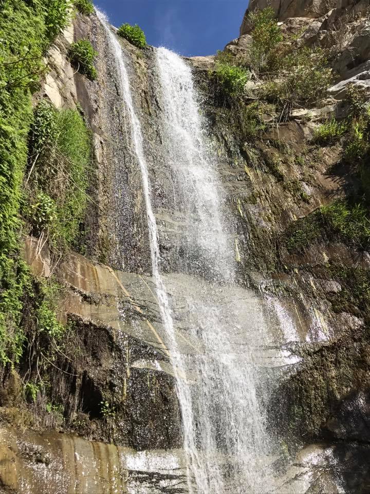
If exploring waterfalls are your thing I highly recommend Trail Canyon Falls. This is another fairly easy Family friendly hike that the kids are sure to enjoy. This stunning 30 foot waterfall was definitely my favorite as far as Southern California falls are concerned. This one is best done in spring or after some good winter rains as summer heat can reduce the fall to a trickle or nothing at all. From the Trailhead its only 2 miles to reach the waterfall. Dogs are welcomed but must be leashed.
PARKING:
Located right off Big tujunga Cyn Rd and the turn out for Trail Cyn Rd. Most likely the gate will be locked and you will have to park along the road. (don't block the gate). If the gate is open proceed to drive into the parking area located .4 miles farther in along the dirt road at 19607 N Trail Canyon Rd. Tujunga, Ca. If you have to hike in from the road your total mileage to the falls and back will be around 4.8 miles. Get here early parking can fill up fast, as seen in my photo below. I've heard an adventure pass is no longer needed here but don't quote me on it. You should display one anyways.


TRAILHEAD:
If you parked at the gate follow the semi steep dirt road until the crest of the first hill. Turn right at the junction and proceed down Trail Cyn Rd to the TrailHead. Which is located amongst a cluster of Cabins. There will be a marker sign pointing you in the direction of the Trail. Follow the dirt road along the Cyn wall, you pass a few more cabins and eventually a sign that that reads "Trail not maintained" that's exactly the route you need to follow and don't worry the trail is in good shape. Up ahead you are in store for multiple creek crossing's and broad views of the Canyon and mountains above.


At around 1.2 miles you begin to hike up along the western wall of the canyon. For the kids this section is probably the toughest, yet for sure doable. My 6 year old made it with no problems. At this point there is little protection from the sun as the vegetation is still making its comeback from the 2009 Station Fire which badly burned this area. Keep going in another .5 mile you will get your first look at the falls.

Close to the 2 mile mark is where the adventure really starts. There is a spur trail leading down to the falls. Its steep and somewhat dangerous with some real ugly spots to traverse. I had to basically cary my little one and help the dog down here. However the reward at the bottom was worth the effort.


Back at the top of the ugly spur trail you can make you way a little further along the main trail and find another path that will lead you down to the top of the falls. This was my favorite view looking down.


At this point is when most turn around and head back to the car. We opted to go a little further but not much. If you have more time you can continue along the trail for another couple miles to visit the Tom Lucas Trail Camp.

Download GPX File (GPS Units)
Download KMZ File (Google Earth)
No comments:
Post a Comment