Showing posts with label big cedar creek trail. Show all posts

Wednesday, June 3, 2020

Upper Buck Creek & The Hunt For Divide

Upper Buck Creek Trail-head with Cobblestone Mountain looming afar. 
Back in December of 2018 we did a reconnaissance of the lower section of the Buck Creek Trail which you can read about here. Without making it all the way to the upper camp my conclusion at that time was that the lower camp was the original forest service site. Well I have since changed my mind. Finally visiting the upper camp adjacent the spring and since that earlier writing acquiring older versions of LP recreation maps I am now fairly confident the upper site was the first. Not that any of this matters to most but at least I'm setting the record straight. To make this a loop trip and even more exciting we dropped in on the old ridge trail that once connected the elusive Divide Camp with Upper Buck Creek Camp. After spending one night at Upper Buck we exited the next morning along 18W01 as it currently runs today.

1937 Los Padres National Forest Recreation Map showing Upper Buck Creek Camp near the spring. Notice there is no lower Camp closer to Piru Creek as can be seen on more modern maps
1950 Los Padres National Forest Recreation map showing part of our route with green being the drop into Buck along the old ridge route and red the exit along 18W01. While I certainly don't have them all I've not seen Divide Camp appear on any other LP Rec maps aside from this one. 
Upper Buck Creek Trail-Head - N34° 38.297' W118° 55.196'

After the long drive up Alamo Mountain we took off from Upper Buck Creek TH in route toward the Summit of Sewart Mountain. Downed trees along this short stretch could really use a good chainsawing as it is  just outside the wilderness boundary. In less than a mile you reach the Summit of Sewart. The views atop this mountain are pretty bad-ass, there is a small register can hidden in the prominent rock pile.

In Route toward Sewart Mtn
Cobblestone Mountain as seen from Sewart.
More Sewart Views.
Snowy Peak
Looking down on Pyramid Lake from Sewart Mountain
After a quick break atop Sewart we continued east dropping down to connect with the Big Cedar Creek Trail 19W05. It is precisely here at the 1.5 mile mark that Big Cedar and Buck Creek 18W01 junction together. The right turn for Buck is faint and easy to miss. Would surely help to have a sign installed here. For the majority of those wanting to visit Upper Buck this would be your turn off. Hoping to find evidence of Divide and having decided on the alternate route down we skipped the turn off and continued along 19W05. 

Buck Creek & Big Cedar Creek Trail Junction. - N34° 38.315' W118° 53.999'
Lupines blooming all along Big Cedar Creek.
Old trail to Divide Spring. - N34° 38.626' W118° 53.789'
A half mile from the Buck junction is where we would exit 19W05 as seen in the photo above. Faint signs of the old trail leading up this ravine were plentiful. Within a short distance of between .1 and .2 of a mile we Located two flat areas that may have been the location of Divide Camp. Both flats had fire ring remnants and piles of rusted old cans. The spring adjacent the flats was flowing well. I have marked all the relevant information on the map at the bottom of this post with Downloadable GPX and KMZ files. Another note if you can I recommend viewing my blog posts from the desktop as the mobile photo views just kinda suck. Though you can always click on any picture to enlarge them. 

 Divide Camp Possibility #1 -  N34° 38.587' W118° 53.730'

Divide Spring
-
 Divide Camp Possibility #2 - N34° 38.516' W118° 53.713'

At this second flat location is where the old trail departs down the ridge. Upon first glance it appears really thick and sorta impenetrable however if you hug the North side of the ridge where some of the tread is still visible it is a lot more open and easier to navigate. Deviate from this path and it becomes a nightmare. We picked our way down slowly enjoying the views and the wildlife interactions. 

Jeff ducking branches coming down the ridge.
This big guy wasn't bothered by us in the slightest. 
Dropping into the upper Buck Creek drainage. 
Just before fully dropping into the drainage things get ugly. Sorry no real good way around it, it's thick down here. There are some open areas before reaching the Camp but you will do a good amount of bushwhacking as is to be expected when traveling decades old routes. Luckily the distance is short. Just put your head down and bulldoze. Traversing the higher right side of the valley through this section helped a lot. About .4 of a mile above the Camp is another spring with reliable water. I have labeled it Upper Buck Spring #2. That being said if you made it into camp and the adjacent spring was dry it would be a bummer to have to bushwhack back up to the higher spring. I might first try my luck at heading downstream to more reliable water from Buck Creek. 

Yeah that's pretty thick
Nicer open area leading toward camp.
Upper Buck Spring #2. What was amazing was the amount of water dumping out here yet going straight underground and not at all flowing further down the drainage. Quite a sight. -  N34° 38.236' W118° 52.499'
You'll do well to walk this higher right side of the drainage and out of the real thick crap. 
The last mile proved to be a bit slow going but we finally arrived at Upper Buck Camp. This secluded and well shaded flat sits under cover from large oaks and conifers. The little compound has a lot going on which wasn't quite apparent at first until we dropped pack and gave it a good search. Getting in was less than 5 miles and we could have made a long day of it though I'm happy we didn't as we most likely would have been rushed and not discovered the old ice can stove and other hidden features. Besides the short stint up to Sewart at around 6800 feet elevation the rest of the way drops steeply downhill bottoming out around the 4200' mark.  This site was one of the last wilderness camp surveys I had left to complete for MPRD. I very much enjoyed the night I spent here and do look forward to returning sometime for a top to bottom shuttle From Upper Buck TH down to Hardluck.

Here's a before and after picture of what is most likely a newer user created site right off the old trail. We brought the ice can stove from where it was hidden down in the ravine up to the site and built a bench from deadwood. I'd say we left the place nicer than we found it. Notice the no longer legible plywood sign in the tree. - N34° 38.251' W118° 52.150'

I left no register this time. Instead signed in on the piece of deadwood used to construct the bench. For the record I would never advocate carving into anything living or historical. If this pisses you off one I don't care and two just know that it must be more environmentally friendly than me leaving a blue can filled with paper and pens. Please do not email me complaining about it.
Paperwork, there always seems to be paperwork.
The Spring at Upper Buck Creek Camp - N34° 38.265' W118° 52.164'


Thousands of Ladybugs by the waters edge.

Metal sign in the tree northeast the plywood sign - N34° 38.251' W118° 52.137'
These photos show what was most likely one of the original sites. Pictured above and below the intricate rock wall structure and fire ring. N34° 38.235' W118° 52.133'

Original position of the ice can stove - N34° 38.268' W118° 52.156'
Third fire ring nearer the ice can stove and lean-to second rock shelter - N34° 38.266' W118° 52.142'
Second rock wall shelter with lean-to built up around it

Zoom in to see the rad little baby California Mountain King snake found down by the spring. 
I suspect this was once a well used camp. We found many antique bottles and various old rusted cans. The location is great and some of the clearest & best tasting water in the LP comes from Buck Creek Before the trails leading in and out went to shit one can see this was most likely a happening spot. I really wish more effort would go into maintaining the Southern Los Padres and for that matter not being able to drive to the lower Buck Creek TH is ridiculous. It's one thing not to resurrect Hardluck for the sake of the Arroyo Toad but for crying out loud please give us back the trail-head access. This would help alleviate pressure on the same trails people use and abuse over and over again. 

Higher on the western side of the drainage 
As was the case with the previous day getting out of the Buck Creek drainage even along the current 18W01 is a pain in the butt. The first .3 of a mile sucks. Major Bushwhack. To get out of the brush we made haste away from the trail and onto to the higher western portion of the drainage where it opens up a little more. In fact if you look at the track you see an abrupt right turn, that was us saying alright enough of this brush choked gully. Luckily this is again a very short distance. Once out of the thick stuff it's not bad at all. Climbing out before reaching the dry pond the trail shows on different sides of the drainage depending on what map your looking at. We found the west side to be just fine in fact switchbacks and plenty of tread will lead you up and out. 

When you pass these you'll know your on the right path.
Dry Pond just before reaching the ridge, you'll push through some brush here and then it's wide open. Apparently this was being used as a campsite at one point as remnants of a fire ring and makeshift bench can be found near the center. - N34° 37.694' W118° 52.734'
After popping out from the pond the rest of the trail is wide open and in decent shape along the ridge. Closer to the Buck/Big Cedar junction there are faint areas that will require pushing through brush and a few downed trees but nothing really to fret over. It's a beast of a climb but affords great views of Cobblestone, Snowy, White Mountain and of course my favorite a glimpse down 19W12 into the Borracho vicinity.

Wide open ridge top along 18W01
Fairly certain this post marks what was once the 19W12 connector leading to Borracho - N34° 37.797' W118° 53.554'
A look down toward Campo Borracho.
Loving that purplish blue color
Upper Buck Creek Trail-Head in the distance.
Beat up old gate on the western flanks of Sewart.
We left the camp around 7:30 am and were back to the car within 4 hours arriving just before 11:30. Total mileage for the loop came in at around 10. This trail desperately needs maintenance especially the half mile stretch into and out of the camp. This is an outstanding hike and can be an even better destination with a little volunteer effort. Maybe the next time I return it will be with tools in hand on a trail crew. 


Monday, December 31, 2018

Snowy Ohv to Seven Pines Part deux

Dropping into the Snowy Creek Drainage
Alright here is the rematch. If you have been following my blog than you already know a few weeks ago I attempted to make a run from Hungry Valley to Seven Pines Camp, however that day did not work out quite as planned and I never made it out of the lower now closed section of Snowy Ohv. Here is that write should you need to get caught up: Snowy Ohv (19W04) Lower Re-route part 1  
Since I already went into great detail before about the lower section I will skip that here. To briefly recap we again parked in the Hungry Valley SVRA Park at Aliklik Campground. This round I was joined by my old scuba buddy Jeff Wright, and I must say I was very impressed Jeff can put down the miles and is a great trail buddy. I foresee many more trips with him on the horizon. From the map at the bottom you can see we left the park through what I called locked gate number 1, headed south up the hillside and dropped into the Smith Fork. From there located the old closed section of Snowy  and followed that to the junction with Piru Creek. This is where my journey ended last time and this new one begins. The easiest way to get onto the now maintained section of Snowy ohv (19W04) from here is to cross Piru creek, go straight a short distance and just to the left or east of the creek spot a faint use trail that will lead you up and onto Snowy. After crossing piru this all happens fast in a little over .1 mile you should be on the motorcycle trail.
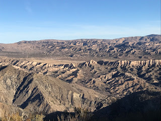
View looking back at the Smith Fork after climbing onto Snowy OHV
Once on the trail you immediately get an outstanding view looking back into the Smith Fork and Piru Creek Drainage from where you came. It is there that I believe could be the sight of some historical significance and possibly holds the key to why the route starting point was moved from Hungry Valley over to the now Kings Campground. The hardest part of the route begins here while 19W04 is well maintained and super easy to follow it is a grind. The trail ascends sharply up and onto the ridge for just over 1800 feet of elevation gain over the next 2.5 miles before dropping into into the Snowy Creek drainage. Once atop the views along this section of the surrounding peaks and back into Hungry Valley are incredible see photos below.

Alamo Mountain

Looking Back at Hungry Valley
Around the 4.5 mile mark you start the descent to snowy creek. Water flow in Snowy was very low but enough to filter could be obtained from small pools here and there along the creek. It did however live up to its name as there were numerous snow patches on the banks.

Snow along the banks of Snowy Creek
At the 5 mile mark the valley opens to a wide flat where you come upon a Guerrilla Camp. Complete with rock fire pit and small cooking grate. Along the outskirts of this site were numerous piles of rocks and what looked like old stone retaining walls. I wondered if this was some sort of Cabin site in the past.

 Guerrilla site on the flat 

A half mile further south we arrived at our first Planned destination The Baker Cabin site. It was here that a mining Cabin was constructed in the 1800's and may have passed through multiple ownerships throughout the years before it met its full demise in the 2006 Day Fire. It was reported that after the last owner died sometime in the 1980's that heavy vandalism was already beginning to take place. 

1960's image of Baker Cabin Courtesy of "The Beard" Craig R Carey
1983 Image of Baker Cabin courtesy of The Los Padres Expatriate Hiker
Baker Cabin Present day December 2018
I feel privileged to have finally made it here and got to bear witness of the remains. However it saddens me to see what has become of this once great historical site. The ruins are strung about everywhere stretching down to the creek and into the mountain range along the back side. Piles of sheeting, rusted equipment and numerous old cans can still be found. My favorite pieces were the wheelbarrow and the shot up gas gan. We even found an old steel tackle box by the creek.


 Ruins From Baker Cabin

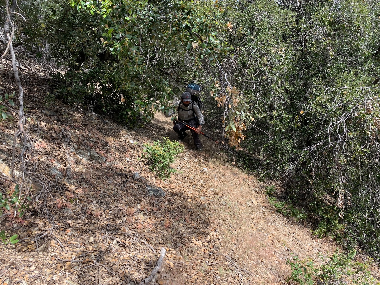
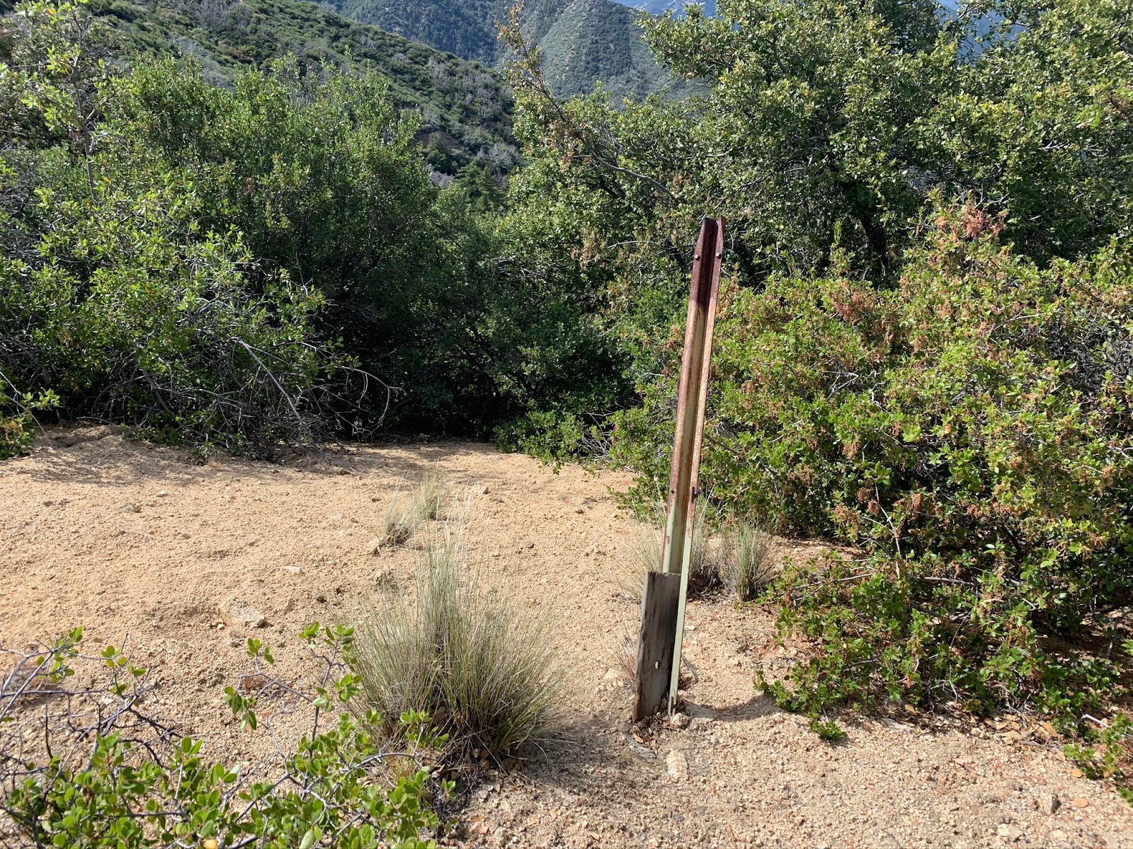
After leaving baker Cabin we continued our accent along the trail following Snowy creek in a south westerly direction. At this upper elevation the landscape really begins to change, Pines and Cedars become more abundant replacing the heavy chaparral and brush below. At about the 6.6 mile mark look for the junction of Snowy (19W04) and Big Cedar Creek Trail (19W05). The remains of this old trail sign below mark the spot.

What's left of the junction sign at snowy and Big Cedar creek
Big Cedar Creek trail is no longer maintained or recognized on current forest service maps. From here the old Trail will eventually lead you up Big Cedar Creek and to the junction with Buck Creek trail (18W01). You can most likely conclude from studying the older maps that this was once the most plausible route to get from Stewart Mtn to Cobblestone Mtn.

1967 LPNF Map showing Seven Pines Camp and the Big Cedar Creek Trail
Follow Big Cedar creek trail about a quarter mile from the junction with Snowy and you arrive at Seven pines Camp. Like so many other Camps in the Los Padres this is another one that is no longer maintained and has fallen off current Maps. 

Seven pines Site number 1


The trail runs right through the center of this large camp site. The first site to your right closest to Snowy creek has rock fire Pit and the remains of the old stove. Here the creek was flowing nicely with water easily obtained. Just past site #1 on your left was site #2

Seven pines Site #2 


Here at the second site a downed tree has crushed the stove and fallen right through the fire ring. It appears someone placed part of the stove 15 feet over in the center of the clearing. It would be of benefit to move the fire ring over as well. Just across from here the Pit toilet still sits up against the brush and makes a fine bench.


Just southeast of site 2 is another large flat area which probably at one time was a third site. There is no fire pit here now, Right next to the flat is the stove graveyard for the many that were once here at Camp. From the photo below it appears someone dismantled and dumped everything at this location

Seven Pines stove graveyard
I found Seven Pines Camp to be really nice and in a beautiful Location. I doubt many hikers use this spot. Most likely it gets occasional use from the OVH riders Travelling Snowy. Although it will probably never happen I would love to see some rehab done here and the camp put back on the map along with Big Cedar Creek Trail. The canyon is an amazing part of the forest. From the Snowy junction Big Cedar was very easy to follow into camp and I would imagine getting up to buck creek would be similar. Now is a great time for hikers and mountain bikers to Travel Snowy OHV as the seasonal closure will ensure no motor traffic. Expect a long day from Hungry Valley our mileage total was just over 14 out and back and there is a lot of elevation Gain. The mileage would be shorter if you started at the Upper Buck creek trailhead from Stewart Mtn after the gates open back up from the seasonal closure. Regardless of how you get there just go you wont be dissapointed. I have included my GPS track and KMZ file for download and the map has all relevant waypoints.


Download GPS Track (GPS Units)
Download KMZ File (Google Earth)