Monday, December 31, 2018

Snowy Ohv to Seven Pines Part deux

Dropping into the Snowy Creek Drainage
Alright here is the rematch. If you have been following my blog than you already know a few weeks ago I attempted to make a run from Hungry Valley to Seven Pines Camp, however that day did not work out quite as planned and I never made it out of the lower now closed section of Snowy Ohv. Here is that write should you need to get caught up: Snowy Ohv (19W04) Lower Re-route part 1  
Since I already went into great detail before about the lower section I will skip that here. To briefly recap we again parked in the Hungry Valley SVRA Park at Aliklik Campground. This round I was joined by my old scuba buddy Jeff Wright, and I must say I was very impressed Jeff can put down the miles and is a great trail buddy. I foresee many more trips with him on the horizon. From the map at the bottom you can see we left the park through what I called locked gate number 1, headed south up the hillside and dropped into the Smith Fork. From there located the old closed section of Snowy  and followed that to the junction with Piru Creek. This is where my journey ended last time and this new one begins. The easiest way to get onto the now maintained section of Snowy ohv (19W04) from here is to cross Piru creek, go straight a short distance and just to the left or east of the creek spot a faint use trail that will lead you up and onto Snowy. After crossing piru this all happens fast in a little over .1 mile you should be on the motorcycle trail.
View looking back at the Smith Fork after climbing onto Snowy OHV
Once on the trail you immediately get an outstanding view looking back into the Smith Fork and Piru Creek Drainage from where you came. It is there that I believe could be the sight of some historical significance and possibly holds the key to why the route starting point was moved from Hungry Valley over to the now Kings Campground. The hardest part of the route begins here while 19W04 is well maintained and super easy to follow it is a grind. The trail ascends sharply up and onto the ridge for just over 1800 feet of elevation gain over the next 2.5 miles before dropping into into the Snowy Creek drainage. Once atop the views along this section of the surrounding peaks and back into Hungry Valley are incredible see photos below.

Alamo Mountain

Looking Back at Hungry Valley
Around the 4.5 mile mark you start the descent to snowy creek. Water flow in Snowy was very low but enough to filter could be obtained from small pools here and there along the creek. It did however live up to its name as there were numerous snow patches on the banks.

Snow along the banks of Snowy Creek
At the 5 mile mark the valley opens to a wide flat where you come upon a Guerrilla Camp. Complete with rock fire pit and small cooking grate. Along the outskirts of this site were numerous piles of rocks and what looked like old stone retaining walls. I wondered if this was some sort of Cabin site in the past.

 Guerrilla site on the flat 

A half mile further south we arrived at our first Planned destination The Baker Cabin site. It was here that a mining Cabin was constructed in the 1800's and may have passed through multiple ownerships throughout the years before it met its full demise in the 2006 Day Fire. It was reported that after the last owner died sometime in the 1980's that heavy vandalism was already beginning to take place. 

1960's image of Baker Cabin Courtesy of "The Beard" Craig R Carey
1983 Image of Baker Cabin courtesy of The Los Padres Expatriate Hiker
Baker Cabin Present day December 2018
I feel privileged to have finally made it here and got to bear witness of the remains. However it saddens me to see what has become of this once great historical site. The ruins are strung about everywhere stretching down to the creek and into the mountain range along the back side. Piles of sheeting, rusted equipment and numerous old cans can still be found. My favorite pieces were the wheelbarrow and the shot up gas gan. We even found an old steel tackle box by the creek.


 Ruins From Baker Cabin

After leaving baker Cabin we continued our accent along the trail following Snowy creek in a south westerly direction. At this upper elevation the landscape really begins to change, Pines and Cedars become more abundant replacing the heavy chaparral and brush below. At about the 6.6 mile mark look for the junction of Snowy (19W04) and Big Cedar Creek Trail (19W05). The remains of this old trail sign below mark the spot.

What's left of the junction sign at snowy and Big Cedar creek
Big Cedar Creek trail is no longer maintained or recognized on current forest service maps. From here the old Trail will eventually lead you up Big Cedar Creek and to the junction with Buck Creek trail (18W01). You can most likely conclude from studying the older maps that this was once the most plausible route to get from Stewart Mtn to Cobblestone Mtn.

1967 LPNF Map showing Seven Pines Camp and the Big Cedar Creek Trail
Follow Big Cedar creek trail about a quarter mile from the junction with Snowy and you arrive at Seven pines Camp. Like so many other Camps in the Los Padres this is another one that is no longer maintained and has fallen off current Maps. 

Seven pines Site number 1


The trail runs right through the center of this large camp site. The first site to your right closest to Snowy creek has rock fire Pit and the remains of the old stove. Here the creek was flowing nicely with water easily obtained. Just past site #1 on your left was site #2

Seven pines Site #2 


Here at the second site a downed tree has crushed the stove and fallen right through the fire ring. It appears someone placed part of the stove 15 feet over in the center of the clearing. It would be of benefit to move the fire ring over as well. Just across from here the Pit toilet still sits up against the brush and makes a fine bench.


Just southeast of site 2 is another large flat area which probably at one time was a third site. There is no fire pit here now, Right next to the flat is the stove graveyard for the many that were once here at Camp. From the photo below it appears someone dismantled and dumped everything at this location

Seven Pines stove graveyard
I found Seven Pines Camp to be really nice and in a beautiful Location. I doubt many hikers use this spot. Most likely it gets occasional use from the OVH riders Travelling Snowy. Although it will probably never happen I would love to see some rehab done here and the camp put back on the map along with Big Cedar Creek Trail. The canyon is an amazing part of the forest. From the Snowy junction Big Cedar was very easy to follow into camp and I would imagine getting up to buck creek would be similar. Now is a great time for hikers and mountain bikers to Travel Snowy OHV as the seasonal closure will ensure no motor traffic. Expect a long day from Hungry Valley our mileage total was just over 14 out and back and there is a lot of elevation Gain. The mileage would be shorter if you started at the Upper Buck creek trailhead from Stewart Mtn after the gates open back up from the seasonal closure. Regardless of how you get there just go you wont be dissapointed. I have included my GPS track and KMZ file for download and the map has all relevant waypoints.


Download GPS Track (GPS Units)
Download KMZ File (Google Earth)

Monday, December 17, 2018

The Buck Creek Camp Conundrum

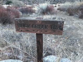
Buck Creek Trailhead Sign

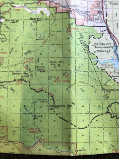
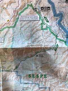
About every 5 years the Mt Pinos Ranger district volunteers submit Wilderness Camp surveys to the Forest Service. This work is very important as it gives them a record of how much use the camp is getting, what the current condition of the camp is and what if any maintenance is required. Often times a Trail Survey will be done in conjunction as well to record trail conditions leading to and from these camps, so that work crews can return with all relevant information needed to maintain the trails. Thanks to my friend and forestry mentor Mark Subbotin I have been trained to do this work and very much enjoy participating in these projects. Next Camp up on the list was to be Buck Creek. Now I sort of have a love hate relationship with this area. I love being there but I hate getting in as access requires a walk or bike ride along the steep 3 mile closed HardLuck or Buck Creek Road from the east and or a high clearance vehicle (which I do not have) from the west at Stewart Mountain. This day would prove to be all Good though since Mark has the Los Alamos Gate keys and the volunteer agreement with the Forest Service we were able to drive all the way to the lower Buck Creek Trailhead(18W01) at the now closed  HardLuck car camp.You can thank the endangered Arroyo Toad for all these closures. Now on to the Conundrum. Buck Creek Camp is literally all over the maps. Looking at several one might wonder where the actual original Buck Creek Forest Service Camp was really located and where does it sit today. Here are some examples of the madness below. Not the best quality shots sorry, however you click on the photos to enlarge them.

(Left) 1967 Los Padres National Forest Map(Courtesy of Craig R Carey) shows Buck Creek at the lower camp east of the drainage as does the 1978 to the (right). 

Also worth noting here is both maps above show Hardluck Camp at the confluence of Buck and Piru Creek.(HardLuck Camp and the road leading into it was permanently closed and no longer maintained in the summer of 2009, due to it's close proximity to Piru Creek which provides habitat for the Arroyo Toad). What remains of this once 26 car camp site is not at the Buck/Piru Confluence but is further North as Pictured below on the newer maps. More on this later.

(Left) 1984 LPNF Map shows Buck Creek at the upper Camp near the spring as does the 2016 FS Topo map to the (right). With HardLuck now showing in the location where it currently resides.

2016 National Geographic Map (left) shows Buck Creek at Lower camp but west of the drainage which conflicts with the older maps and 2014 Tom Harrison Sespe Wilderness map (right) well he has the camp even further up the trail with what appears to be not near any of the other map locations and he has removed HardLuck completely.

Hike Los Padres has Buck Creek at the upper Camp by the spring as Does California Trail Map. I have more evidence of the shenanigans going on above but I will spare you the extra photos and details. I'm sure by now you can smell what I'm stepping in here. So armed with all this I was of course very excited to get this camp survey complete and get some answers as to what's really going on here. This is how the day went. Hopefully your still with me.

View of Hardluck from atop the water tower
We Parked the cars at At Hardluck (pictured above) just adjacent to the cars is the Buck Creek Trailhead sign from which this hike begins. The first 2 miles follows parallel to Piru along an old jeep track with a very slight downhill grade to the Confluence of Buck and Piru Creek. 

 Vehicles Prohibited sign and Flat Camp spot at the OG Hardluck

It is here according to the old maps that the original Hardluck Camp was situated and I found plenty of evidence besides being on the old maps to back this up. First being long ago you could drive in all the way to this spot (see no vehicles beyond this point sign above). If you could drive all the way in here most likely you would have camped here. The area also has a couple flat spots that appear would have been perfect drive up sites. Not pictured we also found the cement in the ground with hole in the middle that was probably the Original Buck Creek Trail sign as this would have been your starting point for (18W01). For whatever reason this Camp would eventually be decommissioned  and the new larger Hardluck was installed where our route began.

Spillway at The Piru & Buck confluence

Cable Car at OG Hardluck

There once was a lot of action going on at this very spot. Pictured above is the Cable Car which still stands today that can carry goods across Piru Creek to a platform and tower that may have been a weather or water gauging system again still standing but doesn't appear to be in use. Also pictured above is the spillway that was most likely put there to keep invasive fish from Lake pyramid out of Piru Creek where the wild trout program is ongoing. 

Another view of the Flat at OG Hardluck Camp
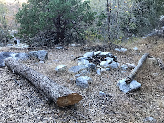
From here your route begins the southwest accent into the buck Creek drainage at around the 3 mile mark and approximately 1 mile from the The Piru/Buck confluence you arrive at a guerrilla site most likely used by hunters. The camp has a rock fire ring, some make shift benches and sits above the creek on a flat. 

Hunters Camp on flat above Buck Creek
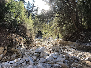
The Buck Creek Drainage is a very beautiful part of the forest. Oaks and Big Cone Spruce dot the landscape and the canyon provides tons of shade. The water in Buck is cold and clear. In my opinion you would be hard pressed to find better local forest water quality. I always filter my water however I know a few guys that drink directly out of this creek. The pools are crystal clear and very inviting. Water was flowing nicely along the whole length of our route.

Water Flowing in Buck Creek
For a trail that receives little use and even less maintenance the lower portions are fairly easy to follow. There are are spots where the trail disappears under heavy tree fall and poison oak but with good observance and route skills is very easy to pick back up again. 

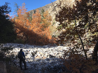
Fall colors in the Los Padres

Unnamed drainage before the second guerrilla  site 
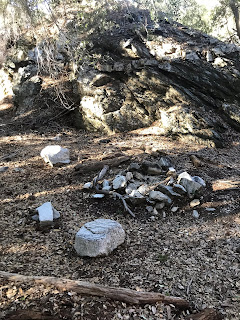
At about 4.5 miles from the trailhead you reach the next guerrilla camp site which is situated under massive oak tress across the drainage pictured above. The site has a rock fire pit and complete shade. Seems it had some recent use as we cleaned up empty gas canisters and plastic bottles left behind. 

Second guerrilla site at about 4.5 miles in

After leaving the guerrilla site continue about a mile along buck creek trail further upstream. At around the 5.5 mile mark you come to what I'm gonna call the original Forest Service Buck Creek Camp. The camp now has 2 sites as the original one lies buried under a large fallen tree.  Here are the coordinates for the the Original Buck Creek Camp. N34° 38' 40.7" W118° 51' 03.5"

Old buried  USFS stove parts

Stove, fire pit and T stakes smashed by the tree

Parts I dug out and and evidence of the original stove that was placed here many years ago


The original Buck Creek Trail Camp

At one point this camp had a table, I'm assuming burned up in the Day Fire. The evidence of the USFS service stove and how this location appears on the old maps confirms for me that this was indeed the original Buck Creek Camp site. While on this trip I was not able to make it further upstream to the upper camp shown on later maps due to time restraints. I am fairly confident that any of the other camp sites listed on maps are just guerrilla sites. At some point in the past Whenever the error occurred on the forest service Topo's probably created a domino effect and subsequent map makers just followed along with the information at hand. Due to budget constraints very few USFS workers are out in the field so errors would have become very common. To fully validate my conclusion I will however come back in  from Stewart mountain and take a look at the upper site listed by the spring. Less than a couple hundred feet below the original site a new camp area has been set up  complete with fire ring and a pile of wood to be used once fire restrictions are lifted. The site is closer to the creek and very well shaded. (See pictures below) The new site is very nice and accommodating I can imagine many hikers would just use this one and possibly pass right by the original one not knowing it was even there.

New site just below the original
Steve doing his best to look presentable (left) and (right) the remains of Carcass found at the original camp. while the site sees little human use at least the mountains lion are still enjoying the place.


To recap as mentioned above most of the trail is easy to follow. From a little over 4 miles in and beyond it starts to get messy. With Lots of overgrowth and poison oak in places. I noted with way points for my trail survey at least 40 downed trees along the trail with most being beyond the second guerrilla site. On the way out we flagged the creek crossing's and most of the hardest parts to follow. We also did some clearing of the smaller downed trees. A return Sawyer trip will hopefully be in the works to clear the larger trees. Tread work will also be needed along with a good amount of brushing to get the trail back in tip top shape. For now though we left the trail in much better condition than we found it and is worth a visit should you feel inclined. I have included my track below for download and a map. Just over 11 was the total mileage for the day out and back. Camp survey and partial trail survey was completed and to me the mystery solved of the original Buck Creek and Hardluck camp locations.


Download GPS Track (GPS Units)
Download KMZ File (Google Earth)

Saturday, December 8, 2018

Snowy OHV (19W04) Lower Re-route Part 1

Snow on the Peaks around Hungry Valley and a view toward the Smith Fork
Snowy OHV (19W04) is a well known Off Highway Vehicle route that connects from Kings Campground to Alamo Mountain. Normally I do not pay much attention to OHV Routes however this particular one has some sites along it that are of interest to me. The Old Baker Cabin (Burned down in the 2006 Day Fire) and Seven Pines Trail Camp (abandoned and no longer recognized on current forest service maps). One day I was looking at my 1978 Los Padres visitors map and I noticed the original Snowy OHV took off out of Hungry Valley and not Kings Campground as it now currently does today. Instantly this peaked my interest even more. I'm a sucker for wanting to visit Abandoned camps and no longer maintained trails. I guess it's just my thing.

1978 Los Padres Map with old Snowy route pictured above
Immediately I started to do some digging to find out why the Lower portion of Snowy was rerouted away from Hungry Valley. I came up with 3 possible reasons that might be the culprit. Endangered species particularly the Arroyo Toad, Fiscal budget cuts to trail maintenance or possibly the existence of a historical site maybe an ancient Chumash Village. I'm not 100 percent sure what the exact reason was (even if I was as far as the blog is concerned I would probably just leave it as a mystery). That being said I devised a grand plan to find and follow the old section on what would have been about a 15 mile day hike from Hungry Valley south to Baker Cabin and on to Seven Pines trail camp then back to the car. Unfortunately my grand plan did not play out as expected. Hints my title for this write up being lower reroute part 1. I had some obstacles working against me this morning the biggest being I have never stepped foot in Hungry Valley OHV Park and burned up a lot of time scouting. Also I woke up a bit later than expected. However I did in the end find the old OHV trail and got in almost 6 miles for the day. With my new perspective of the area, the next time around I know exactly how to get it done. Below are the details of today's events.

Aliklik Campground
I ended up starting at Aliklik Campground located inside the Hungry Valley Park. I wasted a lot of time looking for a self pay kiosk (there is none) it is 5 dollars for day parking here. After eventually talking to a park ranger I  found out that if no one is working the front entrance Kiosk it is okay to just drive in and not pay. If someone is at the kiosk on your way out you can pay then. It turned out no one was there for either so my day was free. I offered to pay the park employee that I found driving toward the Gorman side entrance but he said he could only take my money if he was inside the actual kiosk. Basically I take it people drive in and out of this place all day long for free. The park should really come up with a better pay option they are losing out on lots of cash that could go toward keeping the trails and park better maintained. Aliklik Has Pit toilets and plenty of Camp spaces with picnic tables and fire rings. I had the place all to myself today.

Just me at Aliklik
Weather was cold and crisp with lots of snow on the surrounding peaks. I really enjoyed the views and peacefulness of it all. I imagine in the summer this place would be hot, and dusty but as of now its perfect. 

Snow on all the peaks


To keep this post easy to follow I have included a map below to see my route. Also included under the map is my downloadable GPS track for the garmin and KMZ file for google earth. Basically there are a few locked gates on the outskirts of Aliklik where motorized vehicles are now off limits. The easiest but longer route to follow is from locked gate #2(see map). Which is still a well defined yet becoming overgrown in some places OHV trail. 

Locked gate 2 looking back toward Aliklik
From What I call locked gate 2 the route heads west around the mountain range and then south along the Smith Fork to Upper Piru Creek and to the eventual Snowy OHV trail that is now in use currently after the reroute. Scouting the area for a short cut and a direct route over the The Smith Fork Mountain range I ended up starting from Locked gate number 1 (see map). Following it up the hill off trail and down the backside into the Smith Fork creek drainage and on to the same Trail that leaves from from gate 2. This helped to cut some distance which will be needed later when I return for the full gauntlet. I did however return out from the longer gate 2 exit point just So I could thoroughly explore the whole lower section. Again looking at the map will help this Gibberish make sense.

Old Snowy OHV Trail and Upper Piru Creek

My final destination was where Piru Creek and the Smith Fork meet. Here the area opens up to a wide flat. Water in upper Piru was flowing nicely. I imagine many years ago this made for a good OHV camping spot and today would serve as a great little backpack gorilla site. There are a few different trails and or animal paths which branch out from this flat area. One of which leads you to the Parts graveyard.

Flat area at Piru Creek and Smith Fork

 Piles of old rusted parts

 Shortly past this flat where the old Snowy would have crossed Piru Creek, might have been rough on some vehicles hints the above photos. This was not a long day but it was a good one. The area is very secluded, I don't figure many hikers come this way too often as all the outskirts are OHV. I did not see a single sole after I left from Aliklik Campground. The cool air was so refreshing and seeing the snow all around made me happy. Looking forward to heading back in to finish up what I started.

Great views heading Back toward locked gate 2


Download GPS Track (GPS Units)
Download KMZ File (Google Earth)