Showing posts with label sespe wilderness. Show all posts

Sunday, January 8, 2023

Bailey Trail recon via Slide Mountain


Historic Bailey Homestead as seen from afar (center disturbed area beyond the ridge)

As far east as one can venture into the Los Padres (Sespe Wilderness) on the border with the Angeles National Forest is the seldom used Bailey Trail 18W02. According to former maps along this path approximately here N34° 38.912' W118° 48.200'  was the historic Bailey homestead site. Since the closure of Hardluck Campground this area has been notoriously hard to access and as such the trail gets almost zero use and has fallen into complete disarray. Historically 18W02 ran southeast from the junction with Buck Creek Trail past the homestead, down Beartrap Canyon and terminated at Lake Pyramid. I'm guessing actually at the time perhaps Piru Creek before the lake was installed. Another prominent feature at this terminus was what Lopez described as Bridgeport Flats #4. "A high terrace on the west side of Beartrap Canyon Creek where it flows into Piru Creek. 16 bedrock mortars" I feel comfortable disclosing this as I'm certain the feature now lies forever hidden under the lake. Perhaps time to dust off the old scuba gear.  Bailey has been on my mind for several years, why it has taken me this long to begin recon I don't know, but better late than never.

Frenchman's Flat

Slide Mountain Trail 18W04

I don't have an FS gate key and I despise the road walk to Hardluck, so much in fact I vowed not to do it anymore. I've done it on a bike and on foot, it's a pain in the ass. So with that said I decided to give it a go from Frenchman's Flat. Spoiler alert we did not quite make it to the old homestead nor the terminus of 18W02 At Pyramid. We were very close but no cigar. No matter though we gathered excellent intel for the second attempt and there will indeed be one. Perhaps I can beg a kind sole who has access to drop me at Hardluck. 


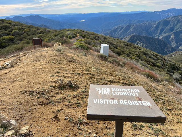
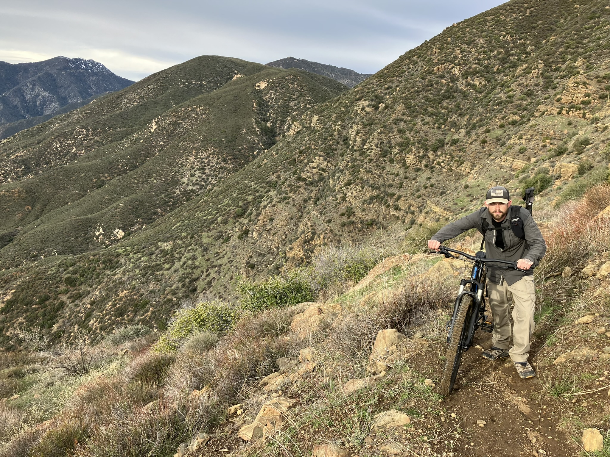
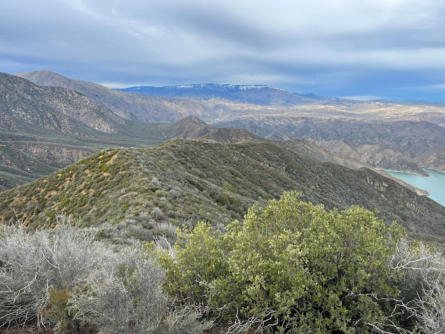
Jeff and I rode the 1.75 miles along the paved road from Frenchman's Flat (2095') to the Slide Mountain gate then proceeded to push our bikes the next 3.75 miles up to the Slide Mountain Lookout (4631'). After a brief visit we locked our bikes and set off afoot down the northwest ridge dropping approximately 1700 feet in elevation into Beartrap Canyon. The switchbacks leading down that once was is no longer. Forget about even attempting to try following that old trail. While we pushed through brush the entire time down the ridge it wasn't terrible. Being non old growth and mostly Chamise it's actually quite forgivable. 


 Looking back toward Slide Mountain

Surprising small flow in Beartrap Canyon


As you can see from the map above the old cut in red that once connected with the Bailey Trail took you about 0.3 of a mile downstream from where we dropped in after which gaining the western bank and bringing you right back,  just much higher up. We made the mistake of trying to follow this. In hindsight we should of just tried to climb it from there and push on toward the homestead but it looked steep and impenetrable. So with that we continued on downstream. All things considered we were moving along pretty good at first but just under a half mile to the lake progress came to a grinding halt. The canyon is chock-full of deadfall and poison oak. You know that couple hundred feet in an hour kind of pace. We didn't have the daylight for that. The realization quickly set in that we were not getting to the homestead nor the waters edge. Neither one of us had any interest in riding back down Slide Mountain in the dark. After acknowledging defeat we sat for a bite to eat adjacent the god awful black tubing that runs from the spring toward the lake. Yet another Beartrap littered with this shit. 

So close but yet so far.

And that's about where our day ended - N34° 38.872' W118° 47.301'

Pot Grow - N34° 38.816' W118° 47.319'

The Climb out.

Total mileage was around 15 but felt like twice that. My legs were torched from what was essentially climbing Slide Mountain two times in a day. For a novice mountain biker I will say that ride down was thrilling and totally worth dragging the bikes to the top. 


Tuesday, July 12, 2022

East Bear Trap (23W01)


With summer in full swing for obvious reasons I tend to turn my focus to higher grounds. East Bear  Trap (23W01) has been on my radar for a few years now. I still recall the first time I spotted it on the older maps. Immediately a "wow check this out" text was sent to Craig who then in typical Craig fashion (if memory serves correctly) proceeded in a very nice way to explain that I had really discovered nothing new, he was well aware of the route and in fact was one his brother would walk yearly back in the day. Sigh, I was so annoying back then. (Might still be) Sorry Mr. Carey. 

East Bear Trap 23W01  (1967 LPNF Recreation Map).

Trailhead Parking (N34.68960° W119.30130°)

Cuyama River

We found this beautiful cat dead in the Cuyama near the intersection of Bear Trap Creek. IMO possibly poisoned from pesticides or other toxic chemical runoff. More on this later.

EBT/ Cuyama junction (N34.68831° W119.28519°)

 
There are some washouts and brushy sections out of the Cuyama and up onto to the ridge top but all in all not bad. Once atop it opens wide and travel is much quicker. Stick with it, the first half mile is the worst and then it's sorta easy street. Assuming of course you stayed on the old trail proper. Deviation in the LP usually ends with ouchies and band-aids. That said throughout, obvious signs of old cans/bottles, cut trees, crib and former tread lead the way. For decades with no maintenance I found the condition quite impressive. 

Signs, signs everywhere signs.

Further up the trail (beyond the falls)


Spur to EBT Falls

Just over 1.5 miles in a rocky marked spur trail leads south away from 23W01 and down into the Bear Trap Creek drainage to what I have labeled East Bear Trap Falls. This magnificent waterfall was unfortunately dry this time of year however during the wet season I reckon its a site to behold. Definitely worth the side trip. We followed BT Creek a short distance past the falls and found a scummy pond still holding that one could filter from if needed. This drainage is really enchanting and the temptation was there to follow it (if possible) all the way to Bear Trap Camp. Mixing things up a bit on the way out instead of climbing the spur we followed the drainage back to where it intersects 23W01 yonder up the ravine.


East Bear Trap Falls

Bear Trap Creek drainage


Back on trail now and progressing onward it wasn't long before we spotted the infamous black tubing. Another Damn grow site. I swear every great remote place in this forest is polluted by these assholes. This tubing does not appear to be that old and unlike some other sites they took the time to completely bury this shit underground over a long distance (semi east/west direction) from the mini falls shown below. I started to pull it out and follow it but stopped short of the end points where most likely the fields were or are ? With the drainage dry my hunch is they are gone for the season. But you never know. Makes me wonder was our friend the Bobcat from earlier a casualty of this mess? I wouldn't doubt it. These zones can be and often are extremely toxic and devastating to wildlife. 

Tubing runs Northeast/Southwest from here.


East Bear Trap grow operation N34.68291° W119.27586°
Much of this crap runs precisely inline with the old trail and was not visible. Rarely (in my experience) does it seem they take the time and effort to hide it this good 

50-75 feet West of the tubing

Looking South up the drainage beyond the site that we would ultimately drop into from 23W01

From the grow site drainage the main trail runs parallel and south up the ridge. Depending on the map in hand some have it terminating around here N34.65502° W119.25185° at 6000 feet or so in elevation, while others show it extending all the way to Haddock Camp. We ultimately went about another mile up before having lunch and deciding to blindly drop off trail into the canyon to loop back down to the grow vicinity. More often than not a move such as that is painful but this worked out okay. We got to poke around numerous interesting rock formations and get a good look at was going on further up. No sign of the growers, in that direction at least. 


The day finished at about 7.2 miles and a few thousand feet of elevation gain. Ultimately I  would have liked to explore further along 23W01 albeit curiosity of what else we might find got the better of us. Sometime I will return and see about following the trail to Haddock and as mentioned earlier maybe skipping along Bear Trap Creek from the falls to the Camp. 

Cheers 

DOWNLOAD KMZ FILE (Google Earth)