Showing posts with label pyramid lake. Show all posts

Sunday, January 8, 2023

Bailey Trail recon via Slide Mountain


Historic Bailey Homestead as seen from afar (center disturbed area beyond the ridge)

As far east as one can venture into the Los Padres (Sespe Wilderness) on the border with the Angeles National Forest is the seldom used Bailey Trail 18W02. According to former maps along this path approximately here N34° 38.912' W118° 48.200'  was the historic Bailey homestead site. Since the closure of Hardluck Campground this area has been notoriously hard to access and as such the trail gets almost zero use and has fallen into complete disarray. Historically 18W02 ran southeast from the junction with Buck Creek Trail past the homestead, down Beartrap Canyon and terminated at Lake Pyramid. I'm guessing actually at the time perhaps Piru Creek before the lake was installed. Another prominent feature at this terminus was what Lopez described as Bridgeport Flats #4. "A high terrace on the west side of Beartrap Canyon Creek where it flows into Piru Creek. 16 bedrock mortars" I feel comfortable disclosing this as I'm certain the feature now lies forever hidden under the lake. Perhaps time to dust off the old scuba gear.  Bailey has been on my mind for several years, why it has taken me this long to begin recon I don't know, but better late than never.

Frenchman's Flat

Slide Mountain Trail 18W04

I don't have an FS gate key and I despise the road walk to Hardluck, so much in fact I vowed not to do it anymore. I've done it on a bike and on foot, it's a pain in the ass. So with that said I decided to give it a go from Frenchman's Flat. Spoiler alert we did not quite make it to the old homestead nor the terminus of 18W02 At Pyramid. We were very close but no cigar. No matter though we gathered excellent intel for the second attempt and there will indeed be one. Perhaps I can beg a kind sole who has access to drop me at Hardluck. 


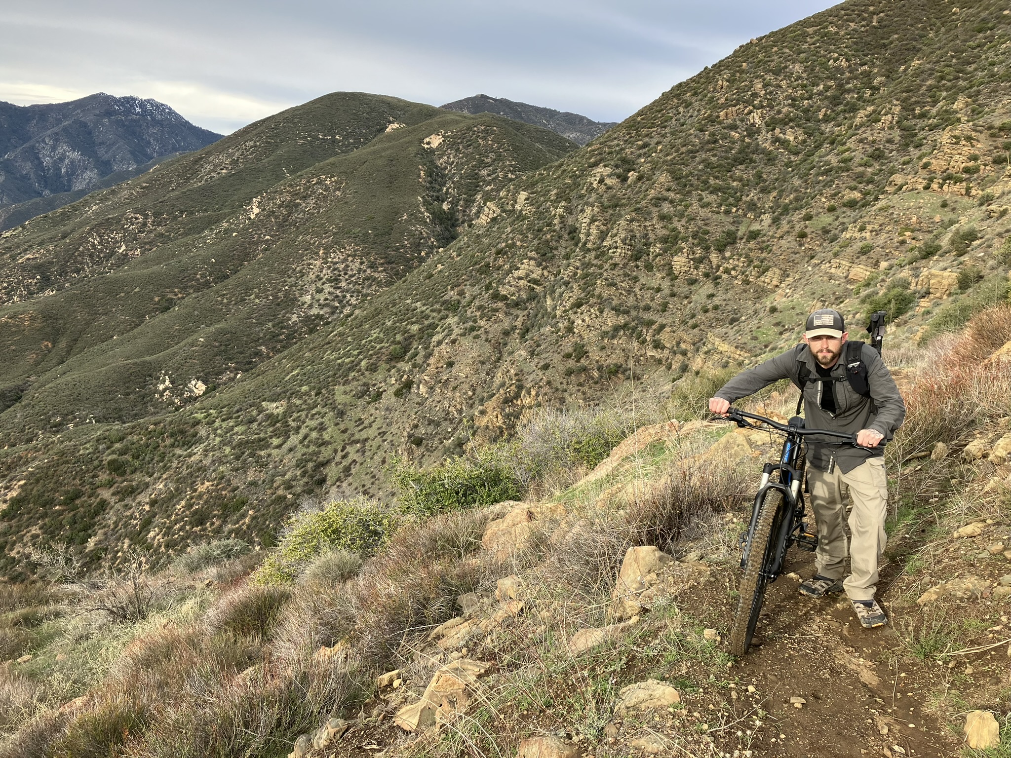
Jeff and I rode the 1.75 miles along the paved road from Frenchman's Flat (2095') to the Slide Mountain gate then proceeded to push our bikes the next 3.75 miles up to the Slide Mountain Lookout (4631'). After a brief visit we locked our bikes and set off afoot down the northwest ridge dropping approximately 1700 feet in elevation into Beartrap Canyon. The switchbacks leading down that once was is no longer. Forget about even attempting to try following that old trail. While we pushed through brush the entire time down the ridge it wasn't terrible. Being non old growth and mostly Chamise it's actually quite forgivable. 


 Looking back toward Slide Mountain

Surprising small flow in Beartrap Canyon


As you can see from the map above the old cut in red that once connected with the Bailey Trail took you about 0.3 of a mile downstream from where we dropped in after which gaining the western bank and bringing you right back,  just much higher up. We made the mistake of trying to follow this. In hindsight we should of just tried to climb it from there and push on toward the homestead but it looked steep and impenetrable. So with that we continued on downstream. All things considered we were moving along pretty good at first but just under a half mile to the lake progress came to a grinding halt. The canyon is chock-full of deadfall and poison oak. You know that couple hundred feet in an hour kind of pace. We didn't have the daylight for that. The realization quickly set in that we were not getting to the homestead nor the waters edge. Neither one of us had any interest in riding back down Slide Mountain in the dark. After acknowledging defeat we sat for a bite to eat adjacent the god awful black tubing that runs from the spring toward the lake. Yet another Beartrap littered with this shit. 

So close but yet so far.

And that's about where our day ended - N34° 38.872' W118° 47.301'

Pot Grow - N34° 38.816' W118° 47.319'

The Climb out.

Total mileage was around 15 but felt like twice that. My legs were torched from what was essentially climbing Slide Mountain two times in a day. For a novice mountain biker I will say that ride down was thrilling and totally worth dragging the bikes to the top. 


Monday, September 10, 2018

Slide Mountain

Slide Mountain Fire Lookout Tower

Looming above Pyramid Lake and the Piru Creek drainage sits Slide Mountain and it's infamous Fire Lookout Tower. The Tower was Built in 1969 as part of the Pyramid Reservoir Project. The 365 foot metal tower was positioned atop the mountain by helicopter and served the needs of the USFS for around a decade before being closed in the early 80's. Many of the Fire lookouts in the Angeles and Los Padres have been lost over the years to closures, budget cuts and natural disasters. Too see one still standing and in such pristine condition is a real treat. In 2003  It was was restored by ANFFLA   ( Angeles National Forest Fire Lookout Association ). Currently they are still looking for Volunteer Hikers to man the station. If your interested in applying and taking the course check out their website for further details. https://www.anffla.org/training/ 

Hikers Wanted

The Trailhead for Slide Mountain starts at Frenchman's flat the main gateway to access Piru creek and the closed road leading toward Pyramid dam. From the 5 Freeway heading north exit Templin Hwy, turn left to go under the bridge and make an immediate right onto old hwy 5. Continue along this road until it dead ends at the Frenchman's Flat camping area and the Locked white Gate. Park here (see picture below) along the road in the designated parking spaces and make sure you display your adventure pass, as the rangers often roll by and check. Parking is plentiful and restrooms are located just west of the parking area.

Frenchman's Flat Parking area


Trailhead Restrooms

The first 1.7 miles is along the paved Road. Frenchman's Flat was and still is a popular fishing and camping area. (Trout are no longer stocked here by DFG but the wild population is still semi okay). I believe up until sometime in the 80's you could drive past the white gate, however that is no longer an option. I'm not a huge fan of hiking asphalt so when here fishing or hiking I normally bring my bike and or scooter for anything along the paved section.

Opted for my scooter along the paved road


 Pass through the gate and follow the paved road along  Piru Creek toward the Dam. Fishing is allowed here with a valid California Fishing license. The season runs all year with a 5 trout limit, HOWEVER from Pyramid Dam downstream about 300 yards below the Lake to the bridge is closed all year to fishing. From the same bridge down to the falls (about a 1/2 mile above the old highway 99 bridge) Is a wild trout fishery and only artificial lures and barbless hooks may be used. There is a zero take limit. Below this point and all the way south to Lake Piru along the creek has no special regulations with a normal 5 trout limit.


As I mentioned above approximately 1.7 miles look to your left for another white locked gate leading west up the mountain this will be your route up to Slide Mtn(18w04). Here if you rode a bike you should probably lock it up to the gate post. I hid my scooter in the bushes nearby.

Leave payment and head up dirt track here


From here the path starts out a wide jeep trail and eventually narrows down to a single track. This section is well maintained and very easy to follow. It's about 3 and half (all uphill) miles to the top. With a fair amount of switchbacks. When traversing the west side of the mountain sections you will get some morning shade. Along the way up you will get some very nice views of Lake Pyramid, Cobblestone Mountain and a whole host of other surrounding mountain Peaks. At the top the views are even better. You get the an incredible perspective of the whole area with a commanding look down into the Piru Creek drainage all the way to lake Piru. 

Slide Mtn Fire Lookout


 Summit Register

Emergency Water Box

The tower is in great shape and you can climb the stairs to the top and take look around. The door to get inside is locked however the tower is wrapped in clear glass windows that give you a great view inside. There is a pit toilet outside, Summit register, water tank and even an emergency box filled with water bottles should you need some. Be careful reaching into the box as a big black widow spider lives inside guarding the water. I think next year I will take the class and return back for a night or 2 of volunteering. 

A look at the kitchen

The bed and desk


 Pit Toilet and Water Tank

Pyramid Lake and Chumash Island


My favorite site was the view of Pyramid Lake and Chumash Island. (I wonder why it got that name). I get the sense that they found a lot of Chumash artifacts or other evidence here before they filled in the lake with water. Never to be seen again what was once below. 

Looking South Down onto the Piru Creek Drainage

View of Cobblestone Mountain

The temps were blazing today by 10am it was already in the mid 90's. My original plan was to hit Slide Mtn and then descend back down to do some fishing in Piru Creek. I need to test out my new Tenkara USA Rod before my trip in a few weeks back into the golden Trout Wilderness. This time come hell or high water I'm catching me that damn elusive Golden Trout.

Rhodo Tenkara Rod and Flies

Due to the high temps I couldn't fish very long, I had my dog with me and I did not want her out in those conditions. Oh well still another great day in the Angeles National Forest. My total mileage for the day out and back was 10.9 with about 2400 feet of elevation gain. 


Download GPS Track (GPS Units)
Download KMZ file (Google Earth)

Tuesday, June 5, 2018

Hard Luck Camp and upper Piru Creek


This mission had two objectives. First one being to complete the Second leg of the Piru Creek Project. I've now seen everything the Creek has to offer from Lake Piru to Above Lake Pyramid and ending just passed the old now closed Hard Luck Campground. Second objective bring Tony Marchese back to Hard Luck where he has so many great memories camping and hunting with his Dad. Logistically this is not the easiest site to access. Established in 1961 Hard Luck Camp and the road leading into it was permanently closed and no longer maintained in the summer of 2009, due to it's close proximity to Piru Creek which provides habitat for the endangered Arroyo Toad. This once 26 car site Camp served as the starting point for Buck Creek Trail(18w01) and Upper Piru creek. You basically have two options now. Hike in from the west via Alamo Mtn(8n01) and Stewart Mtn (6n10) Route, or From the East Gate near Los Alamos Fire Station along the 3 mile now closed Hard Luck road. We chose the latter. Remembering our past mistakes from Lower Piru and hiking in on long, hot, and boring paved roads and how much it sucked. We decided this time to add mountain bikes to this section of our itinerary. Tony picked me up at my house early the morning of and we loaded our packs and mountain bikes in the car for the drive up to Los Alamos Campground where we would leave the car parked overnight.


The weather that weekend was forecast to be hot so in order to stay cool we outfitted the bike I would be riding with saddle bags in order to carry our Ice Mule coolers loaded with beers :) After finding a nice place to park for the night we paid the fees and off we went. From the campground parking lot it was only about .7 miles to the locked gate


From here the next 3.5 miles uphill and then downhill to Hard Luck is rather grueling, especially on a bike carrying a heavy pack. Granted it was still much nicer than walking. I did take note of how bad it would be on the way out from the treacherously steep hill we just went down. Coming into Hard Luck we crossed Piru Creek which still had a decent flow of water for being so late in June. We spent a little time investigating what was left of Hard Luck and Tony Got to relive those old cherished memories with his pops from all those years ago.


We continued our ride along the trail as long as we could before it was no longer passable on a bike. Eventually we found a nice spot to stash the bikes. After a quick break we locked them to a tree and off we went on foot. 

Leaving Hard Luck your awarded with some really nice views of the surrounding valley and  mountain ranges. While here I did do some fishing in the upper creek, I didn't catch anything this time around but I really wasn't trying very hard either. Upper Piru is a wild trout program and only artificial lures and barbless hooks may be used with a 2 trout possession limit.


Our original plan was to follow Piru Creek until it ran into Lake Pyramid. Hoping to camp for the night near the Lake. At about 6.5 miles in we came to the junction of Piru and Buck Creek and surprisingly Buck Creek had a decent little flow of clean cool water coming in. Before heading completely off trail and down into the Piru drainage  we did do some exploring up Buck Creek and found some nice good sized pools to soak in. Note the trail from here up Buck Creek is not in very good condition, it appears then disappears in quite a few places. I would imagine it would be quite difficult to make it all the way up to Buck Creek Trail Camp. Lots of Bush whacking and trail searching involved. I'll have to return another time and explore that one further.


Heading Down Piru very close to the Buck creek junction in the middle nowhere comes this man made gaging station. This in stream structure acts as a barrier to upstream fish migration of non native species under most flow conditions. There has in the past however been reports of anglers catching Large Mouth Bass up and around Hard Luck.


The geology here in the Piru canyon is fascinating. Conglomerate rock formations form steep canyon walls, full of holes with nesting birds in them. At the right time of day the canyon provides a good  amount of shade, something we really needed at this point as the June heat was kicking our butts. I spotted a few turtles hanging by the station structure here as well. 


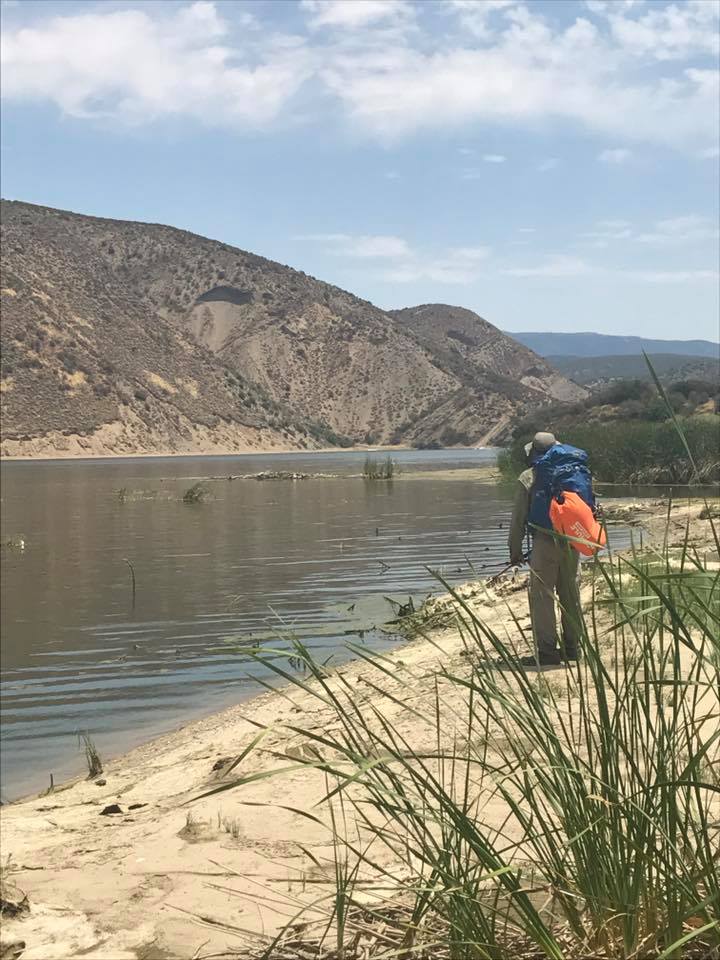
We followed the drainage for approximately 2 more miles before reaching the Lake. Water flow in the creek got lower and lower the closer we got to Pyramid and eventually stopped flowing altogether. About a half mile before landing on lake we got the pleasure of tromping through wet muddy marsh land and to make matters even worse there was no nice dry place to camp and absolutely no shade by the lake. Tony went for a swim and I cracked a cold one and pondered our next move.


At this point we still had plenty of Daylight left so we decided to head back and camp near a spot we noticed by junction with Buck Creek. Our camp had a nice rock wall to sit on and store our gear and good flowing water from Piru. It was actually a really beautiful spot and had a good amount of wildlife around as well.


As I mentioned plenty of times it was Hot, so damn hot I really did not sleep well at all. I was at one point tempted to go lie in the creek during the middle of the night and sleep there but fought back the temptation as that would not be very environmentally stewardedly of me. Eventually it cooled off enough for me to drift off. The next morning we woke, had coffee and breakfast and high tailed it back out the way we came in. Luckily the bikes were still at the stash spot. (not like there is anybody else out here who would have taken them). I stopped a few more times on the way out for a little fishing but again was skunked. Note: the bike ride out is an ass kicker. Basically straight up hill, its slow going and brutal. Once you reach the top of the ridge though its nice and all downhill back to Los Alamos Campground. Besides the heat and ugly bike hills the trip was great I had a blast. There is still a vast upper section of Piru Creek I need to explore before I can say I have travelled the whole length but section 1 and 2 are officially in the books. Our total distance for this trip was about 19.5 miles.


Download GPX File (GPS Units)
Download KMZ File (Google Earth)