Showing posts with label sequoia national forest. Show all posts

Tuesday, August 14, 2018

Maggie Lakes

Lower Maggie Lake

Nothing says Happy Birthday like a trip into the Golden Trout Wilderness. Talk about beautiful scenery this place has it all. This pristine area encompasses 304,000 acres in the Kern Plateau at the Southern end of the Sierra Nevada. Miles of hiking trails stretch in all directions. Streams and lakes dot the landscape, with 2 wild and scenic Rivers (The North and South Forks of the Kern). The area is named for California's prized state fish, the Beautiful Golden Trout which is native only to these waters. A true backpackers paradise the densely packed pine forest's bring an assault to the senses. Christmas has always been my favorite holiday and the sights and smells brought back old childhood memories of my parents taking me to the lots to pick our yearly tree to decorate. Thursday August 9th I turned 38, to celebrate I packed my gear and headed north.There are multiple access points into the wilderness. All overnight stays require a permit. (No permit is needed for day hikes). If entering from the Inyo National Forest side you can obtain your permit here from Recreation.Gov. If entering from the Sequoia National forest side fill out the permit application and mail or fax it in to the appropriate ranger office. Permits can be picked up in person, faxed or received back through the mail. Here is the Forest service website for more information. As with all my posts you can click on any picture to enlarge it and letters in blue have working clickable informative links.


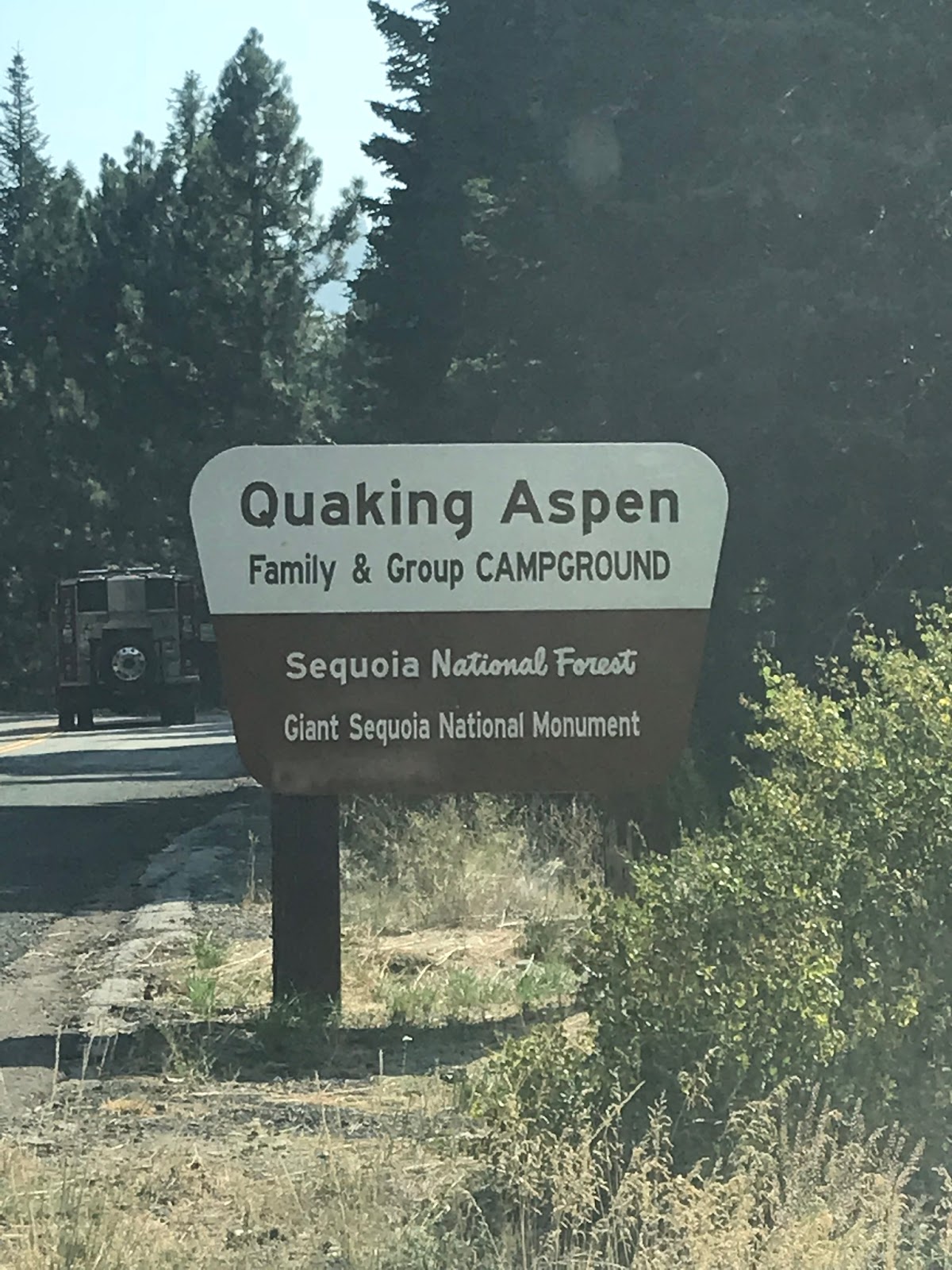
Before hitting the Summit trail to Maggie lakes we decided to car camp for the night at Quaking Aspen Campground.(Named for the Quaking Aspen Trees that grow in the area).Which is located off Hwy 190 at 7200' elevation between Camp Nelson and Ponderosa. Only 10 miles south of our TrailHead. This would serve 2 purposes, first being we won't have to wake up super early Friday morning for the 3 and half hour drive out and second it would be a good place to acclimate for the night at higher elevation. I really enjoyed this campground. The restrooms and grounds were clean. Views exceptional. There was plenty of hiking trails leaving out of the camp to the surrounding area. It accommodates small RVs with a max length of 26 feet, and each sight is outfitted with bear lockers for food storage. We enjoyed a little exploring of Freeman Creek flowing just a few  yards from our site. I'm already planning a return visit with the wife and kids.

Meadow by the creek behind our campsite

Our camp site at Quaking Aspen

A great feature of this campground is the very small town of Ponderosa is right around the corner just 2 miles up the road. We had burgers and beer at the Brewers family lodge and market. (Pet Friendly). They even seated Lacy dog with us on the Patio and served her a burger patty on her own plate. The staff was awesome and the market is stocked with any last minute supplies that you may need.

Ponderosa Brewers family Lodge

From Quaking Aspen Turn left out of the Campground head back down Hwy 190 less than half a mile and turn right onto North Road(21s50). Follow North Rd about 10 miles to the Summit TrailHead. PARK HERE

Summit TrailHead parking sign

North of Maggie Mountain lies a series of 3 Gorgeous alpine Lakes (Maggie Lakes), and when I say Gorgeous that is an understatement. Surrounded by Thick conifer forests, granite peaks and stunning meadows its basically heaven on earth. The Lowest and most commonly camped at lake sits at just over 9000' elevation. The upper Lake is the Largest and the middle lake is the smallest. Both upper and middle require a small off trail trek to reach. 15 min or less Hike to the upper and 5 minutes for the middle. Both definitely worth checking out as you most likely will have them all to yourself. A helpful hint getting to the upper lake is easiest by following along the stream from the lower lake. It will lead you right to it. Nearby if your feeling extra adventurous you can Summit Maggie and North Maggie Mountain. A Sierra club register is currently at North Maggie. The only reason I did not Summit on this trip is I had my dog and it was her first backpacking trip, that would have been too much for her.

Lower Maggie

Middle Maggie

Upper Maggie

My only Bummer was that I only caught 1 fish. I attribute this to the water being very warm and I doubt the trout would be to active in those temps. Perfect swimming conditions though. I did take advantage of that. Fishing regulations here at the lakes in the Golden Trout Wilderness require artificial lures with barbless hooks only. Season is open Last Saturday in April through November 15th. With a 5 trout limit. Fly Fishing will probably land you your best shot at taking home the prized Golden. Also if you have time I've been told you can pull small Golden's out of Mountaineer creek on your way in or out. I will include way points locations in the map for you, should you like to try your luck at the creek.

This little beauty was released unharmed

Unless it's a super secret location I include a map plus GPS track and Google earth KMZ files for you to download at the bottom of every blog post. This makes it very easy for you to follow my exact routes. 

Heading out from Summit Trail

Dan and Lacy with big smiles

Getting to the Lakes from Summit Trail (8,265') is the shortest route.The trail is very well maintained and easy to follow. Very few spots leave you looking around just a little bit for trail, however most of those spots are marked with ducks. Its always a good idea to bring a map and compass or GPS, but most likely you will not need it unless your planning a lot of off trail stuff. The trail starts off heading west and downhill for 1 mile until crossing Mountaineer creek. This is only 1 of the 2 reliable year around water sources before reaching the lakes so If you have not topped off your water due so now. The next reliable water source is about 8.5 miles in at Pecks Creek watershed.

Mountaineer Creek Crossing

After Crossing mountaineer you will begin your first of 3 really good uphill pushes. At around 2 miles in we came across this very interesting Lean to shelter complete with camp fire ring.

Lean to Shelter

Also very close to here you get a peek down into the Alder Creek Drainage. This makes for a great photo opportunity. As you can see from my picture below. The only downside was it was a tad bit smokey that morning from a controlled burn that was taking place nearby.

Alder Creek Drainage view point

Crews have been hard at work clearing downed trees

Endless Forest

Cruising through this area keep an eye on those views to the east you will get some amazing sights of the Great Western Divide and the Surrounding San Joaquin Valley.


Continuing on you will drop down into Jacobson Meadow at 3.7 miles in. I found this meadow to be really neat. If we didn't have so much farther to go I would have made this my lunch spot. In fact all the meadows we came across were so refreshing the wild flowers were in full Bloom.

Behind the downed tree is a nice bench to rest on

Jacobson Meadow

Passing Jacobson's you start a small climb before once again dropping down into another meadow (Mowery Meadow). Basically you can consider this the halfway point at 5 miles in. If water is needed you can head down a ways into the meadow along the "Not so maintained" Mountaineer creek trail(32e10).  If you keep following this east you should find plenty of water. Otherwise you must wait 3 miles until reaching Pecks Creek. Here at Mountaineer creek is one of those spots I mentioned above where you can find small Golden's in the creek. Might just make a great excuse to run out of water :).


Those Wildflowers are much better looking in person

Back to the grind uphill you go on a good push 6.5 miles in you will pass the junction for Griswold trail(31e18). I've not hiked this trail but have heard its steep and treacherous and not maintained. All things that interest me. I'm a glutton for punishment when the reward is taking the path less traveled. This was actually on my original agenda from a different loop trail but changed my mind once I knew I was bringing my pup. Notice how the junction for Griswold kind of looks like a cross in the photo maybe a subtle warning of don't go here. Or maybe now the trail is once again maintained, guess I wont find out until I return.

Junction for Griswold

Griswold Meadow

Not too far from the Lakes now you have another pretty good uphill followed by a big downhill jaunt into the Pecks Canyon watershed at 8.5 miles in. This creek should by all means be flowing and is your second reliable year around water source. From the start of the trail I carried three and a half liters and did not need to refill, however my hiking buddy did. He started with 2 liters and it was not enough for him. Good thing I always carry more than I need. This is a very important rule all hikers should strictly adhere to. I can't stress enough how important it is too carry extra water and know for sure where the reliable fill up sources are located. After passing Pecks creek there is a junction, head left toward Maggie. Going right will lead you to Pecks Cabin this is private property.

Junction sign after leaving Pecks

 I found the next mile into the lake to be the only part of the trail where you had to pay attention where you were going as a few spots on the trail gets faint but again not by much. When all else fails follow the stacked rocks. Note: I'm not a big fan of these all backpackers should know where they are going and how to navigate through the backcountry with proper map skills. Prior Research and knowledge out here is your best friend. At around 9.5 miles in you have just arrived at Lower Maggie. Brace yourself the beauty of this place is the real deal. Immediately upon arriving there are multiple camp spots along the lake complete with nice fire rings. There are also a few dispersed campsites at the middle and upper lake should you want to venture just a little further. However most folks stop here. I found myself drawn to the middle Lake. I think that one was my favorite. Summit trail does not end here, you can continue north to frog lakes, twin lakes and even much farther to Summit Lake and beyond.

Our campsite

My piece of paradise 

This was such an awesome way to spend my birthday. I couldn't have asked for a better birthday present. I absolutely love the Golden trout Wilderness. There is so much more of it yet to explore. I can't wait to get back out there, and hopefully next time catch that ever elusive Golden Trout. Thanks Dan for joining me and special thanks to my beautiful wife who lets me take off on my journeys at a moments notice. 

Obligatory Selfie


Download GPS Track (GPS Units)
Download KMZ File (Google Earth)

Wednesday, May 23, 2018

Kern River from Johnsondale Bridge

What was supposed to be a long off trail journey, deep into the Southern Los Padres National Forest, on a wild and scenic river, through the heart of the Condor Sanctuary, is going to have to wait a little bit longer. Damn you Thomas Fire!!! So with that being said to the Kern River we go. The team had no objections to the route change. In fact I do believe they were secretly cheering inside that they would not be Hiking 40 miles through waist deep waters, scrambling up and down boulders and eating brush sandwiches. I however am a tad bit disappointed. Oh well I will get you Sespe sooner than later. 

At Around 5am Saturday morning I met with my usual cast of characters Tony Marchese and Tony Branam, with the added addition of Dan Thompson, at my house and loaded up for the 3 hour drive to the Trailhead parking at Johnsondale Bridge


I don't believe you need an adventure pass to park here but I always display mine anyways, better to be safe than sorry. Fishing licenses are required for all persons fishing; age 16 and over. Fishing from Johnsondale bridge upstream where Forest Service trail 33E30 heads east  to to join the Rincon Trail, is open beginning the last Saturday in April and runs through the 15th of November. There is a minimum trout size of 14 inches; while artificial lures with barbless hooks must be used. There is a 2 fish limit. From the junction of 33E30 and Rincon further upstream to the mouth of Tyndall Creek same regulations apply except the maximum size limit for rainbow trout is 10 inches. Always best to double check regulations before heading out. The upper Kern is a wild trout fishery and not stocked so expect to work a little harder to catch these beauty's. 


After a quick walk across the bridge and down the steps we made our way onto the Kern River Trail(33E30). This Scenic route runs parallel to the Kern heading North along on the east bank. We began by following a very slight grade with incredible scenic views over riverside bluffs all while staying close enough to the water to be able to get to it should the need arise. The narrow river canyon is steep and scattered with high boulders, Grey pine, live Oak, and cedar. Willow, and cottonwood have taken up residence along the waters edge. Of course it wasn't long before I stopped to throw a line in the water. At about 1.5  miles in you come to a rock outcropping that makes for a great photo opportunity.


 One thing you cant help but notice up here besides the amazing scenery is the smell of the crisp, fresh pine mountain air. A welcome change from my smog infested LA County. Continuing on 
about 2.2 miles in you come to the junction of Kern River and Dry Meadow Creek, where lies the famous 7 Tea Cups waterfalls. This short section of Dry Meadow Creek host some of the best Class C Canyoneering opportunity's in Southern California. If visiting and rappelling down these falls is of interest to you here's a great write up by modern hiker that can help you get it done. https://modernhiker.com/hike/canyoneering-the-seven-teacups/


Up too this point we were jamming through our trek of what was supposed to be a 20-22 mile  loop up the east side of the Kern and back down the west side. Little did we know it would end up being much different. The going really starts to get tough around about 5 miles in. The Kern River trail now heads east away from the water and climbs up a steep canyon. 


At just 6 miles in  during the climb we came across and old shaft or some kind of cave in the side of the mountain. From the outside you could not see the back of the cave. Hoping no bears or mountain lion were home Tony and I  decided to go have a look and see how deep this thing went.


I'm still not exactly sure what this shaft was once used for, but was thank full to have found it, the excitement of it made us forget all about the relentless uphill attack that we were enduring. After what seemed like forever we finally reached the end of the River Trail. From this point forward we would be heading north On Rincon(33e23) Trail, an OHV mostly used by off road motor cycle enthusiasts. This was a great spot to throw off our packs and take a break.


Here is where everything starts to get interesting. At this point Dan was not feeling well. A couple of factors contributed to this. One an over weighted pack, two dehydration from the long hot climb and three not being in tip top shape. The next couple miles were very slow going, we had had to make frequent stops for Dan to rest and or puke a bit, making it worse was the fact that we were still climbing, flat ground was nowhere to be found. Progress was now crawling and day light wasting. The original plan was to get all the way to Durwood Camp the first day in, that was obviously not gonna happen today. We decided to make camp for the night at the junction of Rincon Trail and the 3.3 mile spur trail that leads to Durwood. 


Feeling like we were now beyond schedule was disappointing but would turn out to be a blessing in disguise. What we didn't know was that since the big fire in 2002 most of the trails are seriously overgrown and no longer maintained up here in the Kern. Obviously none of our tax dollars are getting allocated for trail maintenance to this amazing stretch of wilderness. From here on out its near impossible to navigate any former trail without constantly looking at a GPS unit and even then you will be doing major bushwhacking and progress will be insanely slow. The spur trail down to Durwood was not only overgrown but seriously just plain dangerous. Traversing up and down steep mountain cliffs through impenetrable brush was a nightmare and took 3 times as long as we thought it would, and to top it off I slipped  on loose rock and twisted my ankle really bad. Days later I would get home and find out it was a fractured fibula. It was a good thing Dan was not feeling well or we would have been stuck on that steep trail into the night with no flat area at all to camp. I always carry a personal location beacon to alert search and rescue should an emergency occur, my leg was hurting and we still had around 13-15 miles left to go before getting back to the car. It was either hit the button or load up on Advil and just keep trekking as best I could. There was still so much I wanted to see down by the water that I choose to carry on and tried my best to ignore the pain, however now at this rate we would probably never make it back to the car by Monday. 


The Death Trail
We finally made it through the nasty spur trail and down to Durwood camp which is unmaintained private property owned by the forest service. A couple of the cabins are burned down, one is still standing but the bees have taken residence throughout it. There is a flat meadow you can camp at but with little trees for shade. We stopped for lunch and admired the views but decided we would camp somewhere else across the river on the west bank. This area is secluded and seldom traveled on foot, its nice and quiet and the fishing is superb.


There is two ways to cross the Kern here, either swim through ice cold raging water and hope the strong current does not carry you to your death or at your own risk take the old rickety Cable car. This car is not known by many people. I came across a picture of it from a blog that was written in 2006. When I called the Kern Ranger Station days before our trip they would not confirm to me that it even existed. In fact the nice lady who answered the phone played dumb about it. The whole time before we arrived here I was praying that it would still be here and that it would be tied off to the right side of the river for us to be able to reach it and sure enough it was. I quickly volunteered to be the test dummy, I was so excited to ride this thing. Cable looked to be in decent condition, the wood floor had seen better days, oh well here we go I was committed. 


Once everyone was safely across we made our way downstream to what would be the definite highlight of Every body's trip. A beautiful Riverside Campsite, that we had all to ourselves. Complete with fire pits and log and stone chairs already set up. Fishing here was absolutely phenomenal, once I figured out the correct lures I was getting hit on every cast. We set up camp, had a nice fire, and enjoyed a trout dinner served by Tony Marchese our camp chef. He makes a mean trout dish on the trail. I believe this spot is now used mostly only by people on kayak due to its remote nature. However I have now figured out a route from the opposite direction to access it so I'm for sure going back and I will even do some trail maintenance on my way in this time to spruce it up. I was enjoying myself so much here that at times I forgot about my mangled ankle. Words do not do this place justice.


 To get Back to the car my plan was to head out the canyon from Durwood Camp to Bean Camp(32e29) to Drywood Meadow to Elephant Knob(32e43) to Highway 99 with a quick jont back to Johnsondale Bridge. On paper this sounds great and is a noble undertaking on good day with plenty of time and a maintained trail. We had none of these things this morning. What we got instead was zero maintained  trail, guarded by a force field of ticks (more than I have ever seen in my life in one place) rain and of course my broken leg. The forces to be were making every possible effort to keep folks out of this magical spot and us from reaching our destination in time. But of course the views were outstanding.


We made every possible Valiant effort to complete this loop on foot but sometimes you have to know when to call it. Up here there is zero cell service and my wife was expecting us by Monday had she not heard from me I can all but guarantee their would be search and rescue coming for us, and by my calculations had we continued on the original OVERGROWN path we might have had to camp one more night before reaching our car. So with everyone in agreeance I made the call to abandon the path and head up and out on an old OHV Trail Sand Hill Ridge(22s89) which would lead us way out of our way but onto a paved Road, Lloyd Meadow(22s82). All though a remote road  my thoughts were somebody would drive by eventually and at least give Tony Branam a ride down to the bridge to get his car and come pick us up. A gamble indeed because if I was wrong this was gonna add a ton of extra pavement miles to our trip and leave a very panicked wife at home waiting for me. Once again though as luck would have it we walked a couple miles and out of nowhere a forest service worker happened to drive by. Steve was an awesome dude and happily offered to give us a ride in his pick up back to our vehicle. He saved the day. Our total mileage including the car ride was somewhere in the neighborhood of 30 miles.


Next stop french fries and beer at the Kern River Brewing company before heading home. I had the time of my life. Special thanks to my friends for joining me. This is one we will remember forever.
No doubt we will be back soon.  Please pardon my absence from the blog for the next 6-8 weeks while my fracture heals. In the meantime I will be diligently planning the next adventure. Cheers!!!


Download GPX File (GPS Units)
Download KMZ File (Google Earth)