Showing posts with label golden trout wilderness. Show all posts

Friday, September 28, 2018

Trail Pass to Golden Trout Creek

My First Golden Trout

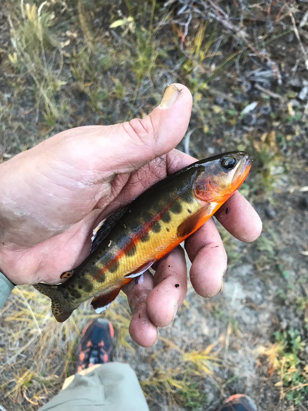
The Golden Trout Wilderness is very quickly becoming one of my favorite places to visit. Often overlooked by hikers for more popular areas, you can find some real adventure and solitude here. Plus the combination of high altitude granite peaks, lush meadows, thick pine forests and trout filled streams make for a backpackers and anglers paradise. This place is a true gem and its home to the California State fish (The Golden Trout). One that has up until last weekend eluded me. I have been wanting for some time now to catch one of these beauty's and on this trip to Golden Trout Creek I was finally able to snag a bunch of them all in a day's work. (All fish were released back into the wild). These rare fish are native to the Southern Sierras and often found between 7,000 and 10,000 feet elevation.The upper reaches of South Forks of the Kern, Golden Trout Creek, Volcano Creek and its tributaries are full of these fish. Most of them in their native habitat are small ranging from 6 to 12 inches however very large ones have been caught at certain lakes. Due to their small size, fly fishing is going to be your best bet at landing one. I used my new Japanese Tenkara rod and was getting hit all day on dry flies. Mostly elk hair caddis, renegades and parachute Adams. The Golden's would congregate in small groups below moving water, looking up stream and waiting for insects to pass. Having a good pair of water shoes enables you stay in the water and avoid line tangles in  the  surrounding vegetation. Casting upstream and allowing my fly to flow back down proved to be deadly.

Golden being brought in 


Obtain your wilderness permit here

There are multiple access points into the Golden Trout Wilderness. All overnight stays require a wilderness permit. Depending on which side you enter from dictates where and what agency you get your permit from. Most of the west side is managed by the Sequoia National forest and the east side managed by Inyo National forest. Fire restrictions on the Inyo side are currently in effect and no campfires are allowed. (except for in designated campground areas). The Sequoia side is still okay for campfires. Getting to Golden Trout Creek requires a lengthy hike. We choose to enter from east at Horseshoe Meadows from Trail Pass Trail. Horseshoe Meadows is one of the major gateways into the GTW, Sequoia and Kings Canyon National Park and of course the infamous Cottonwood Lakes. There are 3 campgrounds and 3 major trail heads leading out. Two of which are quota trails (Cottonwood Lakes and Cottonwood Pass). Permits for these can be obtained online at recreation.gov or in person. Trail Pass is a non quota trail so your guaranteed a permit. Once you arrive in Lone Pine California you will need to stop at the Eastern Sierra Visitors center to obtain your permit.The visitors center has a really nice gift shop and quite a few very neat historical displays. Definitely worth a visit when in Lone Pine even when not obtaining permits. To Reach Horseshoe Meadows from Lone Pine Turn west On Whitney Portal road and then a left on Horseshoe meadows road. It's about 20 miles total on the semi windy road. The drive goes by quick as you will be distracted by the awesome views of Owens Lake, Alabama hills and the towing granite peaks. Watch out for cows crossing the road. 

Cottonwood Pass walk in Campground

We drove up from Los Angeles Thursday afternoon and and stayed our first night at Cottonwood Pass Campground. This made for a good opportunity to acclimate for the night and get an early start on the trail Friday morning. This campground is walk in only. First come first serve and is 6 bucks a night with a maximum one night stay. Parking for the Trailheads is plentiful and there are numerous bear lockers (required for all food storage) and trash cans provided. There are restrooms with pit toilets as well and access to water faucets if needed. Campfires are permitted here in designated areas however there is no gathering of local firewood. (You must bring your own).The sites were nice, complete with fire rings, benches and tables as seen in the picture below. Also the trail leaves right from camp which is extremely convenient.

Site # 10

Trail Pass Trailhead

GTW Sign

 To access Trail Pass you first leave from Cottonwood Pass Trail. In about .3 miles take the junction to your left and proceed onto Trail Pass. Before this junction and right after leaving the Trailhead is the GTW Sign pictured above.

Keep Left at the junction


Within a very short distance you will drop into Horseshoe Meadow and make your first Creek crossing. The views here in the meadow of the surrounding mountains are incredible. Its a good first taste of what's in store ahead.

Creek running through Horseshoe Meadow

View North from Horseshoe Meadow

After Leaving Horseshoe Meadow the next 2 miles is all uphill until you reach the junction with the Pacific Crest Trail. This section is very pretty, as you make your way over the North side of the mountain you are treated with a dense pine forest and plenty of shade. Trail pass is a very well maintained trail and super easy to follow. My only gripe is that most of it is comprised of soft sand so you will work a tad bit harder than normal here. On the way over this pass you will get a look into Round Valley. The cattle were out and grazing in full force.

Round Valley

Pacific Crest Trail Junction

After making it to the top and crossing the PCT the rest is all downhill and or flat all the way to Golden Trout Creek. Basically you will have to negotiate one hill coming in and one bigger hill going out. Granted that's if you make this trip as an out back like we did. There are multiple different loop options should you choose that. 

Olancha Peak in the distance

View down into the valley toward Kern Peak

From the PCT it is approximately 2.5 miles downhill until you reach Mulkey Meadow. Along the gradual trek down notice the killer photo opportunity's of Kern Peak and Olancha Peak. If water is needed you can refill at Mulkey Creek. You will have to take a short detour to reach it as Trail Pass does not cross Mulkey Creek. Once you drop into the Meadow it's very easy to see which direction you would need to follow to hit the creek also there is some signage which would direct you toward Templeton meadow should you need to refill water at Mulkey. If water is not needed continue on Trail pass through Bullfrog Meadow. The walk through Bullfrog was my least favorite part. Very sunny and no shade. Although it does provide some good perspective of the surrounding area

Dropping into Mulkey Meadow

Surrounding rock Formations


Indian Stone Mortar Holes

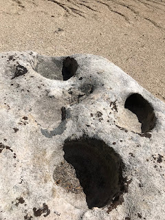
Near the mouth of  Mulkey Meadow and just too your right side is a collection of really neat rock formations with evidence of Indian activity. This is a great spot to have a snack and take a look around. We opted to stop and have lunch here on our way out. If you were on your return trip the rock formations would then be on your left side at the base of the mountain just before you begin the uphill accent.  

South Fork Of The Kern River

Look close and you can see a few Golden's

About 7.7 miles in you encounter the South Forks of the Kern River. Good place to refill water if needed. Small Golden's can be seen from here on out all the way to Golden Trout Creek. The Canyon narrows  for the next mile and I must say it was my favorite part of the route. There is Not much better than meandering along a babbling creek under a forest of pines watching Golden's swim by. This time of year the flow was good but the water was very shallow. Close to 8.5 miles in you can cross the creek on a junction toward McConnell Meadow. Here there is a very large nice flat area that looked to be perfect for larger groups wanting to camp. With lots of shade and some rock fire pits.


Camping Area before McConnell Meadow


Equestrian Stable from old Tunnel Air Camp

Continuing on you will pass  through Tunnel Meadow. A place with an enormous amount of history. Forgive me if I don't touch on all of it, or leave some things out. There was once an airfield here. According to a report from Pat Decano, "The airfield was created by Leonard Shellenbarger at the request of Dr Shook in 1931. Dr. Shook was a friend of Bert Johnson, a cattleman, and he wanted to fly in so he could fish there. He drug the field with a Fresno scraper pulled by a mule and was paid $40 by Dr. Shook for the job."


"A 1970 map depicting the “Tunnel Air Camp” from a brochure for the Bob White Flying Service (courtesy of Jeff Yohe).
Jeff recalled, “At Tunnel Meadows I only remember a ranger station to the west, a small equipment shed & a few tents at the east end of the field.
We did some hikes from the Circel B Scout Ranch (Kennedy Meadows) to the south through Tunnel Meadows then north over the back side of Whitney.
We'd have Bob fly our food in for the second half of our trip. Bob was always on time with a smile on his face."


Old Ranger station Water Tower

Ranger Station west of Tunnel Meadow

At a touch over 11 miles in is where we decided to make camp. We choose our spot basically at the closet point between South Fork Of the Kern and Golden Trout Creek. (so we could easily go back and forth fishing both creeks).Very near to the old ranger station pictured above. I believe at one time this place was built to help maintain the telephone communications between the different cow camps and was staffed full time. That no longer is the case. While the building appears to be still in use nobody was home for the 2 nights we stayed nearby. Here the south fork of the Kern and Golden trout creek pass very close to each other. (A few Hundred feet give or take). With South fork flowing east and golden Trout Creek flowing west. I believe ancient lava flow from the nearby volcanoes (Red Hill being one within eye shot) created this anomaly. I'm not a historian but I also believe Tunnel Meadow got its name from the Tunnel that was at the time attempted to be dug and blasted out by ranchers or cattle farmers who wanted to combine the South Forks of The Kern and Golden Trout Creek together to create more water flow. This was eventually halted and never came to be. I do believe I saw the evidence of the old Tunnel work.


There is a very tempting camping spot with fire ring and tons of shade on the Golden Trout Creek side below the old ranger station. However it is way too close to the water to be legal. So we opted for the spot pictured above closer to the South Fork side. The night time temps were much colder than I expected. Dropping into the 20's. Any water left outside the tent at night would be frozen solid by morning. As mentioned above I caught numerous Golden Trout and I had an absolute blast exploring the area and learning about its rich history. I really do love the golden trout Wilderness and next year I'll be returning to explore different areas of the GTW. 11 miles in and 11 miles out plus some nearby adventuring brought the 2 night total mileage to just under 25 miles. If your seeking the opportunity to land your first Golden Trout this is the place to do so. Please always be respectful of our wild places and pack out what you pack in. I have included a map and GPS track plus google earth KMZ file below for download should you like to follow my exact route.

Trout Themed Beers

We stopped in Lone Pine at the market on our way out for some celebratory trout beers. I feel like I can now wear my Mammoth brewing Golden Trout Shirt and drink their Golden trout beer with a little more pride now that I have actually caught some.


Download GPS Track (GPS Units)
Download KMZ File (Google Earth)

Tuesday, August 14, 2018

Maggie Lakes

Lower Maggie Lake

Nothing says Happy Birthday like a trip into the Golden Trout Wilderness. Talk about beautiful scenery this place has it all. This pristine area encompasses 304,000 acres in the Kern Plateau at the Southern end of the Sierra Nevada. Miles of hiking trails stretch in all directions. Streams and lakes dot the landscape, with 2 wild and scenic Rivers (The North and South Forks of the Kern). The area is named for California's prized state fish, the Beautiful Golden Trout which is native only to these waters. A true backpackers paradise the densely packed pine forest's bring an assault to the senses. Christmas has always been my favorite holiday and the sights and smells brought back old childhood memories of my parents taking me to the lots to pick our yearly tree to decorate. Thursday August 9th I turned 38, to celebrate I packed my gear and headed north.There are multiple access points into the wilderness. All overnight stays require a permit. (No permit is needed for day hikes). If entering from the Inyo National Forest side you can obtain your permit here from Recreation.Gov. If entering from the Sequoia National forest side fill out the permit application and mail or fax it in to the appropriate ranger office. Permits can be picked up in person, faxed or received back through the mail. Here is the Forest service website for more information. As with all my posts you can click on any picture to enlarge it and letters in blue have working clickable informative links.


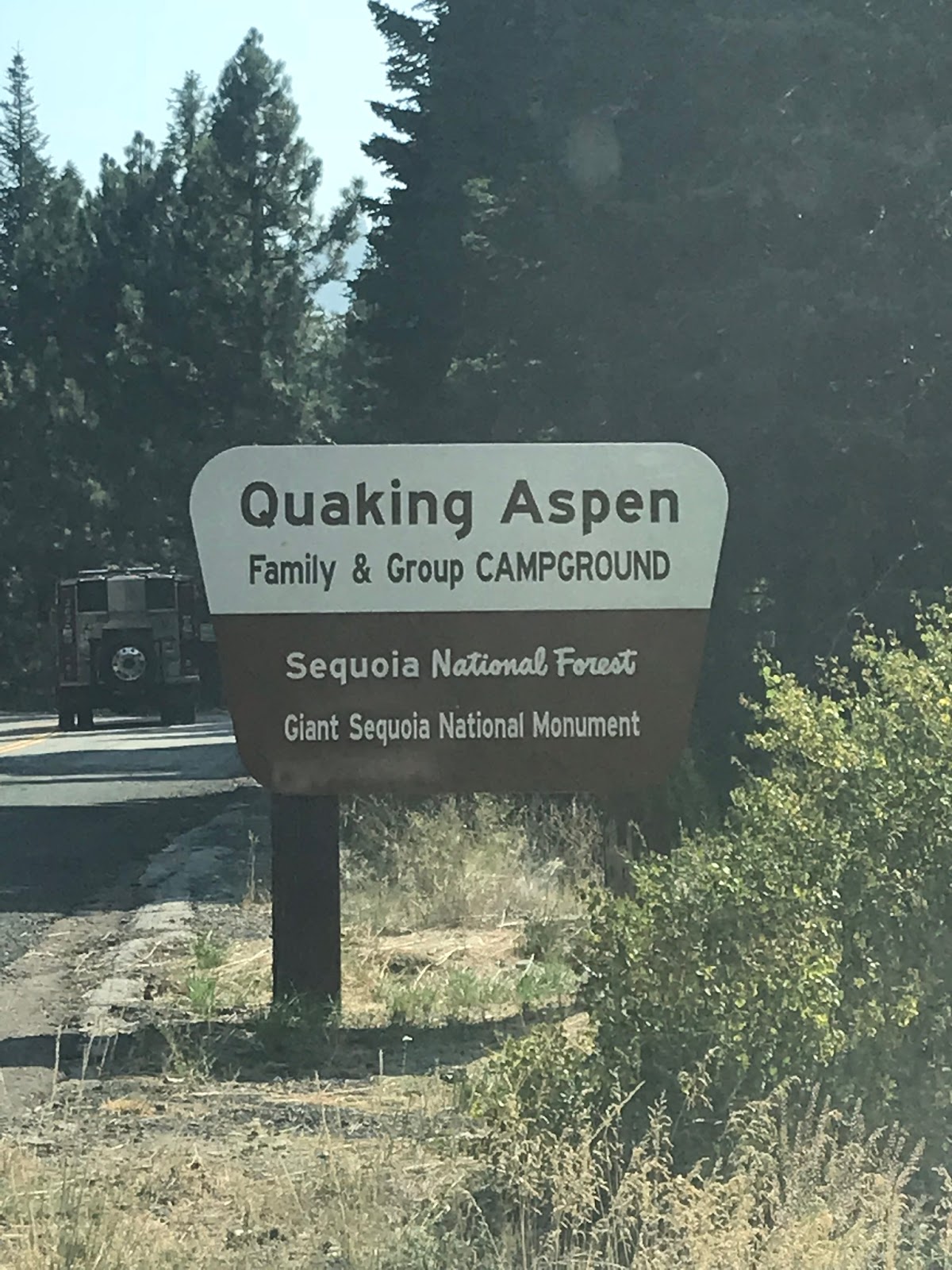
Before hitting the Summit trail to Maggie lakes we decided to car camp for the night at Quaking Aspen Campground.(Named for the Quaking Aspen Trees that grow in the area).Which is located off Hwy 190 at 7200' elevation between Camp Nelson and Ponderosa. Only 10 miles south of our TrailHead. This would serve 2 purposes, first being we won't have to wake up super early Friday morning for the 3 and half hour drive out and second it would be a good place to acclimate for the night at higher elevation. I really enjoyed this campground. The restrooms and grounds were clean. Views exceptional. There was plenty of hiking trails leaving out of the camp to the surrounding area. It accommodates small RVs with a max length of 26 feet, and each sight is outfitted with bear lockers for food storage. We enjoyed a little exploring of Freeman Creek flowing just a few  yards from our site. I'm already planning a return visit with the wife and kids.

Meadow by the creek behind our campsite

Our camp site at Quaking Aspen

A great feature of this campground is the very small town of Ponderosa is right around the corner just 2 miles up the road. We had burgers and beer at the Brewers family lodge and market. (Pet Friendly). They even seated Lacy dog with us on the Patio and served her a burger patty on her own plate. The staff was awesome and the market is stocked with any last minute supplies that you may need.

Ponderosa Brewers family Lodge

From Quaking Aspen Turn left out of the Campground head back down Hwy 190 less than half a mile and turn right onto North Road(21s50). Follow North Rd about 10 miles to the Summit TrailHead. PARK HERE. 

Summit TrailHead parking sign

North of Maggie Mountain lies a series of 3 Gorgeous alpine Lakes (Maggie Lakes), and when I say Gorgeous that is an understatement. Surrounded by Thick conifer forests, granite peaks and stunning meadows its basically heaven on earth. The Lowest and most commonly camped at lake sits at just over 9000' elevation. The upper Lake is the Largest and the middle lake is the smallest. Both upper and middle require a small off trail trek to reach. 15 min or less Hike to the upper and 5 minutes for the middle. Both definitely worth checking out as you most likely will have them all to yourself. A helpful hint getting to the upper lake is easiest by following along the stream from the lower lake. It will lead you right to it. Nearby if your feeling extra adventurous you can Summit Maggie and North Maggie Mountain. A Sierra club register is currently at North Maggie. The only reason I did not Summit on this trip is I had my dog and it was her first backpacking trip, that would have been too much for her.

Lower Maggie

Middle Maggie

Upper Maggie

My only Bummer was that I only caught 1 fish. I attribute this to the water being very warm and I doubt the trout would be to active in those temps. Perfect swimming conditions though. I did take advantage of that. Fishing regulations here at the lakes in the Golden Trout Wilderness require artificial lures with barbless hooks only. Season is open Last Saturday in April through November 15th. With a 5 trout limit. Fly Fishing will probably land you your best shot at taking home the prized Golden. Also if you have time I've been told you can pull small Golden's out of Mountaineer creek on your way in or out. I will include way points locations in the map for you, should you like to try your luck at the creek.

This little beauty was released unharmed

Unless it's a super secret location I include a map plus GPS track and Google earth KMZ files for you to download at the bottom of every blog post. This makes it very easy for you to follow my exact routes. 

Heading out from Summit Trail

Dan and Lacy with big smiles

Getting to the Lakes from Summit Trail (8,265') is the shortest route.The trail is very well maintained and easy to follow. Very few spots leave you looking around just a little bit for trail, however most of those spots are marked with ducks. Its always a good idea to bring a map and compass or GPS, but most likely you will not need it unless your planning a lot of off trail stuff. The trail starts off heading west and downhill for 1 mile until crossing Mountaineer creek. This is only 1 of the 2 reliable year around water sources before reaching the lakes so If you have not topped off your water due so now. The next reliable water source is about 8.5 miles in at Pecks Creek watershed.

Mountaineer Creek Crossing

After Crossing mountaineer you will begin your first of 3 really good uphill pushes. At around 2 miles in we came across this very interesting Lean to shelter complete with camp fire ring.

Lean to Shelter

Also very close to here you get a peek down into the Alder Creek Drainage. This makes for a great photo opportunity. As you can see from my picture below. The only downside was it was a tad bit smokey that morning from a controlled burn that was taking place nearby.

Alder Creek Drainage view point

Crews have been hard at work clearing downed trees

Endless Forest

Cruising through this area keep an eye on those views to the east you will get some amazing sights of the Great Western Divide and the Surrounding San Joaquin Valley.


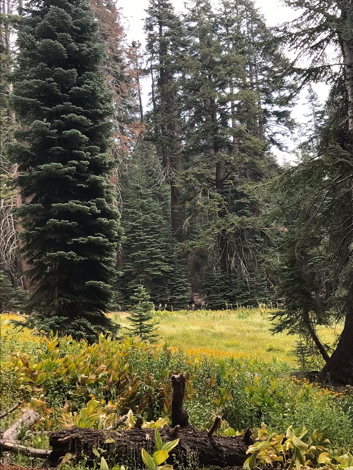
Continuing on you will drop down into Jacobson Meadow at 3.7 miles in. I found this meadow to be really neat. If we didn't have so much farther to go I would have made this my lunch spot. In fact all the meadows we came across were so refreshing the wild flowers were in full Bloom.

Behind the downed tree is a nice bench to rest on

Jacobson Meadow

Passing Jacobson's you start a small climb before once again dropping down into another meadow (Mowery Meadow). Basically you can consider this the halfway point at 5 miles in. If water is needed you can head down a ways into the meadow along the "Not so maintained" Mountaineer creek trail(32e10).  If you keep following this east you should find plenty of water. Otherwise you must wait 3 miles until reaching Pecks Creek. Here at Mountaineer creek is one of those spots I mentioned above where you can find small Golden's in the creek. Might just make a great excuse to run out of water :).


Those Wildflowers are much better looking in person

Back to the grind uphill you go on a good push 6.5 miles in you will pass the junction for Griswold trail(31e18). I've not hiked this trail but have heard its steep and treacherous and not maintained. All things that interest me. I'm a glutton for punishment when the reward is taking the path less traveled. This was actually on my original agenda from a different loop trail but changed my mind once I knew I was bringing my pup. Notice how the junction for Griswold kind of looks like a cross in the photo maybe a subtle warning of don't go here. Or maybe now the trail is once again maintained, guess I wont find out until I return.

Junction for Griswold

Griswold Meadow

Not too far from the Lakes now you have another pretty good uphill followed by a big downhill jaunt into the Pecks Canyon watershed at 8.5 miles in. This creek should by all means be flowing and is your second reliable year around water source. From the start of the trail I carried three and a half liters and did not need to refill, however my hiking buddy did. He started with 2 liters and it was not enough for him. Good thing I always carry more than I need. This is a very important rule all hikers should strictly adhere to. I can't stress enough how important it is too carry extra water and know for sure where the reliable fill up sources are located. After passing Pecks creek there is a junction, head left toward Maggie. Going right will lead you to Pecks Cabin this is private property.

Junction sign after leaving Pecks

 I found the next mile into the lake to be the only part of the trail where you had to pay attention where you were going as a few spots on the trail gets faint but again not by much. When all else fails follow the stacked rocks. Note: I'm not a big fan of these all backpackers should know where they are going and how to navigate through the backcountry with proper map skills. Prior Research and knowledge out here is your best friend. At around 9.5 miles in you have just arrived at Lower Maggie. Brace yourself the beauty of this place is the real deal. Immediately upon arriving there are multiple camp spots along the lake complete with nice fire rings. There are also a few dispersed campsites at the middle and upper lake should you want to venture just a little further. However most folks stop here. I found myself drawn to the middle Lake. I think that one was my favorite. Summit trail does not end here, you can continue north to frog lakes, twin lakes and even much farther to Summit Lake and beyond.

Our campsite

My piece of paradise 

This was such an awesome way to spend my birthday. I couldn't have asked for a better birthday present. I absolutely love the Golden trout Wilderness. There is so much more of it yet to explore. I can't wait to get back out there, and hopefully next time catch that ever elusive Golden Trout. Thanks Dan for joining me and special thanks to my beautiful wife who lets me take off on my journeys at a moments notice. 

Obligatory Selfie


Download GPS Track (GPS Units)
Download KMZ File (Google Earth)