|
| Don Victor Valley From 6N11 |
Over Martin Luther King weekend myself and Jeff Wright set out on an ambitious quest to find and rebuild Don Victor and Pine Canyon Camps. We Parked the truck at the dirt turn out for the Closed Potrero Seco Road 6N03 off Hwy 33, adjacent Pine Mountain Ridge Road. Bikes and Packs heavily loaded down with the necessary backpacking essentials (mostly whiskey and beer) trail tools and some food. At approximately 8am we saddled up and navigated through the locked gate to make our way along Potrero Seco.
 |
| Bikes rigged up and ready |
 |
| Locked Gate at Potrero Seco |
 |
| Icy Road with heavy packs, what could possibly go wrong |
Besides a little snow and the customary annoyance of ups and downs one encounters along most fire roads the first 3.5 miles to Potrero Seco Camp was pretty uneventful, because of the weight on our backs it became much easier to ride the downhills and walk the uphills. Slow and steady was the name of the game.
 |
| Potrero Seco camp |
Potrero Seco (Dry Meadow) was once the home of a Forest Service Ranger Station, the current camp has a couple sites with Picnic tables however is rarely used these days as the road leading in has been closed to public use for almost a decade. The site is still frequented by day hikers, mountain bikers and most likely the nearby landowners on the edge of the Potrero. There is no water available at the Camp. On the way out north of Camp along 6N03 we chatted a bit with Jerome, one of the caretakers of the private inholdings. Super cool guy. Right after leaving we came upon the deer pictured below, one of them actually started charging straight at us, after cutting half the distance decided to take off in another direction. Never seen them do that before.
 |
| Private inholding east of Camp |
 |
| Wildlife near Potrero Seco Camp |
Thus Far everything was going as planned and without hitch, that was about to change. I would estimate about a mile after leaving Potrero Seco is when the nightmare began. We ran smack into some wet sections of road that had some of the worst clay mud you could image. Every step, sticky mounds would pile up on your feet, giving the impression of trying to walk with bricks attached to your shoes and to make matters worse it completely clogged up the tires and brakes on the bikes. No joke you could not roll through it if you wanted to, the tires were deadlocked. This became a battle of trying to drag and carry the bikes. With a 55 pound pack and tools strapped on this is no easy feat. I can take a massive amount of pain and suffering but this almost got the better of me. I couldn't fathom trying to go the next 6 or 7 miles through this shit. Had it continued much longer I swear I would have quit and went home. Luckily the road went dry again closer to the Don Victor turn off, but by this time we were completely drained. I apologized to Jeff for once again putting him through the ringer, my adventures are never easy. "Well Jeff you just never know what your gonna encounter being on trips with me." He replied jokingly "you would think I would've learned by now" followed by "it's all good Chris a little suffering is good every now and then." Jeff's a team player and tough dude. I say unless you know these roads are dry might, want to avoid the bikes and just make the long hike on foot.
 |
| Me really pissed off trying to free mud from my bike's tires |
At just about the 5 mile mark to your right you will come upon another locked gate, this is the junction with the old Don Victor Fire Trail 6N11. Leave Potrero Seco and pass through the gate to start the descent into Don Victor Valley. Elevation at this point 5156 feet. While the old road tread is holding up nicely (besides brushing needed and a few downed trees after the Mono Crossing) the next 6.5 miles are a steep series of ups and downs with the majority being down. Unless you are traveling much lighter than we were or are an elite mountain biker (which I'm far from) this is just downright difficult with a bike especially on the return. (All uphill) Personally I will never ride in here again it's just to much work for a guy that rides a few times a year. My feet are my preferred method of travel.
 |
| Don Victor Fire Trail 6N11 |
 |
| Jeff taking in those views down into Don Victor Valley |
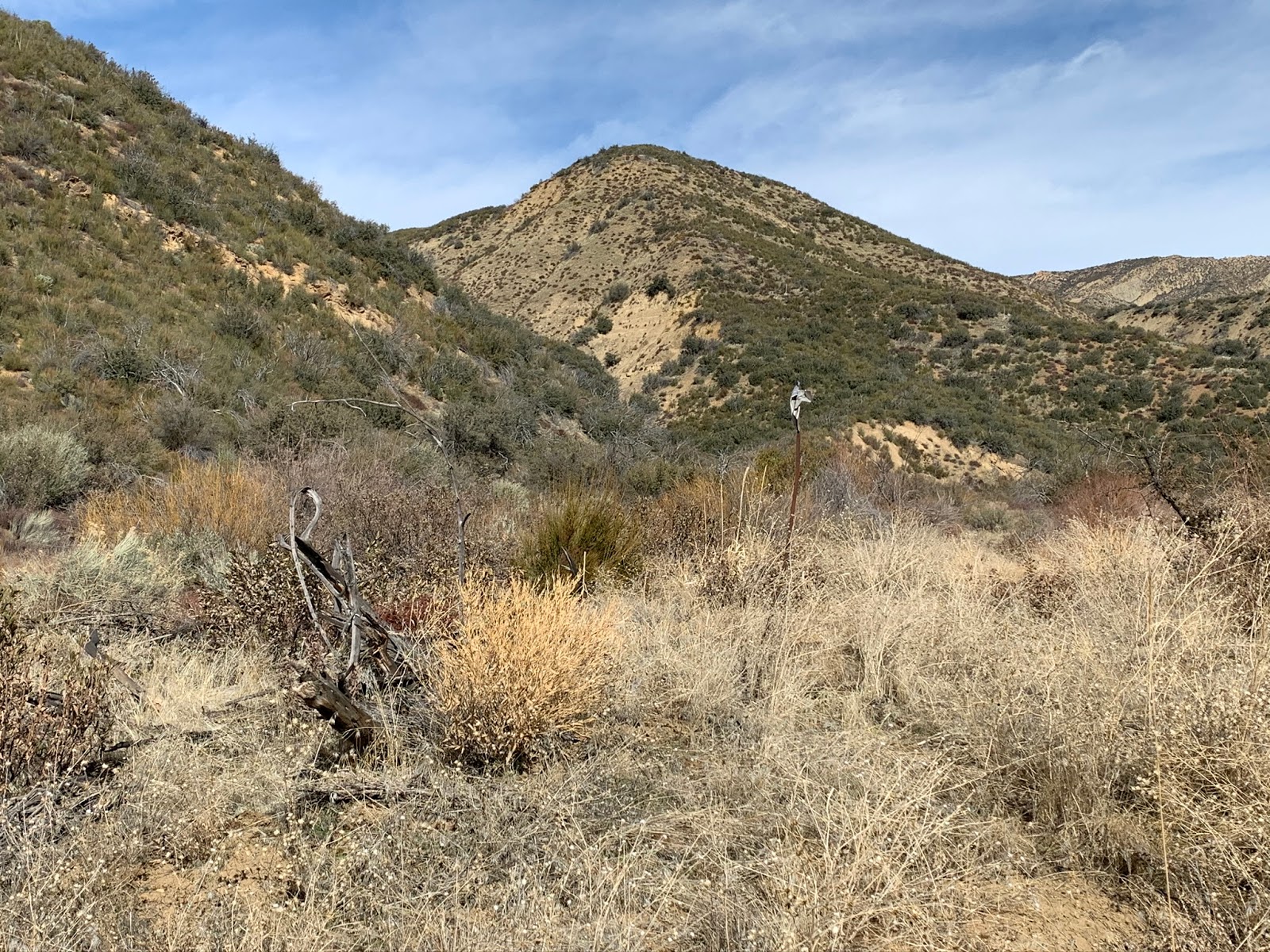
Originally we had planned to try and ride as far down as the Mono Creek Crossing which would have put us 1.3 miles from Don Victor Camp. That plan went out the window as we once again encountered the hellish mud. Instead of trying to fight it again, 1.2 miles from the Mono we unstrapped the tools and stashed the bikes in the bushes to continue on foot the rest of the way and it's a good thing we did as we were slipping and sliding through sections down that mountain that would have been ugly on the bikes. The mud sucks but the the views down Canyon are excellent, providing a real unique perspective of the Valley below. Short of the creek crossing to your right the sign post pictured below marks the old Potrero Seco/Don Victor Trail 25W04. Taking this route would lead you back up and around to the Potrero Seco Car Camp. While there may be some good sections intact I image the majority would be an exercise in bushwhacking.
 |
| Lone metal post marking 25W04 |
 |
| Couple of downed trees after the Mono Creek crossing |
Water was flowing through the crossing, not a huge amount but plenty to filter from if needed. From this point on sporadic sections of the road get a bit brushier and some work is needed to clear the downed trees. After what seemed like a grueling 11.5 miles we finally arrived at a disastrous Don Victor Camp. Remnants of a fire ring, some tossed about corrugated steel panels and a small reflector nailed to a tree marked the spot. The Camp was completely consumed in brush and unrecognizable. You couldn't drop a tent down if you wanted to. Upon first glance I thought dear god our work today has only just begun. Camp coordinates N34° 40' 12.0" W119° 31' 08.5" Check out the before photos below.
 |
| Don Victor Camp upon arrival |
 |
| There's a small rock fire ring buried in there |
Knowing we were gonna have to get moving we dropped packs slammed a beer and went to work. Two dudes, one McLeod, a shovel, small silky boy hand saw, big hearts and hours of grueling back breaking labor and Don Victor would once again rise up to be a damn fine place to spend the night. We cleared a large portion of the flat, rebuilt a bigger much nicer fire ring, cut dead wood to create nice benches around the fire pit and inch by inch rolled a large rock up the road that now makes a hell of good seat. Jeff laid out the metal alongside the tree to give it a rustic look, we left a brand new shovel and Mcleod and DV is also now #5 of the Lost In The Los Padres site register cans complete with a $25 dollar Rei gift card. I'm proud of the work we did and very thankful for Jeff's help, couldn't have done it without you brother. Photos below as we progressed through.
 |
| New improved Fire Ring |
 |
| Rustic look with the corrugated steel panels |
 |
| Jeff Searching for kindling |
 |
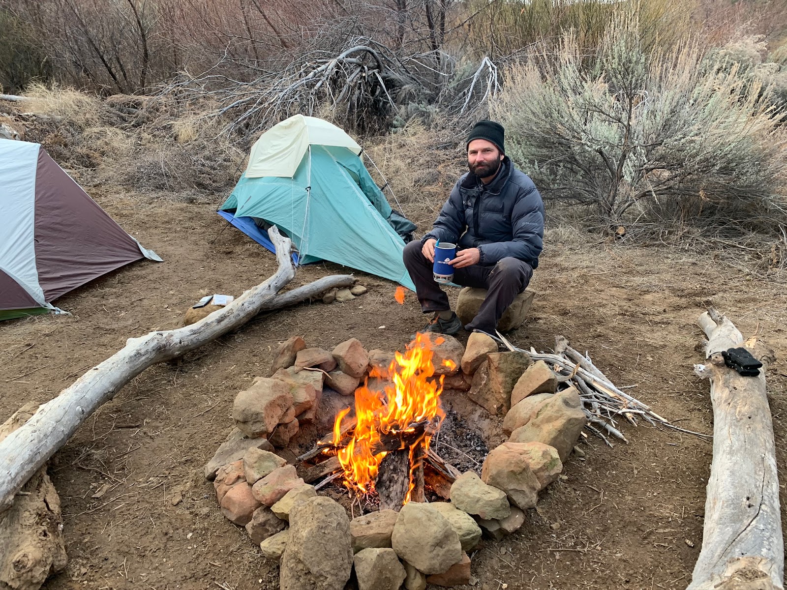
| Majority of the work done, getting ready to embrace the cold |
 |
| What a difference |
 |
| DV is now site #5 of the Lost In The Los Padres Site Register Cans complete with $25 dollar REI Gift card for the next lucky visitor to claim. |
Even with all the work we did there is still more that can be done. The Camp still needs a path cleared to the Creek. Though on this trip there was no water flowing directly behind it. 200 feet back down the road at the creek crossing was a small scummy pool that kept our beers cold and us hydrated. From maps I gather it may have been part of the nearby spring. The water in Don Victor Valley is said to have a high mineral content and not likely good to drink during the summer months. Temps in the Canyon dropped to freezing, Jeff awoke Sunday morning with ice built up on his beanie that he wore all night. I said "hey Jeff did you leave your beanie outside"? he replied "no I've been wearing it all night why" ? Oh just wondering because there is snow on your head, we both laughed Saturday was a cold night.
 |
| Pulling the last beer from the ice chest pond |
Very near the Camp was an old homestead owned by Don Victor in the early 1900's. Originally I thought the cabin was on the actual campsite however seeing old photos from the LPFA archives it appears it was actually a little further north on the flat. Wise counsel confirmed for me that it could have been very possible the cabin and the public camp may have coexisted together at the time. Hence why the sites were not right on top of each other.
 |
| Cabin on the Don Victor August 1908 photo credit LPFA archives |
 |
Photo I took from very near the same location January 19th 2020
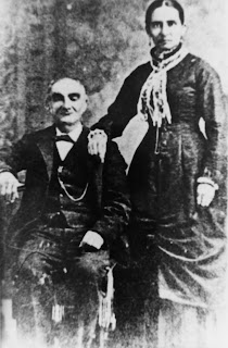
Don Victor and Maria (Ortega). The Don Victor Valley was named for him. He drowned crossing the Ventura River. Photo credit LPFA Archives
|
 |
| Freaud's homestead cabin Don Victor Valley. Ralph Hartman. Photo credit LPFA archives. |
We woke early Sunday morning, after coffee and breakfast before heading up Pine Canyon we decided to do some further exploration of the Valley. Approximately 330 feet Northeast of the Camp we found the Don Victor fire Trail Sign. Continuing along that same line .1 of a mile further we came across the remains of an old Artesian well with the spigot broken off. From Back at the camp it is .1 of a mile Northwest to the start of the Don Victor Trail 25W03 where we caught sight of the Don Victor Valley/Malduce Station sign. See photos below.
 |
| Sign Coordinates: N34° 40' 14.6" W119° 31' 06.3" |
 |
| Artesian Well coordinates: N34° 40' 19.6" W119° 31' 02.1" |
 |
| Sign Coordinates: N34° 40' 18.3" W119° 31' 13.6" |
After all we'd been through so far I honestly figured getting up Pine Canyon would be a walk in the park for a pair of experienced trail hounds such as us. Boy was I mistaken. We spent all day Sunday fully engulfed in brush. A bloody bushwhack ensued. Whatever trail/footpath that once was is gone. Miles of impenetrable brush. We tried are best to stay on and survey the trail but it proved futile. We scoured high and low for better routes but ultimately just ended up trudging right up the dry creek bed (when it wasn't walled in) as often as we could. To make matters worse Pine Canyon was dry no flowing water besides one patch about a mile in that was glowing orange, I never seen such disgusting water. It had a greasy oil looking slick on top like it was laced with chemicals. In a survival situation I'd honestly drink my own piss before I would go anywhere near whatever that was. We did eventually arrive at Pine Canyon Flat where the old camp should have been, however found zero evidence that it ever existed.
 |
| Some thick brush down in there |
 |
| Pine Canyon |
 |
| Pine Canyon Flat |
There's no doubt this site would make for a great camp and I could see why the location was chosen. Especially with Jackson Five Falls right around the bend. In the end we decided to keep it wild. No sense in disturbing nature here, we still need a few wild places and for that matter I guarantee there ain't many people gonna come up here anyways. Those hardy folks that do won't need any fancy camp set up.
 |
| Old hunting Camp in Pine Canyon. Chester Hartman, Lowie Hartman, Ralph Hartman, Will hartman, Frenchi (Frank Feraud). Photo Credit LPFA Archives. |
Our exit from Pine Canyon was definitely smoother than the entrance. Though for some strange reason I ended up getting 2 leg cramps, one in each leg. I rarely ever get leg cramps, it was annoying but not the end of the world, nothing that a couple shots of whiskey wouldn't cure once we returned to Don Victor. We pushed on. Before dinner we put some last minute finishing touches on the camp, and pretty much hit the sack early.
 |
| Modern Times Hazy Pilsner |
 |
| So long Don Victor until we meet again. |
Monday morning the clouds were coming in and the wind was picking up. We wasted no time gathering our goods and hitting the trail. As would be expected it was harder going out than coming in. Many uphill slogs, coupled with more mud patches made for an interesting trek. 2 miles before reaching the truck I tried lifting my bike out of some stuck mud and pulled a muscle in my back. This here old timer took a beating on this one, but you know what deep down I loved every second of it. I'll take a bashing in the sticks over a day in the city any time. Our entire journey consisted of just under 30 miles of travel. Below the map my GPS track and google earth KMZ file are available for download should you like to give it a look. Shout out to BC and CC for the tireless amount of intel you always provide me and LT for donating the tools for this trip, Some fine gentlemen you all are.