|
| Cienega the granddaddy of backcountry Camps |
With temperature forecasts to be in the mid to high 80's something big this weekend was to be in order. I went back and forth for several days over the destination. Bluff and Cienega have been hovering damn near the top of our list for long enough, it was past time to check these off. (Click on any photo to enlarge)
 |
| Getting ready to head up Timber Canyon |
Reece and I met up early Friday morning at Thomas Aquinas College in Santa Paula where we would drop my car at the new Trailhead parking. We then hitched a ride to the beginning of Timber Canyon Trail 20W16. For those interested I have touched on this route in the past in more detail here at
https://christopherplord.blogspot.com/2019/04/santa-paula-peak-first-attempt-at-san.html. Unfortunately if you do not have permission and the gate codes to access Timber Canyon you will need to start and end at the college as Timber is on private property. To make it fair and give folks without access that want to follow our track a chance we did exit the East Fork which is accessible to all.
 |
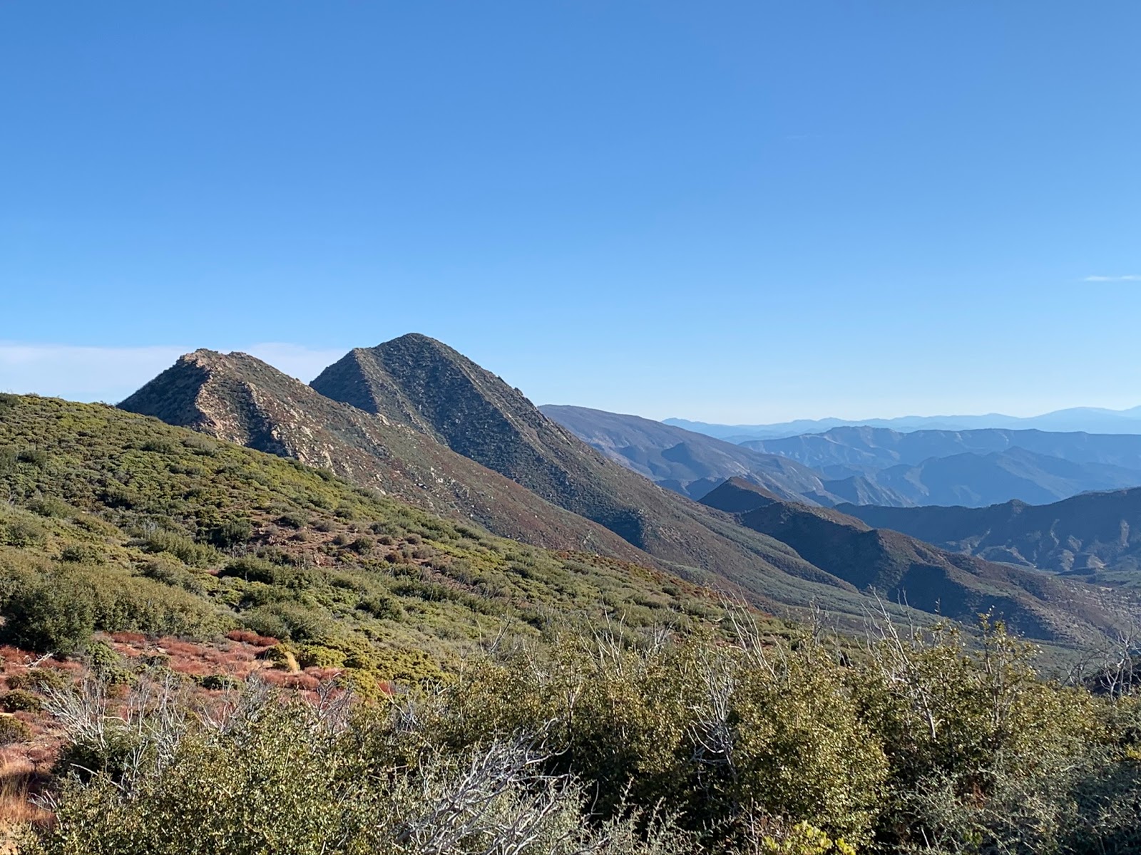
| Looking up toward Santa Paula Peak |
 |
| One of the nicer open sections |
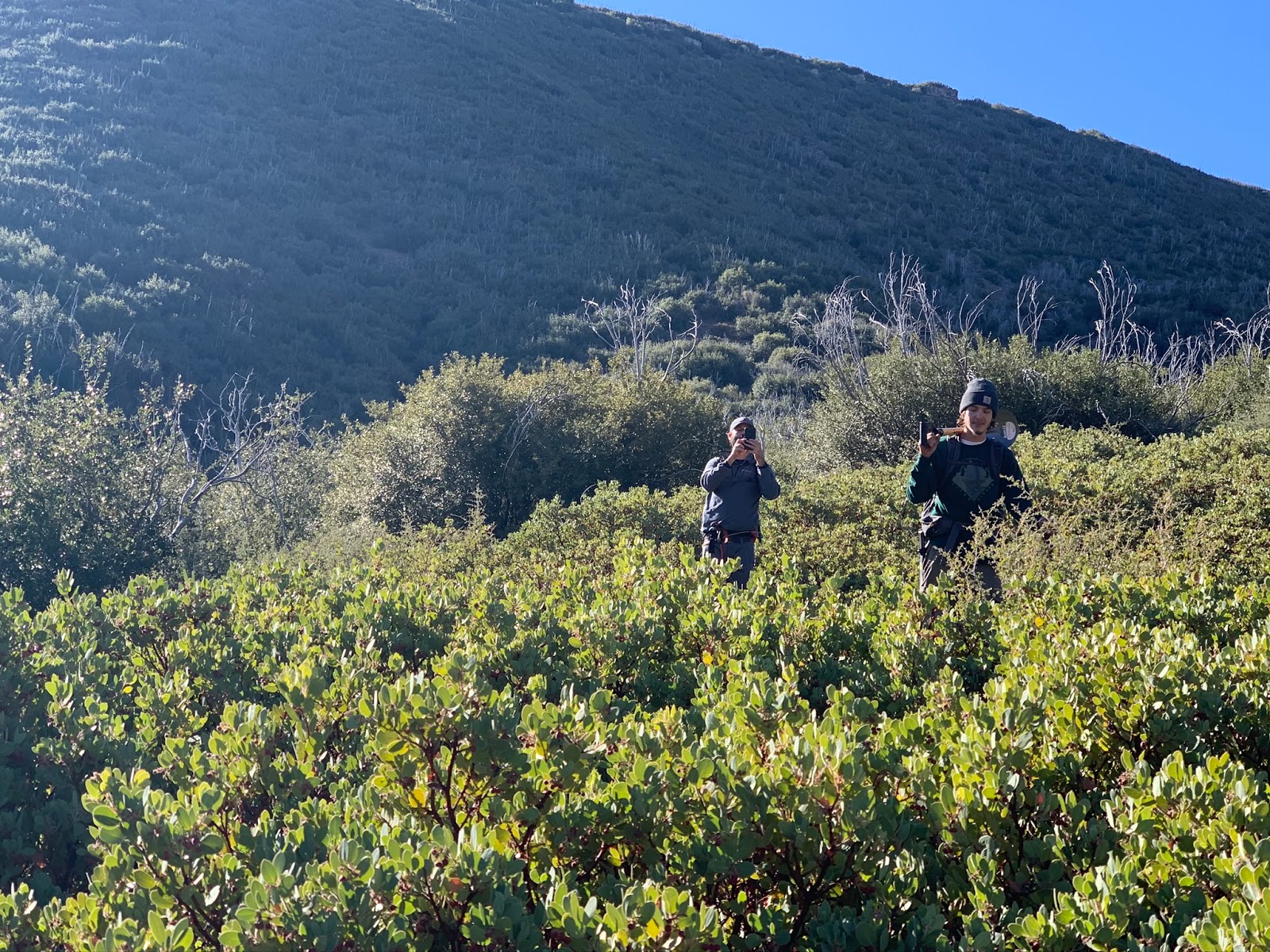
To be fully honest I am not a big fan of Timber Cyn. Yes it will get you to Santa Paula Peak much quicker and easier than the East Fork but its hot, dry, steep, exposed, very overgrown and normally full of ticks. (Not a single tick on this trip though for some reason). It took us around 3 hours to reach the Peak, not our fastest time by any means but good considering the circumstances. Being heavily weighted down with backpacking essentials, work tools and whiskey tends to slow ones pace and to make matters worse that damn shovel you see strapped to the back of my pack kept banging me in the head every time it caught on something.
 |
| Simpler times with Hines Peak in the distance |
 |
| Reece getting a shot with the Chief Peak from Topa Topa Brewing |
The views from SP Peak are damn good and definitely worth the 4 mile trek. Once atop we signed the register had a quick snack and some celebratory brewsky's. About now we were high fiveing and thinking the hardest part of today was over. From here it would be all downhill to Cienega. Little did we know how much worse the backside of 20W16 had become. Since visiting Last in April the short
stretch (about a half mile) from the Peak down to the junction with the ancient San Cayetano 20W15 has imploded with unavoidable Poodle-Dog bush. The trail is quickly rebounding from the Thomas Fire and becoming overgrown. Unless you want the dreaded rash mind your steps through here.
 |
| The backside of 20W16 looks good upon first glance but beware ahead |
 |
| The washout is way steeper than it looks |
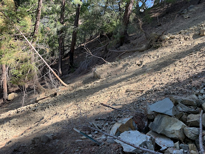
From the Cayetano junction you make a hard left and head downhill toward Cienega. In theory if you stayed on trail it would be just under a mile and half to Camp. The problem is half the trail is gone and badly washed out. At first it starts off pretty good, leading you down into a really beautiful shaded Canyon. It starts getting really bad when you hit the first washout pictured above. This section is much steeper than it looks in the photo and with a heavy pack almost impossible to keep traction. Right away
Reece said I'm not crossing that and he began to climb down to try and find a way around it. I said screw it I'm going for it. Half way through I began to slide smacked my knee on a rock and tore a huge hole in my pants. Eventually I was able to stabilize myself and make my way across, but I paid the price. While I wiped up the blood and patched my pants I watched
Reece badly struggle, desperately fighting and trying to claw his way back up. I didn't think he was gonna make it, at one point he was saying I may need your help. He did eventually make it but he was worked hard. I remember watching him thinking well shit that looks about as bad as what I went through. After that debacle we continued along the trail however it's not long before it completely ends in rubble. The once switchbacks that take you the rest of the way down are long gone. From here it's a pick your own path through the brush and loose rocks until you get down low enough into the valley and are able to pick up the trail again that leads you into Camp. The recent heavy rains took a big toll.
 |
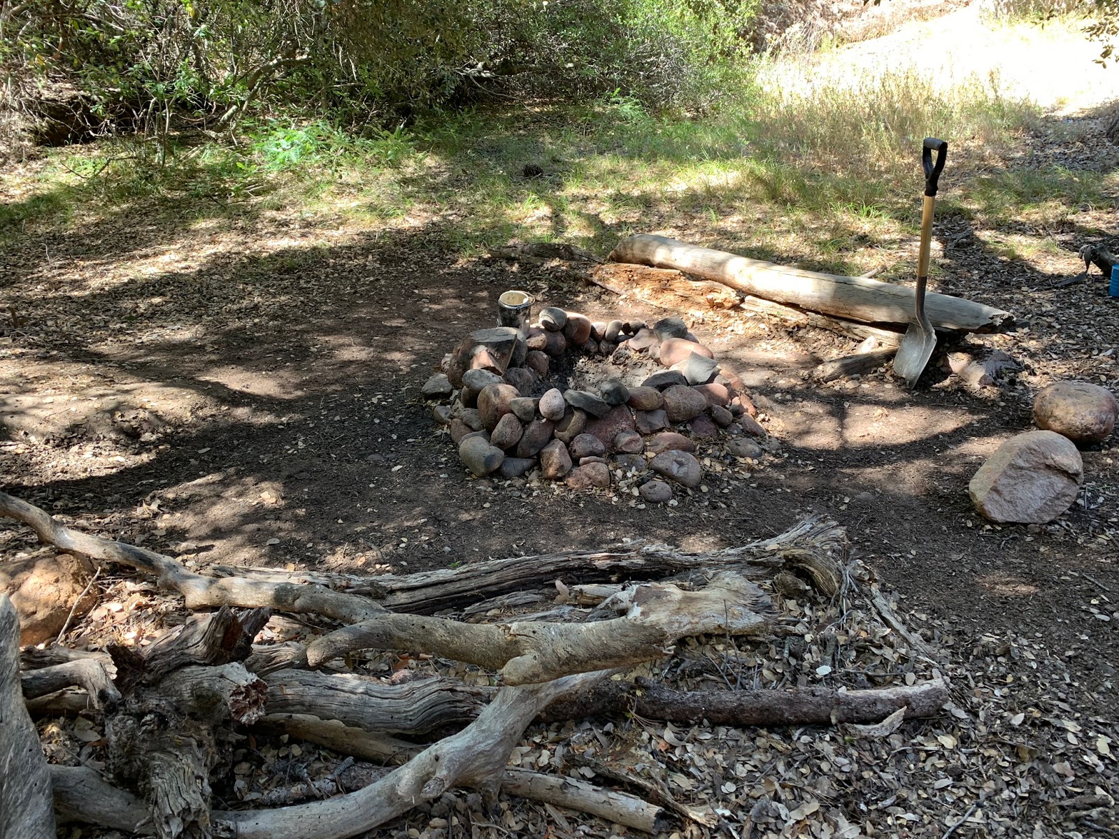
| Main fire ring with heavy duty 6 foot bench. |
 |
| Massive 17 foot picnic Table |
 |
| Nursing my bee stings |
 |
| Adjustable BBQ Pit, wheel lowers and raises the grill. |
 |
| Secondary site off the main with fire ring and Ice can stove |
I'm gonna show you a bunch of photos of Cienega because it's badass. I love this Camp, this is the king of backcountry sites as far as the Los Padres is concerned. The Camp is situated on a massive flat fully shaded by large oaks. All the spring tributaries were flowing. I noted on the map below 4 different places to fill up water along the edges of the site. The main attraction here besides the insanely awesome location is the 17 foot picnic table and fully height adjustable stone BBQ pit grill. The main fire ring also has a tripod that can be set up to hold one of the many dutch oven pans scattered about the camp, should you like to cook a stew over the flames. There is a small secondary fire ring with Ice can stove to help accommodate a larger group. Probably 99% of the time your gonna have the place all to yourself. Most don't bother to even attempt the journey up here.
 |
| Assortment of cookware, shovel blades, a machete |
 |
| Curious who appears in that photo, I forgot to take a closer look. |
 |
| No shortage of good real estate here |
 |
| Main fire ring |
 |
| Those two Ice can stoves have seen better days |
 |
| I stole Red Tailed Reece's Hat. Hell that's gonna be his new nickname going forward |
Immediately upon arrival we got to work surveying the Camp and doing an initial cleanup. After we decided to head over to one of the springs to fill up water and wash up. I spotted a nice pool lower off the trail as I made my way down I snapped off a branch in my way and that's when shit hit the fan. Yellow jackets came swarming out a hollowed tree and nailed me multiple times, in the hand, my back and on my face. As a child I was highly allergic to bee stings, so to be on the safe side I keep an EPIpen in my first aid kit for emergencies. I was stung once as an adult many years ago and I did not have a reaction, my doctor said I may have grown out of the allergy, but still to keep the pen just in case. About now I was a bit concerned the thought of possibly having to end the trip early after all that work before even reaching Bluff camp would have been a super bummer. I popped a bunch of benadryl and hoped for the best. In the end I only ended up with minor swelling and no real problems so hopefully that allergy is a thing of the past.
 |
| Lower Section of Trail looking down toward Cienega |
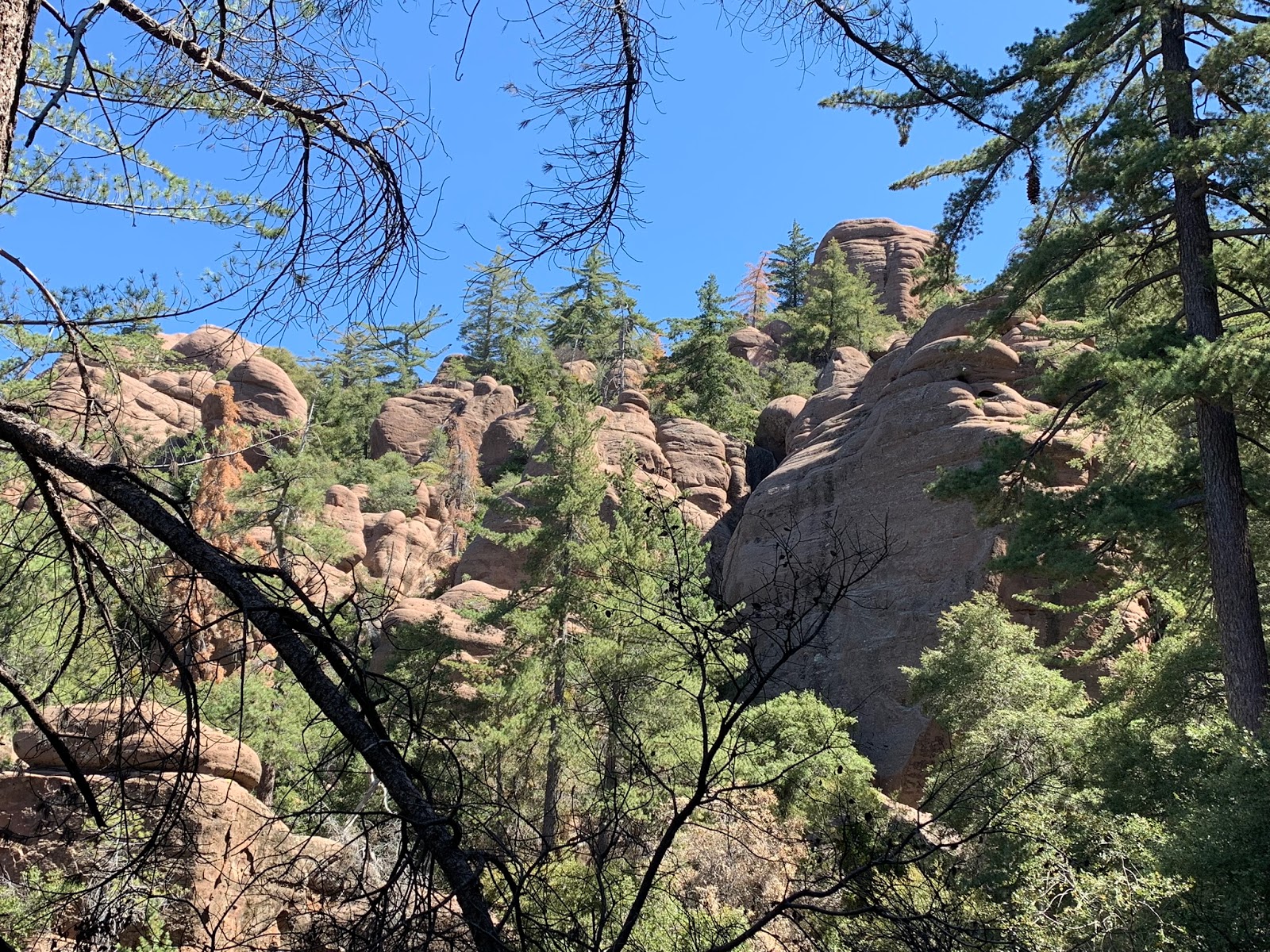
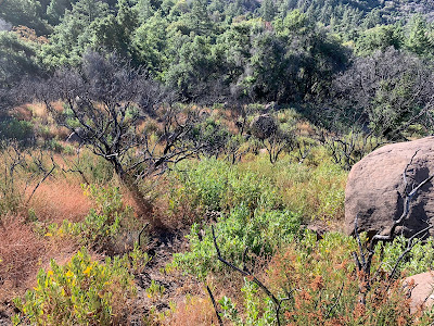
We woke early Saturday morning and after breakfast made the steep ascent up to Bluff. If you stick to the old trail proper it is only around 1.5 miles from Cienega. The problem is the lower half is extremely overgrown, its very easy to get off track. We made the mistake of not really trying to follow the old trail in the beginning and we suffered for it. The trail could be 5 feet away and because of the overgrowth you won't see signs of it unless you're being super diligent. A little over halfway on your left you will see large rock formations (pictured below) it's shortly after this that the trail becomes much easier to follow most of the way into Camp. After the brush beating we took going in we made sure to pay better attention going out and stick to the trail. If you download my track included at the bottom, follow our exit path its considerably better than the entry.


Bluff Camp is situated right near the border of the Sespe Wilderness and the Condor Sanctuary. The Camp is walled in by gigantic Sandstone formations that one could spend what seems like an eternity exploring. This here is big bear country and we saw plenty of evidence to prove that. In need of a breathtaking scenic getaway ? I recommend you get here and fast.
 |
| Tried to re-create the image of the old sign using a photo courtesy Craig R Carey) |
 |
| Site all cleaned up, new shovel and nice pile of firewood |
 |
| #4 Lost In The Los Padres Blue register Can with $25 REI gift card |
As is customary we immediately got to work clearing the site and rebuilding the fire ring. A single bench and a few large rocks provide seating around Camp. I saw only a few remnant pieces of the Ice can stove that was once there. The sign was stolen years ago, only a small portion of the post remains. Unfortunately water was not flowing from the tributary that runs adjacent the Camp. We left a brand new shovel and a $25 dollar REI Gift card for the next lucky visitor. (Take the gift card but please leave the shovel) Making this the #4 Lost In The Los Padres blue register can site. (You can read more about those in previous posts). There is a serenity about this camp that I am struggling to find words to describe. The effects of the towering Sandstone features, surrounded by Big Cone Douglas Furs and just the overall remoteness left me almost never wanting to leave.


From Looking at the Map you can see that we did explore further past the Camp. This was initial recon to find a way to connect Bluff and Last Chance (coming in the future). We stayed until water reserves were starting to run low and then dropped back down to Cienega along the way we found a large boulder that had amazing cell service and a great view so stopped to check in with the family at home. That night Lot's of whiskey was consumed and stories swapped about how great the trip had been thus far. The next morning it would be time to head out.
 |
| Follow that Pink Flagging to Cienega |
 |
| Exit the East Fork Here |
The trail that leads out of Cienega and down to the East Fork is in pretty good shape. Someone took the time to hang pink flagging throughout the majority of the route. I have read reports of people coming up the East Fork and missing the turn off to climb to Camp so I wanted to include the photos above showing two different views of what to look for. If you zoom in you can see the pink flagging telling you where to exit. I'm pretty sure if you miss the exit here and keep on up the East Fork you will eventually run into a large waterfall that may force you to turn around. Also Note at this very same location for folks who have dropped in from Cienega DO NOT, I REPEAT DO NOT cross the creek and attempt to follow the old trail down the East Fork that leads you up onto the north bank. Past reports stated it was bad, however other peoples definition of bad and mine usually vary, plus I like to see things for myself. Turns out they were right that shit sucked. I was determined to try and get to the end where it originally dropped back in but after a half mile of that washed out poison oak hell hole we abandoned ship and looked for a safe way to climb back into the Creek bed. So lesson learned just follow the water and you'll be fine.

 |
| Beautiful the whole length of the East Fork |
 |
| Guerrilla site on the East Fork Located here N34° 26' 48.7" W119° 02' 05.1" |
 |
| Reece picking his way down the boulder strewn Canyon |
Once we dropped back in we were making great time down the creek. I honestly don't see why so many report it as difficult travel. Sure you are rock hopping most of the time but it's not like your crawling on your hands and knees through a jungle. I've been through far worse than the East Fork could present. In fact I found the trail to be quite Lovely. When I said that aloud Reece chuckled and said I never heard anyone ever describe this route as lovely. To each their own right? Surprisingly there are quite a few sections that are still intact save yourself the extra energy and use them. Again pink flagging down through here will lead you the best way. If you have been afraid thus far to tackle this route don't be, its beautiful just mind your steps and go for it. (Note high water flow months may present a more challenging environment so choose travel times wisely). I screwed up just before reaching big Cone Camp and accidentally switched off my GPS. I really wanted to provide the full track including the new Reroute section that was completed in the lower canyon by the college. You can plan on adding an extra 3.5 miles to exit from Big Cone Camp to the Trailhead. My previous post regarding Last Chance Trail has downloadable tracks from that point if needed. Our total trip was in the neighborhood of 17 miles.
 |
| Absolutely Appalled at what's become of Big Cone Camp |
 |
| This idiot actually put their instagram handle on this |
Lower Santa Paula Canyon and the area surrounding the Punch Bowls and Big Cone Camp is a joke. Trash can be found strewn about the trail, diapers floating in the creek. Graffiti all over the rocks. My heart sank when I saw Big Cone. Give people water to swim in and a nice trail and look what you get. The scum of the earth will ruin it. Maybe the Forest Service should shut this tourist attraction down. Those pictures are just a few of the many examples we encountered on the way out. Maybe Thomas Joseph Harper is correct when he says let all the trails be wild again. There is no way in hell the East Fork should ever be rebuilt I don't want any of these shit bags anywhere near Cienega or Bluff.

Pictured above is the new and improved way to follow the re route to the Trailhead Parking. Notice they put up a new chain link fence to keep people from passing through the college. With my crazy work life and everything else I have going on I really needed this trip, felt good to be away from the hustle and bustle of everyday life. I have not done near enough overnights this year. Shout out to my boy Reece for always hanging in tough no matter what the adventure. Good Times.