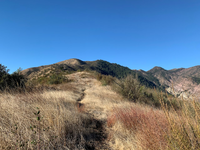
Ridge Route to Cayetano
Back in early 2019 Reece and I made a run for the Summit of Cayetano starting from Timber Canyon after summiting Santa Paula Peak and failed rather miserably. For those interested you can read that old post here Santa Paula Peak & first attempt at San Cayetano Mountain. The notion of another another attempt (which I vowed would eventually happen) got buried in a very long list of Los Padres to do's. Fast forward and here we were with 2020 almost in the rearview and my pal Stephen asks what I thought about a New Years Day revisit. I couldn't think of anywhere else I'd rather be.
Joey in route up the Saddle
This write up is gonna be a bit different in the way that I'm not giving our full exact route. I have my reasons for this. Our starting point will be here N34° 26.987' W118° 56.897' at the Saddle approximately 2.5 miles west of the summit. You can use your imagination for why I will withhold such information about our initial path to that particular saddle. What I will recommended though for anyone who wants a stab at this is to park your car at the end of Grand Avenue. There are a few legal parking spots for day use only. Follow the Sespe River North for about a mile as it starts to round a hard left from there gain the ridge line and take it all the way to the top of Cayetano (map below of recommended route). Total mileage for our actual track came in at just under 13. From the proposed route at the end of Grand your looking at about 12. The Sespe route is a viable option and has been field tested by our crew. Your welcome ;).
Proposed route from the Sespe in Blue keep in mind this was hand drawn and not exactly perfect but you get the idea. Checkered flag is our start point for the downloadable (modified) GPX and KMZ files at the bottom of the post.
You can still see a portion of the old road on the north side of the mountain that once Connected with the San Cayetano Trail 20W15.
Few patches of snow still clinging to the north slope.
Another crew with Jim an acquaintance of mine left a register can here by the carved rock just below the summit in December of 2019 and I believe they took a different route than the ones discussed here which just shows there's multiple ways to skin this cat.
Another crew with Jim an acquaintance of mine left a register can here by the carved rock just below the summit in December of 2019 and I believe they took a different route than the ones discussed here which just shows there's multiple ways to skin this cat.
Summit Views
Opposing views, upper photo looking from the rocky summit to the balder eastern most peak and vise versa.
U.S. Geological Survey located on the eastern most peak
Before heading down from the summit we made our way over to the eastern most peak of Cayetano Mountain for some unfinished business which is a significant story we can save for another day. My stats have us at 12.8 miles with over 3500 feet of elevation gained. We pushed a hard fast pace and after a semi lazy month of eating and drinking to much over the holidays this one left me with sore legs when I woke the following morning. So with that we rang in the new year with a get back at this seldom visited peak and another fine day Lost In The Los Padres. Good bye and good riddance 2020!
Map showing route from the Saddle


Great coverage of your hike. Looking forward to getting to Sespe in February!
ReplyDeleteLooks pretty rough and a long hike up. All in all very interesting as always.
ReplyDeleteWhen I have come out the gorge I felt like if it wasn’t for it being dark we could have got a shotgun blast up our backside getting back through to the road and I am guessing that’s is why your start is a bit vague?
ReplyDeleteNice work gentleman, one heck of a view from up there!
ReplyDeleteI've lived in SP all my life, but I never knew this mountain had such a great name!
ReplyDelete